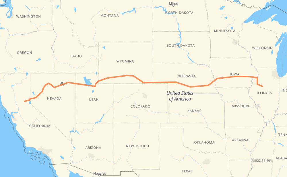
The distance from Peoria to Alta is 1,916 miles by road including 1,914 miles on motorways. Road takes approximately 28 hours and 23 minutes and goes through Davenport, Iowa City, Omaha, Lincoln, North Platte, Cheyenne and Laramie.
You can adjust fuel consumption and fuel price here.
How long is a car ride from Peoria to Alta?
Driving time:
28 h 23 min
This time is calculated for driving at the maximum permitted speed, taking into account traffic rules restrictions.
1,728 mi with a maximum speed 68 mph = 25 h 24 min
167 mi with a maximum speed 65 mph = 2 h 33 min
2 mi with a maximum speed 62 mph = 2 min
2 mi with a maximum speed 60 mph = 2 min
4 mi with a maximum speed 55 mph = 4 min
12 mi with a maximum speed 50 mph = 14 min
1 mi with a maximum speed 31 mph = 1 min
The calculated driving time does not take into account intermediate stops and traffic jams.
How far is Peoria to Alta by land?
The distance between Peoria and Alta is 1,915.7 mi by road including 1,914.4 mi on motorways.
Precise satellite coordinates of highways were used for this calculation. The start and finish points are the centers of Peoria and Alta respectively.
How far is Peoria to Alta by plane?
The shortest distance (air line, as the crow flies) between Peoria and Alta is 1,648.5 mi.
This distance is calculated using the Haversine formula as a great-circle distance between two points on the surface of a sphere. The start and finish points are the centers of Peoria and Alta respectively. Actual distance between airports may be different.
How many hours is Peoria from Alta by plane?
Boeing 737 airliner needs 3 h 18 min to cover the distance of 1,648 mi at a cruising speed of 497 mph.
Small plane "Cessna 172" needs 12 h 3 min to flight this distance at average speed of 136 mph.
This time is approximate and do not take into account takeoff and landing times, airport location and other real world factors.
How long is a helicopter ride from Peoria to Alta?
Fast helicopter "Eurocopter AS350" or "Hughes OH-6 Cayuse" need 11 h 3 min to cover the distance of 1,648 mi at a cruising speed of 149 mph.
Popular "Robinson R44" needs 12 h 38 min to flight this distance at average speed of 130 mph.
This time is approximate and do not take into account takeoff and landing times, aerodrome location and other real world factors.
What city is halfway between Peoria and Alta?
The halfway point between Peoria and Alta is Laramie. It is located about 19 mi from the exact midpoint by road.
The distance from Laramie to Peoria is 939 mi and driving will take about 13 h 55 min. The road between Laramie and Alta has length 977 mi and will take approximately 14 h 27 min.
The other cities located close to halfway point:
PhinDeli Town Buford is in 915 mi from Peoria and 1,002 mi from Alta