Distance between Tamuín and Tenancingo
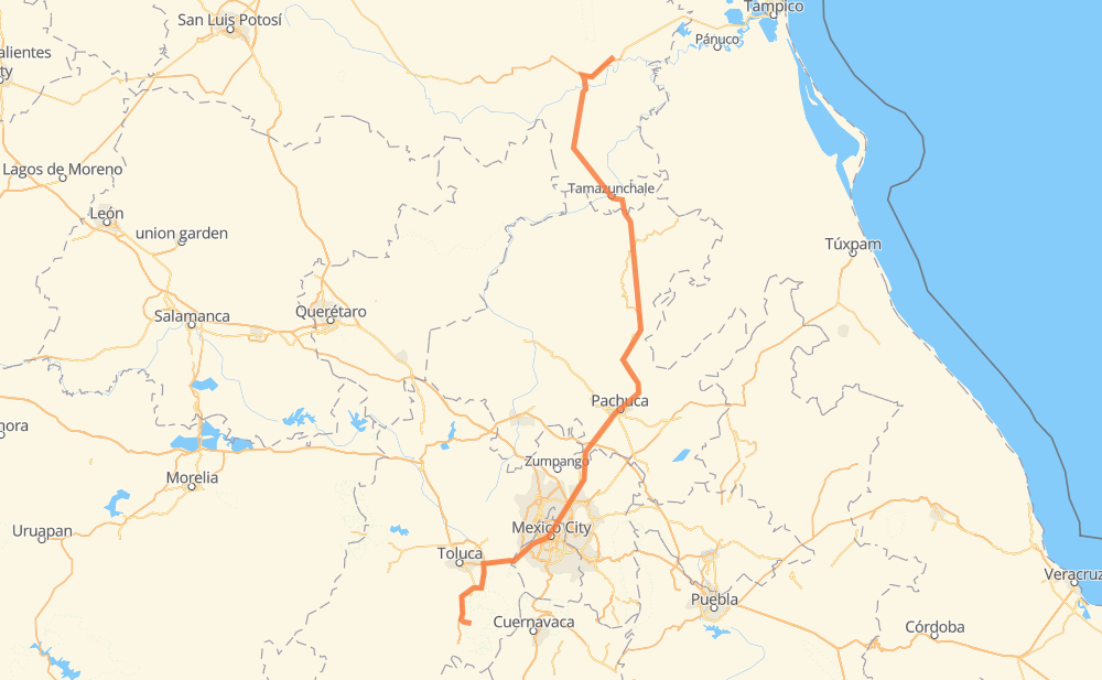
The distance from Tamuín to Tenancingo is 527 kilometers by road including 146 kilometers on motorways. Road takes approximately 6 hours and 56 minutes and goes through Pachuca, Tancahuitz de Santos, Matlapa, Tamazunchale, Casas Quma Tizayuca, Tecámac de Felipe Villanueva and Ecatepec de Morelos.
| Shortest distance by air | 349 km ✈️ |
| Car route length | 527 km 🚗 |
| Driving time | 6 h 56 min |
| Fuel amount | 40.9 L |
| Fuel cost | 712.8 MXN |
| Toll roads cost | 137 + ? MXN |
| Point | Distance | Time | Fuel | |
| Tamuín | 0 km | 00 min | 0.0 L | |
|
MEX 70D MEX 85 63 km, 47 min
|
||||
| Tancahuitz de Santos | 63 km | 47 min | 3.7 L | |
|
MEX 85 40 km, 29 min
|
||||
| Matlapa | 102 km | 1 h 17 min | 7.2 L | |
|
MEX 85 16 km, 11 min
|
||||
| Tamazunchale | 118 km | 1 h 29 min | 8.8 L | |
|
MEX 85 MEX 105 237 km, 3 h 11 min
|
||||
| Pachuca | 355 km | 4 h 41 min | 27.0 L | |
|
MEX 85 39 km, 26 min
|
||||
| Casas Quma Tizayuca | 394 km | 5 h 08 min | 30.3 L | |
|
MEX 85D 17 km, 12 min
|
||||
| Tecámac de Felipe Villanueva | 411 km | 5 h 20 min | 31.5 L | |
|
MEX 85D 12 km, 08 min
|
||||
| Ecatepec de Morelos | 424 km | 5 h 29 min | 32.5 L | |
|
MEX 85D MEX 85 12 km, 08 min
|
||||
| Colinas de San José | 436 km | 5 h 37 min | 33.7 L | |
|
MEX 85 MEX 15D 116 km, 1 h 18 min
|
||||
| Tenancingo | 552 km | 6 h 56 min | 42.6 L | |
Frequently Asked Questions
How many toll booths are there from Tamuín to Tenancingo?
There are 9 toll booths between Tamuín and Tenancingo: La Calera, Tenango, Rayón, Chapultepec, Libramiento la Marquesa, La Venta, Ojo de Agua, Revolucion and San Cristobal.
How much does the toll booths cost from Tamuín to Tenancingo?
Toll roads cost: La Calera (?) + Ojo de Agua (56 MXN) + Revolucion (?) + San Cristobal (?) + La Venta (?) + Libramiento la Marquesa (?) + Rayón (38 MXN) + Chapultepec (43 MXN) + Tenango (?) = 137 + ? MXN
How much does it cost to drive from Tamuín to Tenancingo?
Fuel cost: 712.8 MXN
This fuel cost is calculated as: (Route length 527 km / 100 km) * (Fuel consumption 8.000496031746 L/100 km) * (Fuel price 17.421343487184 MXN / L)
You can adjust fuel consumption and fuel price here.
Toll roads cost: 137 + ? MXN
How long is a car ride from Tamuín to Tenancingo?
Driving time: 6 h 56 min
This time is calculated for driving at the maximum permitted speed, taking into account traffic rules restrictions.
- 61 km with a maximum speed 100 km/h = 36 min
- 51 km with a maximum speed 90 km/h = 34 min
- 27 km with a maximum speed 90 km/h = 17 min
- 372 km with a maximum speed 80 km/h = 4 h 38 min
- 5 km with a maximum speed 60 km/h = 5 min
- 29 km with a maximum speed 50 km/h = 35 min
- 3 km with a maximum speed 40 km/h = 4 min
- 1 km with a maximum speed 20 km/h = 2 min
The calculated driving time does not take into account intermediate stops and traffic jams.
How far is Tamuín to Tenancingo by land?
The distance between Tamuín and Tenancingo is 527 km by road including 146 km on motorways.
Precise satellite coordinates of highways were used for this calculation. The start and finish points are the centers of Tamuín and Tenancingo respectively.
How far is Tamuín to Tenancingo by plane?
The shortest distance (air line, as the crow flies) between Tamuín and Tenancingo is 349 km.
This distance is calculated using the Haversine formula as a great-circle distance between two points on the surface of a sphere. The start and finish points are the centers of Tamuín and Tenancingo respectively. Actual distance between airports may be different.
How many hours is Tamuín from Tenancingo by plane?
Boeing 737 airliner needs 26 min to cover the distance of 349 km at a cruising speed of 800 km/h.
Small plane "Cessna 172" needs 1 h 35 min to flight this distance at average speed of 220 km/h.
This time is approximate and do not take into account takeoff and landing times, airport location and other real world factors.
How long is a helicopter ride from Tamuín to Tenancingo?
Fast helicopter "Eurocopter AS350" or "Hughes OH-6 Cayuse" need 1 h 27 min to cover the distance of 349 km at a cruising speed of 240 km/h.
Popular "Robinson R44" needs 1 h 39 min to flight this distance at average speed of 210 km/h.
This time is approximate and do not take into account takeoff and landing times, aerodrome location and other real world factors.
What city is halfway between Tamuín and Tenancingo?
The halfway point between Tamuín and Tenancingo is Mezquititlán. It is located about 8 km from the exact midpoint by road.
The distance from Mezquititlán to Tamuín is 255 km and driving will take about 3 h 23 min. The road between Mezquititlán and Tenancingo has length 272 km and will take approximately 3 h 32 min.
The other cities located close to halfway point:
Where is Tamuín in relation to Tenancingo?
Tamuín is located 349 km north-east of Tenancingo.
Tamuín has geographic coordinates: latitude 22.00307, longitude -98.77592.
Tenancingo has geographic coordinates: latitude 18.96169, longitude -99.59304.
Which highway goes from Tamuín to Tenancingo?
The route from Tamuín to Tenancingo follows MEX 105, MEX 85.
Other minor sections pass along the road:
- MEX 85D: 37 km
- MEX 15D: 26 km
- MEX 70D: 23 km
- MEX15D: 9 km
- MEX 55: 9 km
- MEX 102: 8 km
- 1P: 4 km
- MEX 15: 3 km
- SLP 14: 2 km
- MEX 70: 2 km
- 1S: 1 km