Distance between Çorlu and Yol
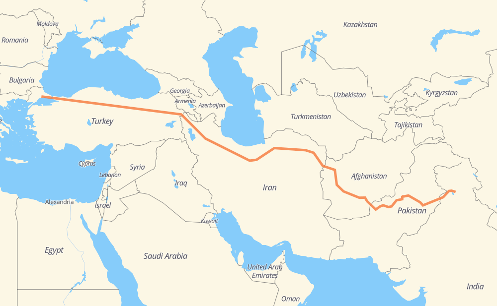
The distance from Çorlu to Yol is 3,531 miles by road including 735 miles on motorways. Road takes approximately 64 hours and 57 minutes and goes through Amasya, Erzincan, Ağrı, Tabriz, Zanjan, Qazvin and Karaj.
| Shortest distance by air | 2,727 mi ✈️ |
| Car route length | 3,531.3 mi 🚗 |
| Driving time | 64 h 57 min |
| Fuel amount | 120.1 gal |
| Fuel cost | 468.4 USD |
| Point | Distance | Time | Fuel | |
| Çorlu | 0 mi | 00 min | 0.0 gal | |
|
D100 487 mi, 8 h 44 min
|
||||
| Amasya | 487 mi | 8 h 44 min | 16.5 gal | |
|
D100 229 mi, 4 h 27 min
|
||||
| Erzincan | 716 mi | 13 h 12 min | 24.3 gal | |
|
D100 232 mi, 4 h 20 min
|
||||
| Ağrı | 948 mi | 17 h 32 min | 32.1 gal | |
|
D 100 32 253 mi, 4 h 46 min
|
||||
| Tabriz | 1,201 mi | 22 h 18 min | 40.7 gal | |
|
2 182 mi, 2 h 59 min
|
||||
| Zanjan | 1,383 mi | 25 h 18 min | 46.9 gal | |
|
2 111 mi, 1 h 37 min
|
||||
| Qazvin | 1,494 mi | 26 h 55 min | 50.6 gal | |
|
2 66 mi, 1 h 00 min
|
||||
| Karaj | 1,560 mi | 27 h 56 min | 53.0 gal | |
|
2 21 mi, 21 min
|
||||
| Tehran | 1,580 mi | 28 h 17 min | 53.1 gal | |
|
2 44 418 mi, 7 h 40 min
|
||||
| Sabzevar | 1,998 mi | 35 h 58 min | 67.9 gal | |
|
44 68 mi, 1 h 14 min
|
||||
| Neyshabur | 2,067 mi | 37 h 12 min | 70.3 gal | |
|
44 97 268 mi, 5 h 04 min
|
||||
| Herat | 2,334 mi | 42 h 17 min | 79.2 gal | |
|
NH0102 353 mi, 6 h 20 min
|
||||
| Kandahar | 2,688 mi | 48 h 37 min | 91.1 gal | |
|
NH0101 NH37 70 mi, 1 h 16 min
|
||||
| Chaman | 2,758 mi | 49 h 54 min | 93.6 gal | |
|
N-25 N-50 239 mi, 4 h 34 min
|
||||
| Zhob | 2,997 mi | 54 h 29 min | 101.5 gal | |
|
N-50 147 mi, 2 h 44 min
|
||||
| Bhakkar | 3,144 mi | 57 h 14 min | 106.7 gal | |
|
54 mi, 1 h 06 min
|
||||
| Atharan Hazari | 3,198 mi | 58 h 20 min | 108.0 gal | |
|
M-3 341 mi, 6 h 36 min
|
||||
| Yol Cantonment | 3,540 mi | 64 h 57 min | 120.4 gal | |
Frequently Asked Questions
How much does it cost to drive from Çorlu to Yol?
Fuel cost: 468.4 USD
This fuel cost is calculated as: (Route length 3,531.3 mi) / (Fuel consumption 29.4 mpg) * (Fuel price 3.9 USD / gal)
You can adjust fuel consumption and fuel price here.
How long is a car ride from Çorlu to Yol?
Driving time: 64 h 57 min
This time is calculated for driving at the maximum permitted speed, taking into account traffic rules restrictions.
- 490 mi with a maximum speed 68 mph = 7 h 12 min
- 130 mi with a maximum speed 62 mph = 2 h 6 min
- 1,097 mi with a maximum speed 56 mph = 19 h 34 min
- 499 mi with a maximum speed 56 mph = 8 h 55 min
- 1,256 mi with a maximum speed 50 mph = 25 h 16 min
- 6 mi with a maximum speed 43 mph = 7 min
- 51 mi with a maximum speed 37 mph = 1 h 22 min
- 7 mi with a maximum speed 31 mph = 14 min
- 2 mi with a maximum speed 25 mph = 4 min
The calculated driving time does not take into account intermediate stops and traffic jams.
How far is Çorlu to Yol by land?
The distance between Çorlu and Yol is 3,531.3 mi by road including 735.1 mi on motorways.
Precise satellite coordinates of highways were used for this calculation. The start and finish points are the centers of Çorlu and Yol respectively.
How far is Çorlu to Yol by plane?
The shortest distance (air line, as the crow flies) between Çorlu and Yol is 2,726.6 mi.
This distance is calculated using the Haversine formula as a great-circle distance between two points on the surface of a sphere. The start and finish points are the centers of Çorlu and Yol respectively. Actual distance between airports may be different.
How many hours is Çorlu from Yol by plane?
Boeing 737 airliner needs 5 h 29 min to cover the distance of 2,727 mi at a cruising speed of 497 mph.
Small plane "Cessna 172" needs 19 h 56 min to flight this distance at average speed of 136 mph.
This time is approximate and do not take into account takeoff and landing times, airport location and other real world factors.
How long is a helicopter ride from Çorlu to Yol?
Fast helicopter "Eurocopter AS350" or "Hughes OH-6 Cayuse" need 18 h 17 min to cover the distance of 2,727 mi at a cruising speed of 149 mph.
Popular "Robinson R44" needs 20 h 53 min to flight this distance at average speed of 130 mph.
This time is approximate and do not take into account takeoff and landing times, aerodrome location and other real world factors.
What city is halfway between Çorlu and Yol?
The halfway point between Çorlu and Yol is Seydabad. It is located about 17 mi from the exact midpoint by road.
The distance from Seydabad to Çorlu is 1,783 mi and driving will take about 31 h 56 min. The road between Seydabad and Yol has length 1,748 mi and will take approximately 33 h 1 min.
The other cities located close to halfway point:
Where is Çorlu in relation to Yol?
Çorlu is located 2,727 mi west of Yol.
Çorlu has geographic coordinates: latitude 41.15909, longitude 27.80411.
Yol has geographic coordinates: latitude 32.18601, longitude 76.37549.
Which highway goes from Çorlu to Yol?
The route from Çorlu to Yol follows D100, 44, 2, N-50, NH0102, 32, D 100, O-4, M-3, 97, NH63, NH0101, NH37.
Other minor sections pass along the road:
- N-25: 55 mi
- NH54: 49 mi
- NH154: 48 mi
- O-7: 47 mi
- 21: 34 mi
- D 100 / D 957: 29 mi
- O-3: 28 mi
- NH3: 22 mi
- E 80 / D 100: 22 mi
- D885: 20 mi
- D785: 17 mi
- O-2: 17 mi
- D052: 16 mi
- 36: 14 mi
- 14: 14 mi
- 48: 12 mi
- N-5: 9 mi
- D 052: 8 mi
- D750: 8 mi
- D865: 6 mi
- L-20: 4 mi
- D 100 / D 975: 4 mi
- NH44: 4 mi
- N-55: 3 mi
- 87: 3 mi
- NH354: 3 mi
- D-100: 3 mi
- Kuzey Marmara Otoyolu: 2 mi
- D805: 2 mi
- SH17: 2 mi
- O-6: 2 mi
- E80: 2 mi
- NH503: 1 mi
- E-4: 1 mi
- M-2: 1 mi