Distance between 新源县 (Xinyuan) and Tailai
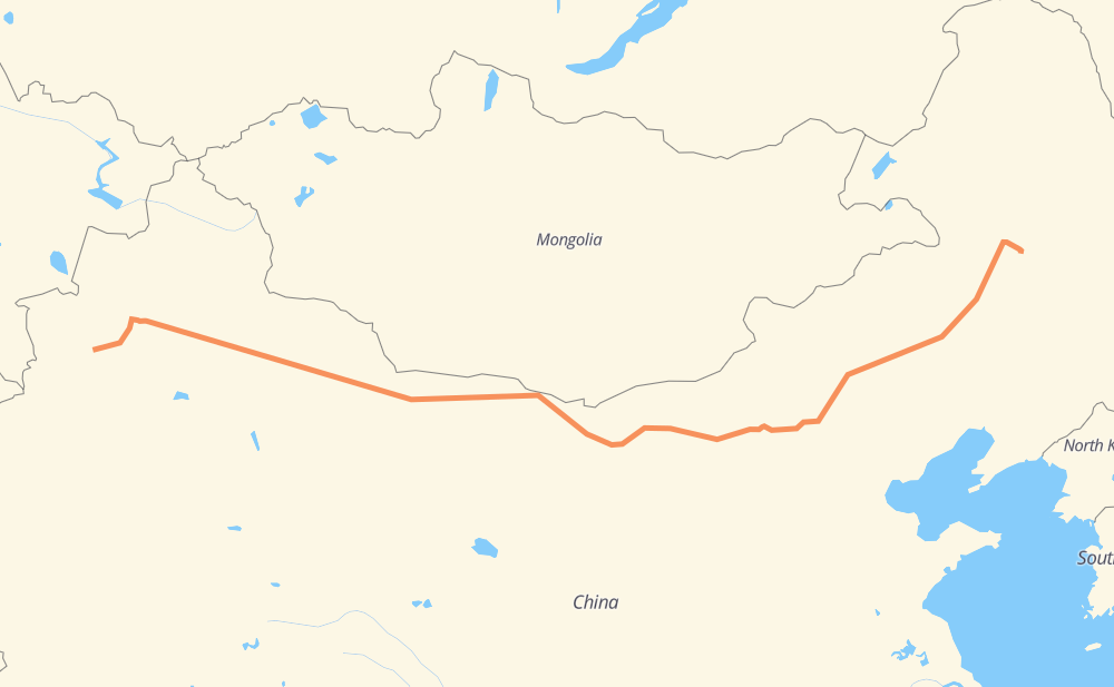
The distance from 新源县 (Xinyuan) to Tailai is 2,609 miles by road including 1,907 miles on motorways. Road takes approximately 44 hours and 59 minutes and goes through Kuitun, Sandaohezi, Shihezi, 杭锦后旗, Ulanqab, Zhangbei and Ulan Hot.
| Shortest distance by air | 1,956 mi ✈️ |
| Car route length | 2,609.1 mi 🚗 |
| Driving time | 44 h 59 min |
| Fuel amount | 88.8 gal |
| Fuel cost | 346.1 USD |
| Point | Distance | Time | Fuel | |
| 新源县 (Xinyuan) | 0 mi | 00 min | 0.0 gal | |
|
7 mi, 08 min
|
||||
| Zeketai | 7 mi | 08 min | 0.1 gal | |
|
S316 G217 163 mi, 2 h 56 min
|
||||
| Kuitun | 170 mi | 3 h 04 min | 5.7 gal | |
|
G30 43 mi, 43 min
|
||||
| Sandaohezi | 213 mi | 3 h 48 min | 6.6 gal | |
|
G30 19 mi, 18 min
|
||||
| Shihezi | 232 mi | 4 h 06 min | 7.9 gal | |
|
G7 1,249 mi, 20 h 23 min
|
||||
| 杭锦后旗 | 1,481 mi | 24 h 30 min | 50.3 gal | |
|
G7 G6 337 mi, 5 h 59 min
|
||||
| Ulanqab | 1,818 mi | 30 h 29 min | 61.4 gal | |
|
G6 G335 94 mi, 1 h 40 min
|
||||
| Zhangbei | 1,913 mi | 32 h 10 min | 64.7 gal | |
|
G335 G1013 592 mi, 10 h 50 min
|
||||
| Ulan Hot | 2,504 mi | 43 h 00 min | 84.9 gal | |
|
G111 106 mi, 1 h 58 min
|
||||
| Tailai | 2,609 mi | 44 h 59 min | 88.7 gal | |
Frequently Asked Questions
How much does it cost to drive from 新源县 (Xinyuan) to Tailai?
Fuel cost: 346.1 USD
This fuel cost is calculated as: (Route length 2,609.1 mi) / (Fuel consumption 29.4 mpg) * (Fuel price 3.9 USD / gal)
You can adjust fuel consumption and fuel price here.
How long is a car ride from 新源县 (Xinyuan) to Tailai?
Driving time: 44 h 59 min
This time is calculated for driving at the maximum permitted speed, taking into account traffic rules restrictions.
- 64 mi with a maximum speed 68 mph = 56 min
- 1,511 mi with a maximum speed 62 mph = 24 h 19 min
- 477 mi with a maximum speed 56 mph = 8 h 31 min
- 556 mi with a maximum speed 50 mph = 11 h 11 min
- 1 mi with a maximum speed 31 mph = 1 min
The calculated driving time does not take into account intermediate stops and traffic jams.
How far is 新源县 (Xinyuan) to Tailai by land?
The distance between 新源县 (Xinyuan) and Tailai is 2,609.1 mi by road including 1,907 mi on motorways.
Precise satellite coordinates of highways were used for this calculation. The start and finish points are the centers of 新源县 (Xinyuan) and Tailai respectively.
How far is 新源县 (Xinyuan) to Tailai by plane?
The shortest distance (air line, as the crow flies) between 新源县 (Xinyuan) and Tailai is 1,956.1 mi.
This distance is calculated using the Haversine formula as a great-circle distance between two points on the surface of a sphere. The start and finish points are the centers of 新源县 (Xinyuan) and Tailai respectively. Actual distance between airports may be different.
How many hours is 新源县 (Xinyuan) from Tailai by plane?
Boeing 737 airliner needs 3 h 56 min to cover the distance of 1,956 mi at a cruising speed of 497 mph.
Small plane "Cessna 172" needs 14 h 18 min to flight this distance at average speed of 136 mph.
This time is approximate and do not take into account takeoff and landing times, airport location and other real world factors.
How long is a helicopter ride from 新源县 (Xinyuan) to Tailai?
Fast helicopter "Eurocopter AS350" or "Hughes OH-6 Cayuse" need 13 h 7 min to cover the distance of 1,956 mi at a cruising speed of 149 mph.
Popular "Robinson R44" needs 14 h 59 min to flight this distance at average speed of 130 mph.
This time is approximate and do not take into account takeoff and landing times, aerodrome location and other real world factors.
What city is halfway between 新源县 (Xinyuan) and Tailai?
The halfway point between 新源县 (Xinyuan) and Tailai is 大树湾乡. It is located about 165 mi from the exact midpoint by road.
The distance from 大树湾乡 to 新源县 (Xinyuan) is 1,469 mi and driving will take about 24 h 18 min. The road between 大树湾乡 and Tailai has length 1,140 mi and will take approximately 20 h 41 min.
The other cities located close to halfway point:
Where is 新源县 (Xinyuan) in relation to Tailai?
新源县 (Xinyuan) is located 1,956 mi west of Tailai.
新源县 (Xinyuan) has geographic coordinates: latitude 43.43253, longitude 83.22763.
Tailai has geographic coordinates: latitude 46.39123, longitude 123.41149.
Which highway goes from 新源县 (Xinyuan) to Tailai?
The route from 新源县 (Xinyuan) to Tailai follows G7, G30, G6, G111, G1013, S306, G217, G16, G303, S105.
Other minor sections pass along the road:
- G335: 51 mi
- S315: 49 mi
- S316: 22 mi
- S24: 11 mi
- S202: 9 mi
- S221: 7 mi
- G218: 3 mi
- G5511: 2 mi
- 312国道: 1 mi
- 312国道: 1 mi