Distance between 9 de Julio and Juan José Castelli
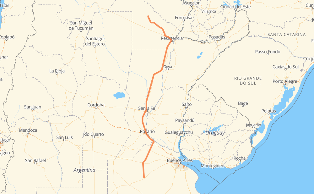
The distance from 9 de Julio to Juan José Castelli is 825 miles by road including 157 miles on motorways. Road takes approximately 15 hours and 19 minutes and goes through Junín, Rosario, Resistencia, Chacras del Bragado, Rojas, Luar Kayad and Granadero Baigorria.
| Shortest distance by air | 657 mi ✈️ |
| Car route length | 824.6 mi 🚗 |
| Driving time | 15 h 19 min |
| Fuel amount | 28.1 gal |
| Fuel cost | 109.4 USD |
| Point | Distance | Time | Fuel | |
| 9 de Julio | 0 mi | 00 min | 0.0 gal | |
|
RN5 60 mi, 1 h 07 min
|
||||
| Chacras del Bragado | 60 mi | 1 h 07 min | 1.4 gal | |
|
RP46 RP65 27 mi, 30 min
|
||||
| Junín | 87 mi | 1 h 37 min | 2.8 gal | |
|
RP65 RN188 29 mi, 31 min
|
||||
| Rojas | 116 mi | 2 h 09 min | 3.8 gal | |
|
RN188 30 mi, 34 min
|
||||
| Luar Kayad | 147 mi | 2 h 44 min | 5.0 gal | |
|
RN188 81 mi, 1 h 23 min
|
||||
| Rosario | 227 mi | 4 h 07 min | 7.5 gal | |
|
RNA008 6 mi, 06 min
|
||||
| Granadero Baigorria | 234 mi | 4 h 14 min | 7.9 gal | |
|
AP01 7 mi, 06 min
|
||||
| San Eduardo | 241 mi | 4 h 20 min | 8.1 gal | |
|
AP01 RN11 424 mi, 7 h 49 min
|
||||
| Resistencia | 665 mi | 12 h 10 min | 22.3 gal | |
|
RN11 RP9 160 mi, 3 h 09 min
|
||||
| Juan José Castelli | 825 mi | 15 h 19 min | 27.8 gal | |
Frequently Asked Questions
How much does it cost to drive from 9 de Julio to Juan José Castelli?
Fuel cost: 109.4 USD
This fuel cost is calculated as: (Route length 824.6 mi) / (Fuel consumption 29.4 mpg) * (Fuel price 3.9 USD / gal)
You can adjust fuel consumption and fuel price here.
How long is a car ride from 9 de Julio to Juan José Castelli?
Driving time: 15 h 19 min
This time is calculated for driving at the maximum permitted speed, taking into account traffic rules restrictions.
- 140 mi with a maximum speed 68 mph = 2 h 4 min
- 12 mi with a maximum speed 62 mph = 11 min
- 411 mi with a maximum speed 56 mph = 7 h 19 min
- 1 mi with a maximum speed 56 mph = 1 min
- 203 mi with a maximum speed 50 mph = 4 h 4 min
- 52 mi with a maximum speed 37 mph = 1 h 24 min
- 2 mi with a maximum speed 31 mph = 4 min
- 3 mi with a maximum speed 25 mph = 6 min
- 1 mi with a maximum speed 12 mph = 3 min
The calculated driving time does not take into account intermediate stops and traffic jams.
How far is 9 de Julio to Juan José Castelli by land?
The distance between 9 de Julio and Juan José Castelli is 824.6 mi by road including 156.6 mi on motorways.
Precise satellite coordinates of highways were used for this calculation. The start and finish points are the centers of 9 de Julio and Juan José Castelli respectively.
How far is 9 de Julio to Juan José Castelli by plane?
The shortest distance (air line, as the crow flies) between 9 de Julio and Juan José Castelli is 656.8 mi.
This distance is calculated using the Haversine formula as a great-circle distance between two points on the surface of a sphere. The start and finish points are the centers of 9 de Julio and Juan José Castelli respectively. Actual distance between airports may be different.
How many hours is 9 de Julio from Juan José Castelli by plane?
Boeing 737 airliner needs 1 h 19 min to cover the distance of 657 mi at a cruising speed of 497 mph.
Small plane "Cessna 172" needs 4 h 48 min to flight this distance at average speed of 136 mph.
This time is approximate and do not take into account takeoff and landing times, airport location and other real world factors.
How long is a helicopter ride from 9 de Julio to Juan José Castelli?
Fast helicopter "Eurocopter AS350" or "Hughes OH-6 Cayuse" need 4 h 24 min to cover the distance of 657 mi at a cruising speed of 149 mph.
Popular "Robinson R44" needs 5 h 2 min to flight this distance at average speed of 130 mph.
This time is approximate and do not take into account takeoff and landing times, aerodrome location and other real world factors.
What city is halfway between 9 de Julio and Juan José Castelli?
The halfway point between 9 de Julio and Juan José Castelli is Gobernador Crespo. It is located about 6 mi from the exact midpoint by road.
The distance from Gobernador Crespo to 9 de Julio is 418 mi and driving will take about 7 h 22 min. The road between Gobernador Crespo and Juan José Castelli has length 406 mi and will take approximately 7 h 57 min.
The other cities located close to halfway point:
Where is 9 de Julio in relation to Juan José Castelli?
9 de Julio is located 657 mi south of Juan José Castelli.
9 de Julio has geographic coordinates: latitude -35.44441, longitude -60.88423.
Juan José Castelli has geographic coordinates: latitude -25.94671, longitude -60.62002.
Which highway goes from 9 de Julio to Juan José Castelli?
The route from 9 de Julio to Juan José Castelli follows RN11, AP01, RN188, RP9.
Other minor sections pass along the road:
- RP46: 41 mi
- RN9: 37 mi
- RN95: 36 mi
- RN16: 35 mi
- RN5: 32 mi
- RNA007: 15 mi
- RNA008: 10 mi
- RP65: 4 mi
- RP32: 2 mi
- RP7: 2 mi
- RN8: 1 mi