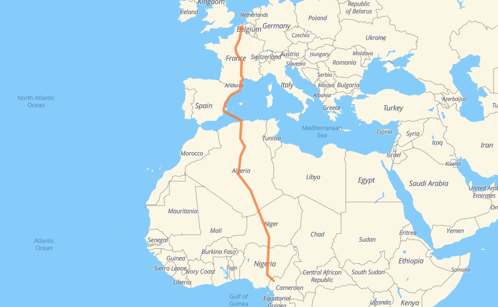
Distance between Aeltre and Bali
The distance from Aeltre to Bali is 4,176 miles by road including 1,328 miles on motorways. Road takes approximately 93 hours and 55 minutes and goes through Lille, Montreuil, París, Clermont-Ferrand, Perpiñán, Castellón de la Plana and Algiers.
| Shortest distance by air | 3,147 mi ✈️ |
| Car route length | 4,175.6 mi 🚗 |
| Driving time | 93 h 55 min |
| Fuel amount | 142 gal |
| Fuel cost | 558.1 USD |
| Point | Distance | Time | Fuel | |
| Aeltre | 0 mi | 00 min | 0.0 gal | |
|
N37 E403 48 mi, 51 min
|
||||
| Lille | 48 mi | 51 min | 1.6 gal | |
|
N 356 A 1 138 mi, 2 h 06 min
|
||||
| París | 186 mi | 2 h 58 min | 6.2 gal | |
|
A 6b A 71 257 mi, 3 h 51 min
|
||||
| Clermont-Ferrand | 443 mi | 6 h 49 min | 15.0 gal | |
|
A 71 A 75 266 mi, 3 h 59 min
|
||||
| Perpiñán | 709 mi | 10 h 48 min | 24.0 gal | |
|
A 9 AP-7 693 mi, 25 h 32 min
|
||||
| Blida | 1,402 mi | 36 h 20 min | 47.7 gal | |
|
A1 RN 1 16 mi, 17 min
|
||||
| Medea | 1,418 mi | 36 h 38 min | 48.1 gal | |
|
RN 1 78 mi, 1 h 32 min
|
||||
| Ain Oussara | 1,496 mi | 38 h 10 min | 50.3 gal | |
|
RN 1 62 mi, 1 h 15 min
|
||||
| Djelfa | 1,558 mi | 39 h 26 min | 52.5 gal | |
|
RN 1 63 mi, 1 h 13 min
|
||||
| Laghouat | 1,622 mi | 40 h 40 min | 54.8 gal | |
|
RN 1 116 mi, 2 h 07 min
|
||||
| Ghardaia | 1,737 mi | 42 h 47 min | 58.9 gal | |
|
RN 1 1,348 mi, 27 h 09 min
|
||||
| Arlit | 3,086 mi | 69 h 57 min | 104.9 gal | |
|
N 25 149 mi, 2 h 40 min
|
||||
| Agadez | 3,235 mi | 72 h 38 min | 110.0 gal | |
|
N 25 N 11 178 mi, 3 h 25 min
|
||||
| Tanout | 3,413 mi | 76 h 03 min | 116.0 gal | |
|
N 11 94 mi, 1 h 53 min
|
||||
| Zinder | 3,507 mi | 77 h 57 min | 119.2 gal | |
|
N 11 50 mi, 1 h 00 min
|
||||
| Magaria | 3,557 mi | 78 h 57 min | 120.3 gal | |
|
N 11 F.244 101 mi, 2 h 00 min
|
||||
| Kano | 3,658 mi | 80 h 58 min | 124.4 gal | |
|
A2 A3 316 mi, 6 h 13 min
|
||||
| Lafia | 3,973 mi | 87 h 11 min | 135.0 gal | |
|
A3 N6 342 mi, 6 h 51 min
|
||||
| Bali | 4,315 mi | 94 h 02 min | 146.5 gal | |
Hotels of Bali
Frequently Asked Questions
How much does it cost to drive from Aeltre to Bali?
Fuel cost: 558.1 USD
This fuel cost is calculated as: (Route length 4,175.6 mi) / (Fuel consumption 29.4 mpg) * (Fuel price 3.93 USD / gal)
You can adjust fuel consumption and fuel price here.
How long is a car ride from Aeltre to Bali?
Driving time: 93 h 55 min
This time is calculated for driving at the maximum permitted speed, taking into account traffic rules restrictions.
- 965 mi with a maximum speed 68 mph = 14 h 11 min
- 157 mi with a maximum speed 62 mph = 2 h 31 min
- 851 mi with a maximum speed 56 mph = 15 h 12 min
- 43 mi with a maximum speed 56 mph = 46 min
- 1,854 mi with a maximum speed 50 mph = 37 h 17 min
- 24 mi with a maximum speed 43 mph = 32 min
- 170 mi with a maximum speed 37 mph = 4 h 33 min
- 14 mi with a maximum speed 31 mph = 25 min
- 3 mi with a maximum speed 25 mph = 7 min
- 1 mi with a maximum speed 19 mph = 2 min
- 227 mi with a maximum speed 12 mph = 18 h 14 min
The calculated driving time does not take into account intermediate stops and traffic jams.
How far is Aeltre to Bali by land?
The distance between Aeltre and Bali is 4,175.6 mi by road including 1,328.5 mi on motorways.
Precise satellite coordinates of highways were used for this calculation. The start and finish points are the centers of Aeltre and Bali respectively.
How far is Aeltre to Bali by plane?
The shortest distance (air line, as the crow flies) between Aeltre and Bali is 3,146.6 mi.
This distance is calculated using the Haversine formula as a great-circle distance between two points on the surface of a sphere. The start and finish points are the centers of Aeltre and Bali respectively. Actual distance between airports may be different.
How many hours is Aeltre from Bali by plane?
Boeing 737 airliner needs 6 h 19 min to cover the distance of 3,147 mi at a cruising speed of 497 mph.
Small plane "Cessna 172" needs 23 h 1 min to flight this distance at average speed of 136 mph.
This time is approximate and do not take into account takeoff and landing times, airport location and other real world factors.
How long is a helicopter ride from Aeltre to Bali?
Fast helicopter "Eurocopter AS350" or "Hughes OH-6 Cayuse" need 21 h 6 min to cover the distance of 3,147 mi at a cruising speed of 149 mph.
Popular "Robinson R44" needs 24 h 6 min to flight this distance at average speed of 130 mph.
This time is approximate and do not take into account takeoff and landing times, aerodrome location and other real world factors.
What city is halfway between Aeltre and Bali?
The halfway point between Aeltre and Bali is In Salah. It is located about 32 mi from the exact midpoint by road.
The distance from In Salah to Aeltre is 2,119 mi and driving will take about 49 h 58 min. The road between In Salah and Bali has length 2,056 mi and will take approximately 43 h 57 min.
The other cities located close to halfway point:
Where is Aeltre in relation to Bali?
Aeltre is located 3,147 mi north of Bali.
Aeltre has geographic coordinates: latitude 51.08389, longitude 3.44852.
Bali has geographic coordinates: latitude 5.8879, longitude 10.01103.
Which highway goes from Aeltre to Bali?
The route from Aeltre to Bali follows RN 1, N 25, N 11, AP-7, A3, A 75, A 71, N6, A 1, A-7, F.243, A 9, A 10.
Other minor sections pass along the road:
- F.244: 59 mi
- A2: 53 mi
- A236: 53 mi
- A4: 51 mi
- A1: 25 mi
- N37: 14 mi
- A 3: 13 mi
- E403: 12 mi
- A 89: 12 mi
- V-21: 11 mi
- A 22: 11 mi
- V-31: 9 mi
- A 6b: 6 mi
- N 356: 5 mi
- A-77: 4 mi
- A344: 4 mi
- E17: 2 mi
- A-31: 2 mi
- A-70: 2 mi
- ط و 1: 1 mi
- RN 11: 1 mi
- RN 8: 1 mi