Distance between Alta Floresta and Estreito
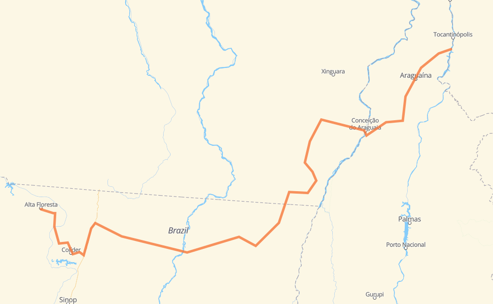
The distance from Alta Floresta to Estreito is 993 miles by road. Road takes approximately 18 hours and 35 minutes and goes through União do Norte, Santana do Araguaia, Del Rei, Nova Santa Helena, Vila Terena Kopenoty, Santo Antonio do Fontoura MT and Veranópolis.
| Shortest distance by air | 634 mi ✈️ |
| Car route length | 993 mi 🚗 |
| Driving time | 18 h 35 min |
| Fuel amount | 33.8 gal |
| Fuel cost | 132.8 USD |
| Point | Distance | Time | Fuel | |
| -9.87150, -56.08399 | 0 mi | 00 min | 0.0 gal | |
|
MT-208 31 mi, 36 min
|
||||
| Del Rei | 31 mi | 36 min | 1.3 gal | |
|
MT-320 93 mi, 1 h 41 min
|
||||
| Nova Santa Helena | 124 mi | 2 h 17 min | 4.7 gal | |
|
BR-163 91 mi, 1 h 39 min
|
||||
| Vila Terena Kopenoty | 215 mi | 3 h 57 min | 7.6 gal | |
|
MT-322 MT-080 103 mi, 2 h 08 min
|
||||
| Aldeia Piaracu | 318 mi | 6 h 06 min | 11.3 gal | |
|
MT-080 MT-437 59 mi, 1 h 14 min
|
||||
| Santo Antonio do Fontoura MT | 377 mi | 7 h 20 min | 13.1 gal | |
|
MT-437 MT-430 75 mi, 1 h 22 min
|
||||
| Veranópolis | 451 mi | 8 h 43 min | 15.6 gal | |
|
BR-158 148 mi, 2 h 40 min
|
||||
| Santana do Araguaia | 599 mi | 11 h 24 min | 20.8 gal | |
|
BR-158 207 mi, 3 h 43 min
|
||||
| Juari | 805 mi | 15 h 08 min | 27.7 gal | |
|
TO-336 BR-153 132 mi, 2 h 24 min
|
||||
| Ponta do Asfalto | 938 mi | 17 h 32 min | 32.2 gal | |
|
BR-153 BR-226 55 mi, 1 h 02 min
|
||||
| Estreito | 993 mi | 18 h 35 min | 34.4 gal | |
Frequently Asked Questions
How much does it cost to drive from Alta Floresta to Estreito?
Fuel cost: 132.8 USD
This fuel cost is calculated as: (Route length 993 mi) / (Fuel consumption 29.4 mpg) * (Fuel price 3.93 USD / gal)
You can adjust fuel consumption and fuel price here.
How long is a car ride from Alta Floresta to Estreito?
Driving time: 18 h 35 min
This time is calculated for driving at the maximum permitted speed, taking into account traffic rules restrictions.
- 686 mi with a maximum speed 56 mph = 12 h 14 min
- 295 mi with a maximum speed 50 mph = 5 h 55 min
- 2 mi with a maximum speed 37 mph = 3 min
- 11 mi with a maximum speed 31 mph = 20 min
- 1 mi with a maximum speed 12 mph = 1 min
The calculated driving time does not take into account intermediate stops and traffic jams.
How far is Alta Floresta to Estreito by land?
The distance between Alta Floresta and Estreito is 993 mi by road.
Precise satellite coordinates of highways were used for this calculation. The start and finish points are the centers of Alta Floresta and Estreito respectively.
How far is Alta Floresta to Estreito by plane?
The shortest distance (air line, as the crow flies) between Alta Floresta and Estreito is 633.8 mi.
This distance is calculated using the Haversine formula as a great-circle distance between two points on the surface of a sphere. The start and finish points are the centers of Alta Floresta and Estreito respectively. Actual distance between airports may be different.
How many hours is Alta Floresta from Estreito by plane?
Boeing 737 airliner needs 1 h 16 min to cover the distance of 634 mi at a cruising speed of 497 mph.
Small plane "Cessna 172" needs 4 h 38 min to flight this distance at average speed of 136 mph.
This time is approximate and do not take into account takeoff and landing times, airport location and other real world factors.
How long is a helicopter ride from Alta Floresta to Estreito?
Fast helicopter "Eurocopter AS350" or "Hughes OH-6 Cayuse" need 4 h 15 min to cover the distance of 634 mi at a cruising speed of 149 mph.
Popular "Robinson R44" needs 4 h 51 min to flight this distance at average speed of 130 mph.
This time is approximate and do not take into account takeoff and landing times, aerodrome location and other real world factors.
What city is halfway between Alta Floresta and Estreito?
The halfway point between Alta Floresta and Estreito is Veranópolis. It is located about 45 mi from the exact midpoint by road.
The distance from Veranópolis to Alta Floresta is 451 mi and driving will take about 8 h 43 min. The road between Veranópolis and Estreito has length 542 mi and will take approximately 9 h 51 min.
The other cities located close to halfway point:
Where is Alta Floresta in relation to Estreito?
Alta Floresta is located 634 mi south-west of Estreito.
Alta Floresta has geographic coordinates: latitude -9.8715, longitude -56.08399.
Estreito has geographic coordinates: latitude -6.5583, longitude -47.44322.
Which highway goes from Alta Floresta to Estreito?
The route from Alta Floresta to Estreito follows BR-158, PA-150, MT-320, MT-080, BR-153, PA-287, MT-437, MT-158.
Other minor sections pass along the road:
- BR-163: 52 mi
- BR-226: 45 mi
- TO-336: 35 mi
- MT-430: 31 mi
- TO-335: 25 mi
- MT-322: 22 mi
- MT-208: 17 mi
- PA-447: 9 mi
- TO-164: 7 mi
- Santo Antonio do Fontoura: 2 mi
- BR-230: 1 mi
- BR-010: 1 mi