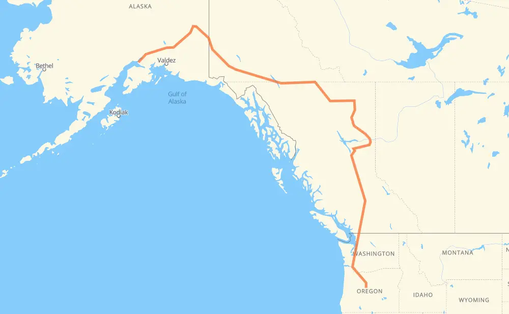
The distance from Anchorage to Redmond is 2,669 miles by road including 347 miles on motorways. Road takes approximately 48 hours and 53 minutes and goes through Whitehorse, Fort St. John, Prince George, Quesnel, Williams Lake, Chilliwack and Abbotsford.
You can adjust fuel consumption and fuel price here.
How long is a car ride from Anchorage to Redmond?
Driving time:
48 h 53 min
This time is calculated for driving at the maximum permitted speed, taking into account traffic rules restrictions.
119 mi with a maximum speed 68 mph = 1 h 44 min
29 mi with a maximum speed 65 mph = 26 min
49 mi with a maximum speed 62 mph = 47 min
144 mi with a maximum speed 60 mph = 2 h 23 min
1,431 mi with a maximum speed 56 mph = 25 h 33 min
96 mi with a maximum speed 56 mph = 1 h 43 min
193 mi with a maximum speed 55 mph = 3 h 30 min
18 mi with a maximum speed 50 mph = 21 min
511 mi with a maximum speed 50 mph = 10 h 16 min
18 mi with a maximum speed 45 mph = 24 min
22 mi with a maximum speed 43 mph = 31 min
6 mi with a maximum speed 40 mph = 9 min
11 mi with a maximum speed 37 mph = 16 min
11 mi with a maximum speed 35 mph = 17 min
11 mi with a maximum speed 31 mph = 22 min
2 mi with a maximum speed 25 mph = 4 min
The calculated driving time does not take into account intermediate stops and traffic jams.
How far is Anchorage to Redmond by land?
The distance between Anchorage and Redmond is 2,669.4 mi by road including 347.3 mi on motorways.
Precise satellite coordinates of highways were used for this calculation. The start and finish points are the centers of Anchorage and Redmond respectively.
How far is Anchorage to Redmond by plane?
The shortest distance (air line, as the crow flies) between Anchorage and Redmond is 1,652.8 mi.
This distance is calculated using the Haversine formula as a great-circle distance between two points on the surface of a sphere. The start and finish points are the centers of Anchorage and Redmond respectively. Actual distance between airports may be different.
How many hours is Anchorage from Redmond by plane?
Boeing 737 airliner needs 3 h 19 min to cover the distance of 1,653 mi at a cruising speed of 497 mph.
Small plane "Cessna 172" needs 12 h 5 min to flight this distance at average speed of 136 mph.
This time is approximate and do not take into account takeoff and landing times, airport location and other real world factors.
How long is a helicopter ride from Anchorage to Redmond?
Fast helicopter "Eurocopter AS350" or "Hughes OH-6 Cayuse" need 11 h 5 min to cover the distance of 1,653 mi at a cruising speed of 149 mph.
Popular "Robinson R44" needs 12 h 40 min to flight this distance at average speed of 130 mph.
This time is approximate and do not take into account takeoff and landing times, aerodrome location and other real world factors.
What city is halfway between Anchorage and Redmond?
The halfway point between Anchorage and Redmond is Muskwa. It is located about 29 mi from the exact midpoint by road.
The distance from Muskwa to Anchorage is 1,306 mi and driving will take about 24 h 7 min. The road between Muskwa and Redmond has length 1,364 mi and will take approximately 24 h 45 min.
The other cities located close to halfway point:
Fort Nelson is in 1,279 mi from Anchorage and 1,390 mi from Redmond
Toad River is in 1,176 mi from Anchorage and 1,494 mi from Redmond
Charlie Lake is in 1,525 mi from Anchorage and 1,144 mi from Redmond
Where is Anchorage in relation to Redmond?
Anchorage is located 1,653 mi north-west of Redmond.
Anchorage has geographic coordinates: latitude 61.21631, longitude -149.89485.
Redmond has geographic coordinates: latitude 44.27262, longitude -121.17392.
Which highway goes from Anchorage to Redmond?
The route from Anchorage to Redmond follows 97, 1, AK 1, I 5, US 26, AK 2.