Distance between Arraial do Cabo and Montalvânia
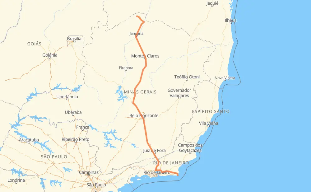
The distance from Arraial do Cabo to Montalvânia is 827 miles by road including 282 miles on motorways. Road takes approximately 15 hours and 20 minutes and goes through Magé, Barbacena, Conselheiro Lafaiete and Ribeirão das Neves.
| Shortest distance by air | 610 mi ✈️ |
| Car route length | 827 mi 🚗 |
| Driving time | 15 h 20 min |
| Fuel amount | 28.1 gal |
| Fuel cost | 110.5 USD |
| Point | Distance | Time | Fuel | |
| -22.96628, -42.02443 | 0 mi | 00 min | 0.0 gal | |
|
RJ-140 12 mi, 14 min
|
||||
| Campo Redondo | 12 mi | 14 min | 0.7 gal | |
|
RJ-140 4 mi, 05 min
|
||||
| Rua do Fogo | 16 mi | 19 min | 0.8 gal | |
|
RJ-106 RJ-124 7 mi, 07 min
|
||||
| União | 23 mi | 27 min | 1.1 gal | |
|
RJ-124 34 mi, 32 min
|
||||
| Parque das Acacias | 57 mi | 59 min | 2.2 gal | |
|
BR-101 21 mi, 21 min
|
||||
| Itambi | 79 mi | 1 h 21 min | 3.0 gal | |
|
BR-493 7 mi, 08 min
|
||||
| Magé | 86 mi | 1 h 30 min | 3.2 gal | |
|
BR-493 BR-040 165 mi, 2 h 51 min
|
||||
| Barbacena | 252 mi | 4 h 22 min | 8.8 gal | |
|
BR-040 44 mi, 52 min
|
||||
| Conselheiro Lafaiete | 296 mi | 5 h 14 min | 10.2 gal | |
|
BR-040 74 mi, 1 h 26 min
|
||||
| Ribeirão das Neves | 370 mi | 6 h 40 min | 12.8 gal | |
|
BR-040 BR-135 457 mi, 8 h 39 min
|
||||
| Montalvânia | 827 mi | 15 h 20 min | 28.0 gal | |
Frequently Asked Questions
How much does it cost to drive from Arraial do Cabo to Montalvânia?
Fuel cost: 110.5 USD
This fuel cost is calculated as: (Route length 827 mi) / (Fuel consumption 29.4 mpg) * (Fuel price 3.93 USD / gal)
You can adjust fuel consumption and fuel price here.
How long is a car ride from Arraial do Cabo to Montalvânia?
Driving time: 15 h 20 min
This time is calculated for driving at the maximum permitted speed, taking into account traffic rules restrictions.
- 158 mi with a maximum speed 68 mph = 2 h 19 min
- 60 mi with a maximum speed 62 mph = 57 min
- 224 mi with a maximum speed 56 mph = 3 h 59 min
- 6 mi with a maximum speed 56 mph = 6 min
- 336 mi with a maximum speed 50 mph = 6 h 45 min
- 22 mi with a maximum speed 43 mph = 29 min
- 9 mi with a maximum speed 37 mph = 13 min
- 10 mi with a maximum speed 31 mph = 19 min
- 4 mi with a maximum speed 25 mph = 8 min
The calculated driving time does not take into account intermediate stops and traffic jams.
How far is Arraial do Cabo to Montalvânia by land?
The distance between Arraial do Cabo and Montalvânia is 827 mi by road including 282.1 mi on motorways.
Precise satellite coordinates of highways were used for this calculation. The start and finish points are the centers of Arraial do Cabo and Montalvânia respectively.
How far is Arraial do Cabo to Montalvânia by plane?
The shortest distance (air line, as the crow flies) between Arraial do Cabo and Montalvânia is 610.2 mi.
This distance is calculated using the Haversine formula as a great-circle distance between two points on the surface of a sphere. The start and finish points are the centers of Arraial do Cabo and Montalvânia respectively. Actual distance between airports may be different.
How many hours is Arraial do Cabo from Montalvânia by plane?
Boeing 737 airliner needs 1 h 13 min to cover the distance of 610 mi at a cruising speed of 497 mph.
Small plane "Cessna 172" needs 4 h 27 min to flight this distance at average speed of 136 mph.
This time is approximate and do not take into account takeoff and landing times, airport location and other real world factors.
How long is a helicopter ride from Arraial do Cabo to Montalvânia?
Fast helicopter "Eurocopter AS350" or "Hughes OH-6 Cayuse" need 4 h 5 min to cover the distance of 610 mi at a cruising speed of 149 mph.
Popular "Robinson R44" needs 4 h 40 min to flight this distance at average speed of 130 mph.
This time is approximate and do not take into account takeoff and landing times, aerodrome location and other real world factors.
What city is halfway between Arraial do Cabo and Montalvânia?
The halfway point between Arraial do Cabo and Montalvânia is Paraopeba.
The distance from Paraopeba to Arraial do Cabo is 413 mi and driving will take about 7 h 23 min. The road between Paraopeba and Montalvânia has length 413 mi and will take approximately 7 h 57 min.
The other cities located close to halfway point:
Where is Arraial do Cabo in relation to Montalvânia?
Arraial do Cabo is located 610 mi south-east of Montalvânia.
Arraial do Cabo has geographic coordinates: latitude -22.96628, longitude -42.02443.
Montalvânia has geographic coordinates: latitude -14.42302, longitude -44.37018.
Which highway goes from Arraial do Cabo to Montalvânia?
The route from Arraial do Cabo to Montalvânia follows BR-135, BR-040, MGC-135, CMG-135.
Other minor sections pass along the road:
- RJ-124: 35 mi
- MG-135: 26 mi
- BR-101: 20 mi
- BR-116: 14 mi
- BR-493: 14 mi
- BR-356: 12 mi
- RJ-140: 11 mi
- RJ-102: 4 mi
- RJ-106: 2 mi
- MG-353: 2 mi
- BR-381: 1 mi
- BR-262: 1 mi
- BR 040: 1 mi