Distance between Ataliva Roca and La Flor
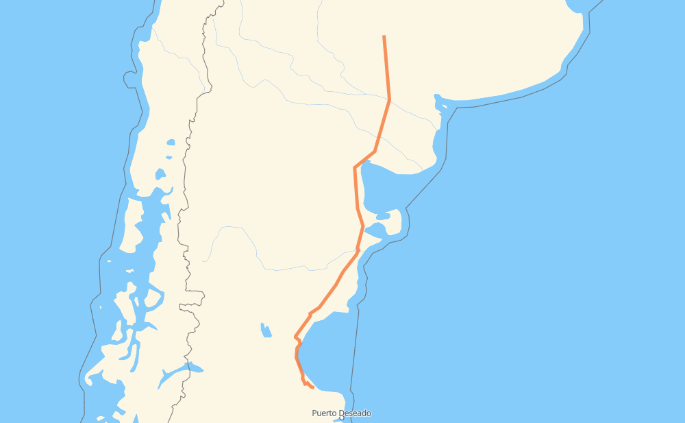
The distance from Ataliva Roca to La Flor is 823 miles by road. Road takes approximately 15 hours and 46 minutes and goes through Comodoro Rivadavia, Caleta Olivia, Río Colorado, El Empalme, Sierra Grande, El Doradillo and Los Teros.
| Shortest distance by air | 700 mi ✈️ |
| Car route length | 822.7 mi 🚗 |
| Driving time | 15 h 46 min |
| Fuel amount | 28 gal |
| Fuel cost | 110 USD |
| Point | Distance | Time | Fuel | |
| Ataliva Roca | 0 mi | 00 min | 0.0 gal | |
|
RN35 RN154 143 mi, 2 h 37 min
|
||||
| Río Colorado | 143 mi | 2 h 37 min | 4.9 gal | |
|
RN22 RN251 146 mi, 2 h 38 min
|
||||
| El Empalme | 289 mi | 5 h 15 min | 9.8 gal | |
|
RN3 75 mi, 1 h 21 min
|
||||
| Sierra Grande | 364 mi | 6 h 36 min | 12.4 gal | |
|
RN3 75 mi, 1 h 21 min
|
||||
| El Doradillo | 439 mi | 7 h 57 min | 14.9 gal | |
|
RN3 47 mi, 51 min
|
||||
| Los Teros | 487 mi | 8 h 49 min | 16.5 gal | |
|
RN3 209 mi, 3 h 43 min
|
||||
| Campamento Primero | 695 mi | 12 h 33 min | 23.3 gal | |
|
RN3 11 mi, 12 min
|
||||
| Astra | 706 mi | 12 h 45 min | 24.0 gal | |
|
RN3 10 mi, 14 min
|
||||
| Comodoro Rivadavia | 716 mi | 13 h 00 min | 24.4 gal | |
|
RN3 107 mi, 2 h 45 min
|
||||
| Las Rosas | 823 mi | 15 h 46 min | 27.7 gal | |
Frequently Asked Questions
How much does it cost to drive from Ataliva Roca to La Flor?
Fuel cost: 110 USD
This fuel cost is calculated as: (Route length 822.7 mi) / (Fuel consumption 29.4 mpg) * (Fuel price 3.93 USD / gal)
You can adjust fuel consumption and fuel price here.
How long is a car ride from Ataliva Roca to La Flor?
Driving time: 15 h 46 min
This time is calculated for driving at the maximum permitted speed, taking into account traffic rules restrictions.
- 742 mi with a maximum speed 56 mph = 13 h 14 min
- 36 mi with a maximum speed 50 mph = 43 min
- 18 mi with a maximum speed 37 mph = 29 min
- 15 mi with a maximum speed 31 mph = 28 min
- 3 mi with a maximum speed 25 mph = 7 min
- 9 mi with a maximum speed 12 mph = 42 min
The calculated driving time does not take into account intermediate stops and traffic jams.
How far is Ataliva Roca to La Flor by land?
The distance between Ataliva Roca and La Flor is 822.7 mi by road.
Precise satellite coordinates of highways were used for this calculation. The start and finish points are the centers of Ataliva Roca and La Flor respectively.
How far is Ataliva Roca to La Flor by plane?
The shortest distance (air line, as the crow flies) between Ataliva Roca and La Flor is 700.3 mi.
This distance is calculated using the Haversine formula as a great-circle distance between two points on the surface of a sphere. The start and finish points are the centers of Ataliva Roca and La Flor respectively. Actual distance between airports may be different.
How many hours is Ataliva Roca from La Flor by plane?
Boeing 737 airliner needs 1 h 24 min to cover the distance of 700 mi at a cruising speed of 497 mph.
Small plane "Cessna 172" needs 5 h 7 min to flight this distance at average speed of 136 mph.
This time is approximate and do not take into account takeoff and landing times, airport location and other real world factors.
How long is a helicopter ride from Ataliva Roca to La Flor?
Fast helicopter "Eurocopter AS350" or "Hughes OH-6 Cayuse" need 4 h 41 min to cover the distance of 700 mi at a cruising speed of 149 mph.
Popular "Robinson R44" needs 5 h 22 min to flight this distance at average speed of 130 mph.
This time is approximate and do not take into account takeoff and landing times, aerodrome location and other real world factors.
What city is halfway between Ataliva Roca and La Flor?
The halfway point between Ataliva Roca and La Flor is Arroyo Verde. It is located about 11 mi from the exact midpoint by road.
The distance from Arroyo Verde to Ataliva Roca is 401 mi and driving will take about 7 h 16 min. The road between Arroyo Verde and La Flor has length 422 mi and will take approximately 8 h 29 min.
The other cities located close to halfway point:
Where is Ataliva Roca in relation to La Flor?
Ataliva Roca is located 700 mi north of La Flor.
Ataliva Roca has geographic coordinates: latitude -37.03168, longitude -64.28535.
La Flor has geographic coordinates: latitude -46.96883, longitude -66.94398.
Which highway goes from Ataliva Roca to La Flor?
The route from Ataliva Roca to La Flor follows RN3, RN251, RN154.
Other minor sections pass along the road:
- RN35: 55 mi
- RN22: 20 mi