Distance between Belchatow and Berent

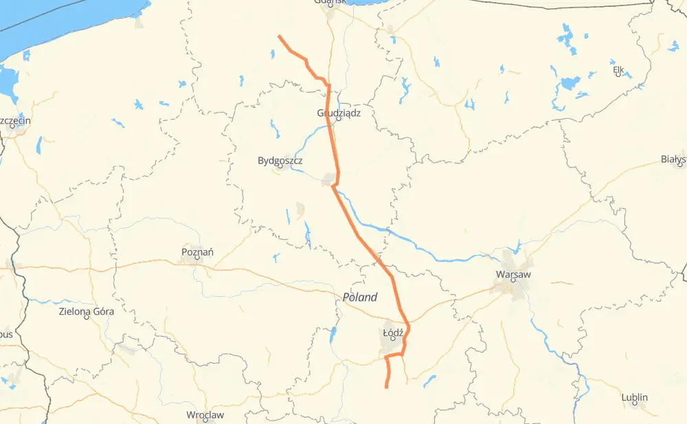
The distance from Belchatow to Berent is 237 miles by road including 165 miles on motorways. Road takes approximately 3 hours and 59 minutes and goes through Stryków, Skurz, Kałduny, Drużbice, Katarzynka, Czarny Las and Wadlew.

There are tolls on the route.
Click here to load the interactive map
Compare this route in other services:
City
Town
Village
Hamlet
Motorway
Primary
Secondary
Unclassified
Point Distance Time Fuel
Belchatow 0 mi 0:00 00 min 0.0 gal
485 4 mi, 04 min
Kałduny 4 mi 0:04 04 min 0.1 gal
485 2 mi, 02 min
Drużbice 6 mi 0:07 07 min 0.2 gal
485 4 mi, 04 min
Wadlew 10 mi 0:11 11 min 0.3 gal
485 4 mi, 04 min
Dłutów 14 mi 0:16 16 min 0.5 gal
485 2 mi, 03 min
Huta Dłutowska 16 mi 0:19 19 min 0.5 gal
485 2 mi, 02 min
Pawłówek 18 mi 0:21 21 min 0.6 gal
485 A1 30 mi, 29 min
Stryków 48 mi 0:50 50 min 1.6 gal
A1 150 mi, 2 h 17 min
Skurz 198 mi 3:07 3 h 07 min 6.7 gal
231 214 38 mi, 51 min
Berent 237 mi 3:59 3 h 59 min 8.0 gal
City
Town
Village
Hamlet
Motorway
Primary
Secondary
Unclassified
Point Distance Time Fuel
Belchatow 0 mi 0:00 00 min 0.0 gal
485 4 mi, 04 min
Kałduny 4 mi 0:04 04 min 0.1 gal
485 2 mi, 02 min
Drużbice 6 mi 0:07 07 min 0.2 gal
485 4 mi, 04 min
Wadlew 10 mi 0:11 11 min 0.3 gal
485 4 mi, 04 min
Dłutów 14 mi 0:16 16 min 0.5 gal
485 1 mi, 01 min
Kozia Wólka 15 mi 0:17 17 min 0.5 gal
485 1 mi, 01 min
Huta Dłutowska 16 mi 0:19 19 min 0.5 gal
485 2 mi, 02 min
Pawłówek 18 mi 0:21 21 min 0.6 gal
485 S8 6 mi, 06 min
Babichy 24 mi 0:27 27 min 0.8 gal
S8 3 mi, 03 min
Modlica 27 mi 0:30 30 min 0.9 gal
S8 3 mi, 03 min
Romanów 30 mi 0:34 34 min 1.0 gal
A1 8 mi, 07 min
Wiączyń Dolny 38 mi 0:41 41 min 1.2 gal
A1 2 mi, 02 min
Natolin 40 mi 0:43 43 min 1.4 gal
A1 1 mi, 00 min
Jerzmanów 42 mi 0:44 44 min 1.4 gal
A1 1 mi, 00 min
Laski 42 mi 0:45 45 min 1.4 gal
A1 2 mi, 01 min
Janinów 44 mi 0:47 47 min 1.5 gal
A1 4 mi, 03 min
Stryków 48 mi 0:50 50 min 1.6 gal
A1 2 mi, 01 min
Wola Błędowa 50 mi 0:52 52 min 1.7 gal
A1 2 mi, 01 min
Nowa Sadówka 52 mi 0:53 53 min 1.7 gal
A1 4 mi, 04 min
Gadka 57 mi 0:57 57 min 1.9 gal
A1 2 mi, 01 min
Stare Piaski 58 mi 0:59 59 min 1.9 gal
A1 2 mi, 02 min
Orenice 61 mi 1:02 1 h 02 min 2.0 gal
A1 1 mi, 01 min
Rogaszyn 63 mi 1:03 1 h 03 min 2.1 gal
A1 2 mi, 01 min
Pęcławice 65 mi 1:05 1 h 05 min 2.2 gal
A1 2 mi, 01 min
Łęki Górne 66 mi 1:06 1 h 06 min 2.2 gal
A1 2 mi, 01 min
Krzyżanówek 69 mi 1:08 1 h 08 min 2.3 gal
A1 2 mi, 01 min
Kaszewy Dworne 70 mi 1:10 1 h 10 min 2.4 gal
A1 4 mi, 03 min
Dębina 75 mi 1:13 1 h 13 min 2.5 gal
A1 4 mi, 03 min
Wieszczyce 78 mi 1:17 1 h 17 min 2.6 gal
A1 2 mi, 01 min
Niedrzew Drugi 81 mi 1:18 1 h 18 min 2.7 gal
A1 2 mi, 02 min
Jastrzębia Stara 83 mi 1:21 1 h 21 min 2.8 gal
A1 5 mi, 04 min
Szewo 88 mi 1:25 1 h 25 min 2.9 gal
A1 4 mi, 03 min
Myszki 93 mi 1:29 1 h 29 min 3.1 gal
A1 1 mi, 00 min
Kaliska 93 mi 1:30 1 h 30 min 3.2 gal
A1 1 mi, 01 min
Dąbrówka 94 mi 1:31 1 h 31 min 3.2 gal
A1 1 mi, 00 min
Dąbrówka Pierwsza 95 mi 1:31 1 h 31 min 3.2 gal
A1 1 mi, 01 min
Czerniewiczki 97 mi 1:33 1 h 33 min 3.2 gal
A1 2 mi, 01 min
Świerkowo 98 mi 1:34 1 h 34 min 3.3 gal
A1 2 mi, 02 min
Nakonowo Stare 101 mi 1:36 1 h 36 min 3.4 gal
A1 2 mi, 01 min
Dębice 103 mi 1:38 1 h 38 min 3.5 gal
A1 6 mi, 05 min
Machnacz 109 mi 1:43 1 h 43 min 3.7 gal
A1 2 mi, 01 min
Lipiny 111 mi 1:45 1 h 45 min 3.8 gal
A1 2 mi, 02 min
Witoldowo 114 mi 1:47 1 h 47 min 3.8 gal
A1 2 mi, 01 min
Kolonia Ustrońska Mała 115 mi 1:49 1 h 49 min 3.9 gal
A1 2 mi, 01 min
Przywieczerzynek 117 mi 1:51 1 h 51 min 4.0 gal
A1 2 mi, 01 min
Przywieczerzyn 119 mi 1:52 1 h 52 min 4.0 gal
A1 3 mi, 02 min
Dąbrówka Mała 122 mi 1:55 1 h 55 min 4.1 gal
A1 2 mi, 01 min
Dąbrówka 124 mi 1:56 1 h 56 min 4.2 gal
A1 1 mi, 01 min
Kuczek 126 mi 1:58 1 h 58 min 4.2 gal
A1 2 mi, 02 min
Nowy Ciechocinek 127 mi 2:00 2 h 00 min 4.3 gal
A1 1 mi, 00 min
Wygoda 129 mi 2:01 2 h 01 min 4.4 gal
A1 1 mi, 01 min
Otłoczyn 130 mi 2:02 2 h 02 min 4.4 gal
A1 4 mi, 03 min
Brzoza 134 mi 2:06 2 h 06 min 4.5 gal
A1 6 mi, 05 min
Lampusz 140 mi 2:11 2 h 11 min 4.7 gal
A1 3 mi, 02 min
Rogowo 143 mi 2:14 2 h 14 min 4.8 gal
A1 2 mi, 01 min
Brzeźno 145 mi 2:16 2 h 16 min 4.9 gal
A1 2 mi, 01 min
Kamionki Małe 147 mi 2:18 2 h 18 min 5.0 gal
A1 5 mi, 04 min
Kiełbasin 152 mi 2:22 2 h 22 min 5.1 gal
A1 4 mi, 03 min
Scherokopaß 155 mi 2:25 2 h 25 min 5.2 gal
A1 6 mi, 04 min
Dąbrówka 161 mi 2:30 2 h 30 min 5.4 gal
A1 2 mi, 01 min
Działowo 163 mi 2:32 2 h 32 min 5.5 gal
A1 2 mi, 01 min
Klęczkowo 165 mi 2:34 2 h 34 min 5.6 gal
A1 1 mi, 01 min
Ruda 167 mi 2:35 2 h 35 min 5.7 gal
A1 3 mi, 02 min
Kulmisch Roßgarten 170 mi 2:37 2 h 37 min 5.7 gal
A1 2 mi, 01 min
Groß Westphalen 171 mi 2:39 2 h 39 min 5.8 gal
A1 4 mi, 03 min
Mischke 175 mi 2:42 2 h 42 min 5.9 gal
A1 4 mi, 03 min
Rulewo 179 mi 2:46 2 h 46 min 6.1 gal
A1 2 mi, 01 min
Bąkowo 181 mi 2:48 2 h 48 min 6.1 gal
A1 2 mi, 01 min
Płochocinek 183 mi 2:49 2 h 49 min 6.2 gal
A1 5 mi, 04 min
Rudawki 188 mi 2:54 2 h 54 min 6.3 gal
A1 231 8 mi, 09 min
Mirotki 196 mi 3:03 3 h 03 min 6.7 gal
231 2 mi, 03 min
Skurz 198 mi 3:06 3 h 06 min 6.7 gal
231 4 mi, 04 min
Drewniaczki 202 mi 3:11 3 h 11 min 6.8 gal
214 2 mi, 01 min
Wielki Bukowiec 204 mi 3:12 3 h 12 min 6.9 gal
214 2 mi, 03 min
Zelgoszcz 206 mi 3:15 3 h 15 min 7.0 gal
214 2 mi, 02 min
Lubichowo 208 mi 3:18 3 h 18 min 7.0 gal
214 1 mi, 01 min
Bietowo 209 mi 3:20 3 h 20 min 7.1 gal
214 2 mi, 03 min
Bordzichow 211 mi 3:24 3 h 24 min 7.2 gal
214 3 mi, 04 min
Zblewo 214 mi 3:28 3 h 28 min 7.2 gal
214 4 mi, 05 min
Struga 218 mi 3:33 3 h 33 min 7.4 gal
214 2 mi, 02 min
Bożepole Szlacheckie 221 mi 3:36 3 h 36 min 7.5 gal
214 1 mi, 02 min
Chwarzno 222 mi 3:38 3 h 38 min 7.5 gal
214 2 mi, 02 min
Stara Kiszewa 224 mi 3:41 3 h 41 min 7.6 gal
214 2 mi, 02 min
Chwarzenko 225 mi 3:43 3 h 43 min 7.6 gal
214 1 mi, 01 min
Foshuta 226 mi 3:44 3 h 44 min 7.7 gal
214 4 mi, 04 min
Małe Stawiska 231 mi 3:49 3 h 49 min 7.8 gal
214 2 mi, 01 min
Sarnowy 232 mi 3:51 3 h 51 min 7.9 gal
214 2 mi, 02 min
Wierzysko-Leśnictwo 234 mi 3:53 3 h 53 min 7.9 gal
214 2 mi, 04 min
Berent 237 mi 3:58 3 h 58 min 8.0 gal

Frequently Asked Questions

How much does it cost to drive from Belchatow to Berent?

Fuel cost: 31.6 USD

This fuel cost is calculated as: (Route length 236.7 mi) / (Fuel consumption 29.4 mpg) * (Fuel price 3.93 USD / gal)

You can adjust fuel consumption and fuel price here.

How long is a car ride from Belchatow to Berent?

Driving time: 3 h 59 min

This time is calculated for driving at the maximum permitted speed, taking into account traffic rules restrictions.

  • 156 mi with a maximum speed 68 mph = 2 h 17 min
  • 7 mi with a maximum speed 62 mph = 6 min
  • 17 mi with a maximum speed 56 mph = 17 min
  • 26 mi with a maximum speed 56 mph = 27 min
  • 14 mi with a maximum speed 50 mph = 16 min
  • 1 mi with a maximum speed 43 mph = 1 min
  • 2 mi with a maximum speed 37 mph = 2 min
  • 11 mi with a maximum speed 31 mph = 22 min
  • 2 mi with a maximum speed 25 mph = 4 min

The calculated driving time does not take into account intermediate stops and traffic jams.

How far is Belchatow to Berent by land?

The distance between Belchatow and Berent is 236.7 mi by road including 165.3 mi on motorways.

Precise satellite coordinates of highways were used for this calculation. The start and finish points are the centers of Belchatow and Berent respectively.

How far is Belchatow to Berent by plane?

The shortest distance (air line, as the crow flies) between Belchatow and Berent is 198.8 mi.

This distance is calculated using the Haversine formula as a great-circle distance between two points on the surface of a sphere. The start and finish points are the centers of Belchatow and Berent respectively. Actual distance between airports may be different.

How many hours is Belchatow from Berent by plane?

Boeing 737 airliner needs 24 min to cover the distance of 199 mi at a cruising speed of 497 mph.

Small plane "Cessna 172" needs 1 h 27 min to flight this distance at average speed of 136 mph.

This time is approximate and do not take into account takeoff and landing times, airport location and other real world factors.

How long is a helicopter ride from Belchatow to Berent?

Fast helicopter "Eurocopter AS350" or "Hughes OH-6 Cayuse" need 1 h 20 min to cover the distance of 199 mi at a cruising speed of 149 mph.

Popular "Robinson R44" needs 1 h 31 min to flight this distance at average speed of 130 mph.

This time is approximate and do not take into account takeoff and landing times, aerodrome location and other real world factors.

What city is halfway between Belchatow and Berent?

The halfway point between Belchatow and Berent is Przywieczerzyn. It is located about 1 mi from the exact midpoint by road.

The distance from Przywieczerzyn to Belchatow is 119 mi and driving will take about 1 h 52 min. The road between Przywieczerzyn and Berent has length 117 mi and will take approximately 2 h 6 min.

The other cities located close to halfway point:

  • Przywieczerzynek is in 117 mi from Belchatow and 119 mi from Berent
  • Kolonia Ustrońska Mała is in 115 mi from Belchatow and 121 mi from Berent
  • Dąbrówka Mała is in 122 mi from Belchatow and 114 mi from Berent

Where is Belchatow in relation to Berent?

Belchatow is located 199 mi south-east of Berent.

Belchatow has geographic coordinates: latitude 51.36504, longitude 19.3684.

Berent has geographic coordinates: latitude 54.12102, longitude 17.97816.

Which highway goes from Belchatow to Berent?

The route from Belchatow to Berent follows A1.

Other minor sections pass along the road:

  • 214: 37 mi
  • 485: 18 mi
  • S8: 9 mi
  • 231: 7 mi
  • S10: 6 mi
  • 12: 6 mi
Have any questions? Contact us!