Distance between Buenavista and Cabo San Lucas
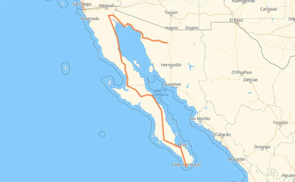
The distance from Buenavista to Cabo San Lucas is 1,240 miles by road including 51 miles on motorways. Road takes approximately 25 hours and 26 minutes and goes through Heroica Caborca, La Paz, Altar, Ingeniero Luis B. Sánchez, Ejido Alberto Oviero Mota, Fraccionamiento Palos Verdes and Guerrero Negro.
| Shortest distance by air | 539 mi ✈️ |
| Car route length | 1,240.3 mi 🚗 |
| Driving time | 25 h 26 min |
| Fuel amount | 42.2 gal |
| Fuel cost | 165.8 USD |
| Toll roads cost | 120 MXN |
| Point | Distance | Time | Fuel | |
| Buenavista | 0 mi | 00 min | 0.0 gal | |
|
MEX 2D 52 mi, 50 min
|
||||
| Altar | 52 mi | 50 min | 1.7 gal | |
|
MEX 2D MEX 2 19 mi, 21 min
|
||||
| Heroica Caborca | 70 mi | 1 h 11 min | 2.2 gal | |
|
MEX 2 SON 003 243 mi, 4 h 33 min
|
||||
| Ingeniero Luis B. Sánchez | 313 mi | 5 h 45 min | 10.6 gal | |
|
SON 34 BC 4 12 mi, 14 min
|
||||
| Ejido Alberto Oviero Mota | 325 mi | 6 h 00 min | 10.9 gal | |
|
BC 4 MEX 5 94 mi, 1 h 44 min
|
||||
| Fraccionamiento Palos Verdes | 419 mi | 7 h 44 min | 14.0 gal | |
|
MEX 5 MEX 1 274 mi, 7 h 08 min
|
||||
| Guerrero Negro | 693 mi | 14 h 53 min | 23.0 gal | |
|
MEX 1 30 mi, 34 min
|
||||
| El Marasal | 723 mi | 15 h 28 min | 24.4 gal | |
|
MEX 1 431 mi, 8 h 10 min
|
||||
| La Paz | 1,155 mi | 23 h 38 min | 39.1 gal | |
|
MEX 1 MEX 19 98 mi, 1 h 47 min
|
||||
| Cabo San Lucas | 1,251 mi | 25 h 25 min | 42.4 gal | |
Hotels of Cabo San Lucas
Frequently Asked Questions
How many toll booths are there from Buenavista to Cabo San Lucas?
There are 1 tollbooth between Buenavista and Cabo San Lucas: Santa Ana.
How much does the toll booths cost from Buenavista to Cabo San Lucas?
Toll roads cost: Santa Ana (120 MXN) = 120 MXN
How much does it cost to drive from Buenavista to Cabo San Lucas?
Fuel cost: 165.8 USD
This fuel cost is calculated as: (Route length 1,240.3 mi) / (Fuel consumption 29.4 mpg) * (Fuel price 3.93 USD / gal)
You can adjust fuel consumption and fuel price here.
Toll roads cost: 120 MXN
How long is a car ride from Buenavista to Cabo San Lucas?
Driving time: 25 h 26 min
This time is calculated for driving at the maximum permitted speed, taking into account traffic rules restrictions.
- 50 mi with a maximum speed 62 mph = 48 min
- 425 mi with a maximum speed 56 mph = 7 h 35 min
- 291 mi with a maximum speed 56 mph = 5 h 12 min
- 372 mi with a maximum speed 50 mph = 7 h 28 min
- 63 mi with a maximum speed 43 mph = 1 h 26 min
- 18 mi with a maximum speed 37 mph = 29 min
- 2 mi with a maximum speed 31 mph = 3 min
- 1 mi with a maximum speed 25 mph = 2 min
- 29 mi with a maximum speed 12 mph = 2 h 18 min
The calculated driving time does not take into account intermediate stops and traffic jams.
How far is Buenavista to Cabo San Lucas by land?
The distance between Buenavista and Cabo San Lucas is 1,240.3 mi by road including 51 mi on motorways.
Precise satellite coordinates of highways were used for this calculation. The start and finish points are the centers of Buenavista and Cabo San Lucas respectively.
How far is Buenavista to Cabo San Lucas by plane?
The shortest distance (air line, as the crow flies) between Buenavista and Cabo San Lucas is 539.4 mi.
This distance is calculated using the Haversine formula as a great-circle distance between two points on the surface of a sphere. The start and finish points are the centers of Buenavista and Cabo San Lucas respectively. Actual distance between airports may be different.
How many hours is Buenavista from Cabo San Lucas by plane?
Boeing 737 airliner needs 1 h 5 min to cover the distance of 539 mi at a cruising speed of 497 mph.
Small plane "Cessna 172" needs 3 h 56 min to flight this distance at average speed of 136 mph.
This time is approximate and do not take into account takeoff and landing times, airport location and other real world factors.
How long is a helicopter ride from Buenavista to Cabo San Lucas?
Fast helicopter "Eurocopter AS350" or "Hughes OH-6 Cayuse" need 3 h 37 min to cover the distance of 539 mi at a cruising speed of 149 mph.
Popular "Robinson R44" needs 4 h 8 min to flight this distance at average speed of 130 mph.
This time is approximate and do not take into account takeoff and landing times, aerodrome location and other real world factors.
What city is halfway between Buenavista and Cabo San Lucas?
The halfway point between Buenavista and Cabo San Lucas is Rosarito. It is located about 27 mi from the exact midpoint by road.
The distance from Rosarito to Buenavista is 647 mi and driving will take about 14 h 1 min. The road between Rosarito and Cabo San Lucas has length 593 mi and will take approximately 11 h 24 min.
The other cities located close to halfway point:
Where is Buenavista in relation to Cabo San Lucas?
Buenavista is located 539 mi north of Cabo San Lucas.
Buenavista has geographic coordinates: latitude 30.585, longitude -111.40083.
Cabo San Lucas has geographic coordinates: latitude 22.89381, longitude -109.91113.
Which highway goes from Buenavista to Cabo San Lucas?
The route from Buenavista to Cabo San Lucas follows MEX 1, MEX 5, SON 003, BCS 53, BC 5, MEX 19, SON 3.
Other minor sections pass along the road:
- MEX 2D: 53 mi
- SON 44: 36 mi
- MEX 2: 19 mi
- BC 4: 16 mi
- BC 41: 4 mi
- SON 34: 2 mi