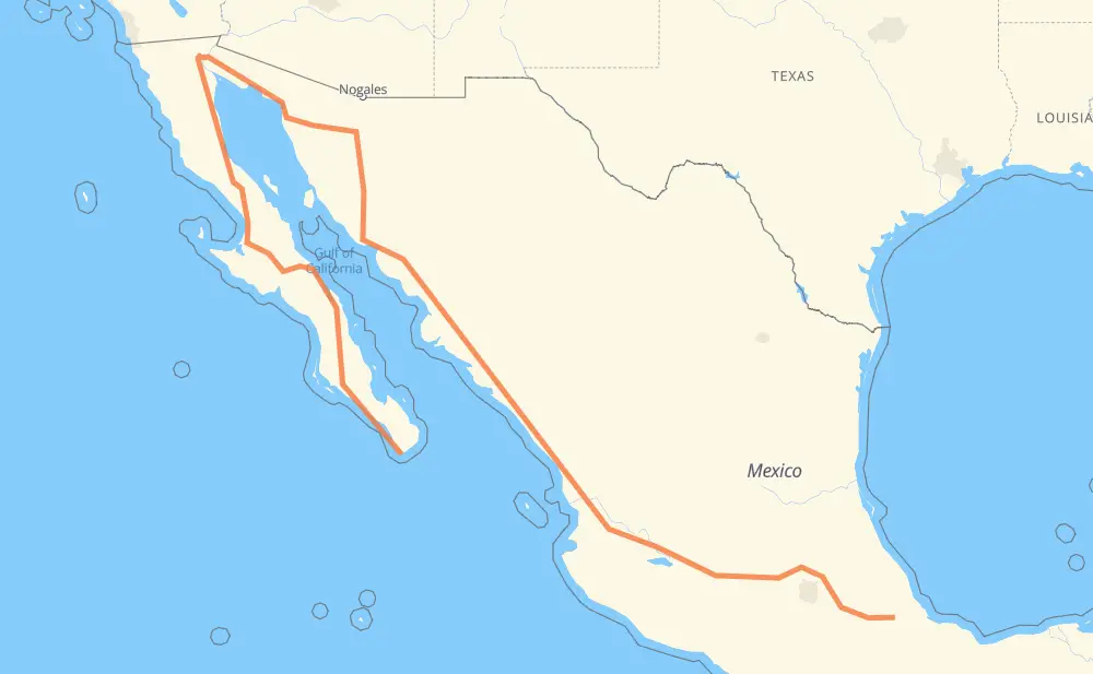
Distance between Cabo San Lucas and General Alatriste (San Joaquín)
The distance from Cabo San Lucas to General Alatriste (San Joaquín) is 2,700 miles by road including 1,440 miles on motorways. Road takes approximately 51 hours and 10 minutes and goes through La Paz, Heroica Caborca, Hermosillo, Navojoa, Los Mochis, Gabriel Leyva Solano and Dimas (Estación Dimas).
| Shortest distance by air | 892 mi ✈️ |
| Car route length | 2,700.5 mi 🚗 |
| Driving time | 51 h 10 min |
| Fuel amount | 91.9 gal |
| Fuel cost | 361 USD |
| Toll roads cost | 2,603 + ? MXN |
| Point | Distance | Time | Fuel | |
| Cabo San Lucas | 0 mi | 00 min | 0.0 gal | |
|
MEX 19 95 mi, 1 h 45 min
|
||||
| La Paz | 95 mi | 1 h 45 min | 3.1 gal | |
|
MEX 1 1,084 mi, 22 h 25 min
|
||||
| Heroica Caborca | 1,179 mi | 24 h 11 min | 39.9 gal | |
|
MEX 2 MEX 15D 169 mi, 2 h 50 min
|
||||
| Hermosillo | 1,349 mi | 27 h 01 min | 45.8 gal | |
|
MEX 15 MEX 15D 201 mi, 3 h 29 min
|
||||
| Navojoa | 1,549 mi | 30 h 30 min | 52.6 gal | |
|
MEX 15D 99 mi, 1 h 55 min
|
||||
| Los Mochis | 1,648 mi | 32 h 26 min | 56.0 gal | |
|
MEX 15D 27 mi, 31 min
|
||||
| Gabriel Leyva Solano | 1,675 mi | 32 h 58 min | 56.7 gal | |
|
MEX 15D 180 mi, 3 h 09 min
|
||||
| Dimas (Estación Dimas) | 1,855 mi | 36 h 08 min | 62.8 gal | |
|
MEX 15D 208 mi, 3 h 38 min
|
||||
| Tepic | 2,062 mi | 39 h 46 min | 70.0 gal | |
|
MEX 15D 138 mi, 2 h 17 min
|
||||
| Tonalá | 2,200 mi | 42 h 04 min | 74.7 gal | |
|
MEX 15D 488 mi, 8 h 39 min
|
||||
| Orizaba | 2,687 mi | 50 h 44 min | 91.3 gal | |
|
MEX 150D 24 mi, 26 min
|
||||
| General Alatriste (San Joaquín) | 2,712 mi | 51 h 10 min | 92.2 gal | |
Frequently Asked Questions
How many toll booths are there from Cabo San Lucas to General Alatriste (San Joaquín)?
There are 33 toll booths between Cabo San Lucas and General Alatriste (San Joaquín): Santa Ana, Hermosillo, Guaymas, Libramiento Cd Obregon, Fundicion, Estacion Don La Jaula, Fortín, San Miguel, Sinaloa, Las Brisas, San Pedro km 197+100, Costa Rica, Marmol, El Rosario, Ruiz, Trapichillo, Santa Maria del Oro, Plan de Barrancas, La Joya, Ocotlán, Zinapecuaro, Contepec, Panindicuaro, Ecuandureo, Atlacomulco — Maravatio, Atlacomulco 2, San Martin Texmelucan, San Martín, Viaducto Elevado de Puebla, Amozoc, Esperanza 27, Arenal and El Pisal.
How much does the toll booths cost from Cabo San Lucas to General Alatriste (San Joaquín)?
Toll roads cost: Santa Ana (120 MXN) + Hermosillo (90 MXN) + Guaymas (38 MXN) + Libramiento Cd Obregon (?) + Fundicion (90 MXN) + Estacion Don La Jaula (90 MXN) + San Miguel (69 MXN) + Sinaloa (24 MXN) + Las Brisas (76 MXN) + El Pisal (73 MXN) + San Pedro km 197+100 (34 MXN) + Costa Rica (152 MXN) + Marmol (131 MXN) + El Rosario (140 MXN) + Ruiz (120 MXN) + Trapichillo (80 MXN) + Santa Maria del Oro (115 MXN) + Plan de Barrancas (195 MXN) + Arenal (131 MXN) + La Joya (?) + Ocotlán (226 MXN) + Ecuandureo (111 MXN) + Panindicuaro (?) + Zinapecuaro (161 MXN) + Contepec (?) + Atlacomulco — Maravatio (50 MXN) + Atlacomulco 2 (?) + San Martin Texmelucan (?) + San Martín (42 MXN) + Viaducto Elevado de Puebla (?) + Amozoc (72 MXN) + Esperanza 27 (140 MXN) + Fortín (33 MXN) = 2,603 + ? MXN
How much does it cost to drive from Cabo San Lucas to General Alatriste (San Joaquín)?
Fuel cost: 361 USD
This fuel cost is calculated as: (Route length 2,700.5 mi) / (Fuel consumption 29.4 mpg) * (Fuel price 3.93 USD / gal)
You can adjust fuel consumption and fuel price here.
Toll roads cost: 2,603 + ? MXN
How long is a car ride from Cabo San Lucas to General Alatriste (San Joaquín)?
Driving time: 51 h 10 min
This time is calculated for driving at the maximum permitted speed, taking into account traffic rules restrictions.
- 295 mi with a maximum speed 68 mph = 4 h 20 min
- 574 mi with a maximum speed 62 mph = 9 h 13 min
- 440 mi with a maximum speed 56 mph = 7 h 51 min
- 359 mi with a maximum speed 56 mph = 6 h 25 min
- 904 mi with a maximum speed 50 mph = 18 h 11 min
- 73 mi with a maximum speed 43 mph = 1 h 40 min
- 32 mi with a maximum speed 37 mph = 51 min
- 4 mi with a maximum speed 31 mph = 8 min
- 1 mi with a maximum speed 25 mph = 3 min
- 29 mi with a maximum speed 12 mph = 2 h 18 min
- 1 mi with a maximum speed 6 mph = 6 min
The calculated driving time does not take into account intermediate stops and traffic jams.
How far is Cabo San Lucas to General Alatriste (San Joaquín) by land?
The distance between Cabo San Lucas and General Alatriste (San Joaquín) is 2,700.5 mi by road including 1,439.7 mi on motorways.
Precise satellite coordinates of highways were used for this calculation. The start and finish points are the centers of Cabo San Lucas and General Alatriste (San Joaquín) respectively.
How far is Cabo San Lucas to General Alatriste (San Joaquín) by plane?
The shortest distance (air line, as the crow flies) between Cabo San Lucas and General Alatriste (San Joaquín) is 891.7 mi.
This distance is calculated using the Haversine formula as a great-circle distance between two points on the surface of a sphere. The start and finish points are the centers of Cabo San Lucas and General Alatriste (San Joaquín) respectively. Actual distance between airports may be different.
How many hours is Cabo San Lucas from General Alatriste (San Joaquín) by plane?
Boeing 737 airliner needs 1 h 47 min to cover the distance of 892 mi at a cruising speed of 497 mph.
Small plane "Cessna 172" needs 6 h 31 min to flight this distance at average speed of 136 mph.
This time is approximate and do not take into account takeoff and landing times, airport location and other real world factors.
How long is a helicopter ride from Cabo San Lucas to General Alatriste (San Joaquín)?
Fast helicopter "Eurocopter AS350" or "Hughes OH-6 Cayuse" need 5 h 58 min to cover the distance of 892 mi at a cruising speed of 149 mph.
Popular "Robinson R44" needs 6 h 50 min to flight this distance at average speed of 130 mph.
This time is approximate and do not take into account takeoff and landing times, aerodrome location and other real world factors.
What city is halfway between Cabo San Lucas and General Alatriste (San Joaquín)?
The halfway point between Cabo San Lucas and General Alatriste (San Joaquín) is Hermosillo. It is located about 1 mi from the exact midpoint by road.
The distance from Hermosillo to Cabo San Lucas is 1,349 mi and driving will take about 27 h. The road between Hermosillo and General Alatriste (San Joaquín) has length 1,351 mi and will take approximately 24 h 10 min.
The other cities located close to halfway point:
- Campo Grande is in 1,358 mi from Cabo San Lucas and 1,343 mi from General Alatriste (San Joaquín)
- Rancho el Tijerito is in 1,338 mi from Cabo San Lucas and 1,363 mi from General Alatriste (San Joaquín)
- Ganadera Gapa is in 1,370 mi from Cabo San Lucas and 1,331 mi from General Alatriste (San Joaquín)
Where is Cabo San Lucas in relation to General Alatriste (San Joaquín)?
Cabo San Lucas is located 892 mi north-west of General Alatriste (San Joaquín).
Cabo San Lucas has geographic coordinates: latitude 22.89381, longitude -109.91113.
General Alatriste (San Joaquín) has geographic coordinates: latitude 18.84, longitude -96.79361.
Which highway goes from Cabo San Lucas to General Alatriste (San Joaquín)?
The route from Cabo San Lucas to General Alatriste (San Joaquín) follows MEX 15D, MEX 1, MEX 5, MEX M40D, SON 003, MEX 150D, BCS 53, BC 5, MEX 19, SON 3.
Other minor sections pass along the road:
- MEX 2D: 47 mi
- SON 44: 38 mi
- MEX 15: 22 mi
- MEX 90: 19 mi
- MEX 70: 19 mi
- MEX 2: 18 mi
- BC 4: 17 mi
- MEX 80D: 11 mi
- MEX 80: 7 mi
- MEX 23: 5 mi
- MEX 150: 5 mi
- BC 41: 4 mi
- MEX 040D: 4 mi
- SON 34: 2 mi
- MEX 15d: 2 mi