Distance between Cabo San Lucas and Laguna de Canachi
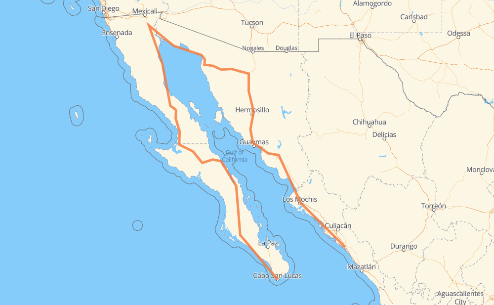
The distance from Cabo San Lucas to Laguna de Canachi is 1,813 miles by road including 557 miles on motorways. Road takes approximately 35 hours and 31 minutes and goes through La Paz, Heroica Caborca, Hermosillo, Navojoa, Los Mochis and Gabriel Leyva Solano.
You can adjust fuel consumption and fuel price here.
Toll roads cost:
856 + ? MXN
How long is a car ride from Cabo San Lucas to Laguna de Canachi?
Driving time:
35 h 31 min
This time is calculated for driving at the maximum permitted speed, taking into account traffic rules restrictions.
170 mi with a maximum speed 68 mph = 2 h 29 min
181 mi with a maximum speed 62 mph = 2 h 54 min
439 mi with a maximum speed 56 mph = 7 h 50 min
331 mi with a maximum speed 56 mph = 5 h 55 min
575 mi with a maximum speed 50 mph = 11 h 34 min
63 mi with a maximum speed 43 mph = 1 h 26 min
29 mi with a maximum speed 37 mph = 46 min
4 mi with a maximum speed 31 mph = 7 min
1 mi with a maximum speed 25 mph = 3 min
29 mi with a maximum speed 12 mph = 2 h 18 min
1 mi with a maximum speed 6 mph = 6 min
The calculated driving time does not take into account intermediate stops and traffic jams.
How far is Cabo San Lucas to Laguna de Canachi by land?
The distance between Cabo San Lucas and Laguna de Canachi is 1,812.5 mi by road including 556.7 mi on motorways.
Precise satellite coordinates of highways were used for this calculation. The start and finish points are the centers of Cabo San Lucas and Laguna de Canachi respectively.
How far is Cabo San Lucas to Laguna de Canachi by plane?
The shortest distance (air line, as the crow flies) between Cabo San Lucas and Laguna de Canachi is 197.6 mi.
This distance is calculated using the Haversine formula as a great-circle distance between two points on the surface of a sphere. The start and finish points are the centers of Cabo San Lucas and Laguna de Canachi respectively. Actual distance between airports may be different.
How many hours is Cabo San Lucas from Laguna de Canachi by plane?
Boeing 737 airliner needs 23 min to cover the distance of 198 mi at a cruising speed of 497 mph.
Small plane "Cessna 172" needs 1 h 26 min to flight this distance at average speed of 136 mph.
This time is approximate and do not take into account takeoff and landing times, airport location and other real world factors.
How long is a helicopter ride from Cabo San Lucas to Laguna de Canachi?
Fast helicopter "Eurocopter AS350" or "Hughes OH-6 Cayuse" need 1 h 19 min to cover the distance of 198 mi at a cruising speed of 149 mph.
Popular "Robinson R44" needs 1 h 30 min to flight this distance at average speed of 130 mph.
This time is approximate and do not take into account takeoff and landing times, aerodrome location and other real world factors.
What city is halfway between Cabo San Lucas and Laguna de Canachi?
The halfway point between Cabo San Lucas and Laguna de Canachi is Ejido Alberto Oviero Mota. It is located about 18 mi from the exact midpoint by road.
The distance from Ejido Alberto Oviero Mota to Cabo San Lucas is 925 mi and driving will take about 19 h 23 min. The road between Ejido Alberto Oviero Mota and Laguna de Canachi has length 888 mi and will take approximately 16 h 8 min.
The other cities located close to halfway point:
Ingeniero Luis B. Sánchez is in 937 mi from Cabo San Lucas and 876 mi from Laguna de Canachi
Mesa Rica Dos is in 943 mi from Cabo San Lucas and 870 mi from Laguna de Canachi
Flor del Desierto is in 951 mi from Cabo San Lucas and 861 mi from Laguna de Canachi
Where is Cabo San Lucas in relation to Laguna de Canachi?
Cabo San Lucas is located 198 mi south-west of Laguna de Canachi.
Cabo San Lucas has geographic coordinates: latitude 22.89381, longitude -109.91113.
Laguna de Canachi has geographic coordinates: latitude 24.13579, longitude -107.09882.
Which highway goes from Cabo San Lucas to Laguna de Canachi?
The route from Cabo San Lucas to Laguna de Canachi follows MEX 15D, MEX 1, MEX 5, SON 003, BCS 53, BC 5, MEX 19, SON 3.