Distance between Camapuã and São Francisco de Itabapoana
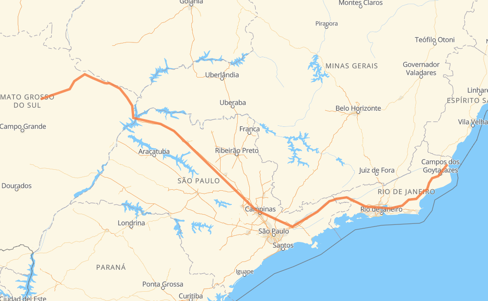
The distance from Camapuã to São Francisco de Itabapoana is 1,120 miles by road including 676 miles on motorways. Road takes approximately 19 hours and 18 minutes and goes through Rio Claro, Itatiba, Atibaia, Jacareí, Guaratinguetá and Magé.
| Shortest distance by air | 848 mi ✈️ |
| Car route length | 1,119.7 mi 🚗 |
| Driving time | 19 h 18 min |
| Fuel amount | 38.1 gal |
| Fuel cost | 148.6 USD |
| Point | Distance | Time | Fuel | |
| Camapuã | 0 mi | 00 min | 0.0 gal | |
|
BR-060 334 mi, 5 h 50 min
|
||||
| Conjunto Habitacional Antônio Marin | 334 mi | 5 h 50 min | 11.3 gal | |
|
SP-320 44 mi, 38 min
|
||||
| Jardim Santa Mônica | 378 mi | 6 h 29 min | 12.8 gal | |
|
SP-320 16 mi, 14 min
|
||||
| Bairro São Pedro | 394 mi | 6 h 43 min | 13.3 gal | |
|
SP-310 173 mi, 2 h 44 min
|
||||
| Rio Claro | 567 mi | 9 h 28 min | 19.2 gal | |
|
SP-310 SP-330 70 mi, 1 h 07 min
|
||||
| Itatiba | 637 mi | 10 h 36 min | 21.5 gal | |
|
SP-065 16 mi, 14 min
|
||||
| Atibaia | 653 mi | 10 h 50 min | 21.9 gal | |
|
SP-065 50 mi, 46 min
|
||||
| Jacareí | 703 mi | 11 h 37 min | 23.8 gal | |
|
SP-060 BR-116 62 mi, 58 min
|
||||
| Guaratinguetá | 764 mi | 12 h 35 min | 25.9 gal | |
|
SP-060 BR-116 168 mi, 2 h 58 min
|
||||
| Magé | 933 mi | 15 h 34 min | 31.6 gal | |
|
BR-493 BR-101 188 mi, 3 h 43 min
|
||||
| -21.47434, -41.11184 | 1,121 mi | 19 h 18 min | 38.1 gal | |
Frequently Asked Questions
How much does it cost to drive from Camapuã to São Francisco de Itabapoana?
Fuel cost: 148.6 USD
This fuel cost is calculated as: (Route length 1,119.7 mi) / (Fuel consumption 29.4 mpg) * (Fuel price 3.9 USD / gal)
You can adjust fuel consumption and fuel price here.
How long is a car ride from Camapuã to São Francisco de Itabapoana?
Driving time: 19 h 18 min
This time is calculated for driving at the maximum permitted speed, taking into account traffic rules restrictions.
- 451 mi with a maximum speed 68 mph = 6 h 37 min
- 139 mi with a maximum speed 62 mph = 2 h 13 min
- 352 mi with a maximum speed 56 mph = 6 h 17 min
- 19 mi with a maximum speed 56 mph = 20 min
- 89 mi with a maximum speed 50 mph = 1 h 47 min
- 19 mi with a maximum speed 43 mph = 26 min
- 37 mi with a maximum speed 37 mph = 59 min
- 14 mi with a maximum speed 25 mph = 35 min
The calculated driving time does not take into account intermediate stops and traffic jams.
How far is Camapuã to São Francisco de Itabapoana by land?
The distance between Camapuã and São Francisco de Itabapoana is 1,119.7 mi by road including 676.1 mi on motorways.
Precise satellite coordinates of highways were used for this calculation. The start and finish points are the centers of Camapuã and São Francisco de Itabapoana respectively.
How far is Camapuã to São Francisco de Itabapoana by plane?
The shortest distance (air line, as the crow flies) between Camapuã and São Francisco de Itabapoana is 847.6 mi.
This distance is calculated using the Haversine formula as a great-circle distance between two points on the surface of a sphere. The start and finish points are the centers of Camapuã and São Francisco de Itabapoana respectively. Actual distance between airports may be different.
How many hours is Camapuã from São Francisco de Itabapoana by plane?
Boeing 737 airliner needs 1 h 42 min to cover the distance of 848 mi at a cruising speed of 497 mph.
Small plane "Cessna 172" needs 6 h 12 min to flight this distance at average speed of 136 mph.
This time is approximate and do not take into account takeoff and landing times, airport location and other real world factors.
How long is a helicopter ride from Camapuã to São Francisco de Itabapoana?
Fast helicopter "Eurocopter AS350" or "Hughes OH-6 Cayuse" need 5 h 41 min to cover the distance of 848 mi at a cruising speed of 149 mph.
Popular "Robinson R44" needs 6 h 29 min to flight this distance at average speed of 130 mph.
This time is approximate and do not take into account takeoff and landing times, aerodrome location and other real world factors.
What city is halfway between Camapuã and São Francisco de Itabapoana?
The halfway point between Camapuã and São Francisco de Itabapoana is Rio Claro. It is located about 7 mi from the exact midpoint by road.
The distance from Rio Claro to Camapuã is 567 mi and driving will take about 9 h 28 min. The road between Rio Claro and São Francisco de Itabapoana has length 553 mi and will take approximately 9 h 50 min.
The other cities located close to halfway point:
Where is Camapuã in relation to São Francisco de Itabapoana?
Camapuã is located 848 mi west of São Francisco de Itabapoana.
Camapuã has geographic coordinates: latitude -19.52917, longitude -54.04346.
São Francisco de Itabapoana has geographic coordinates: latitude -21.47434, longitude -41.11184.
Which highway goes from Camapuã to São Francisco de Itabapoana?
The route from Camapuã to São Francisco de Itabapoana follows BR-116, SP-310, BR-101, BR-060, SP-320, SP-060, SP-065, BR-364, BR-158, MS-306.
Other minor sections pass along the road:
- BR-493: 44 mi
- BR-267: 37 mi
- SP-330: 30 mi
- BR-050: 30 mi
- RJ-224: 19 mi
- RJ-109: 12 mi
- BR-459: 9 mi
- BR-383: 7 mi
- KM-272: 2 mi
- BR-436: 1 mi