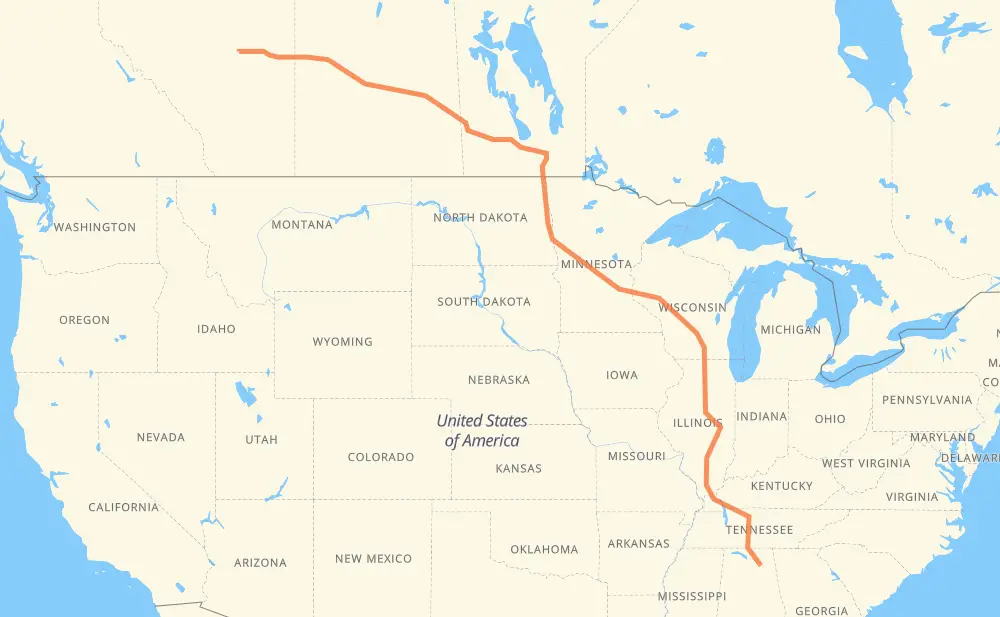
Distance between Camrose AB and Albertville AL
The distance from Camrose to Albertville is 2,262 miles by road including 1,373 miles on motorways. Road takes approximately 37 hours and 56 minutes and goes through North Battleford, Saskatoon, Yorkton, Portage la Prairie, Winnipeg, Grand Forks and Fargo.
| Shortest distance by air | 1,838 mi ✈️ |
| Car route length | 2,261.8 mi 🚗 |
| Driving time | 37 h 56 min |
| Fuel amount | 76.9 gal |
| Fuel cost | 302.3 USD |
| Point | Distance | Time | Fuel | |
| Camrose | 0 mi | 00 min | 0.0 gal | |
|
26 40 199 mi, 3 h 38 min
|
||||
| North Battleford | 199 mi | 3 h 38 min | 6.7 gal | |
|
40 16 86 mi, 1 h 35 min
|
||||
| Saskatoon | 286 mi | 5 h 13 min | 9.6 gal | |
|
16 202 mi, 3 h 37 min
|
||||
| Yorkton | 487 mi | 8 h 51 min | 16.5 gal | |
|
16 PTH 16 229 mi, 4 h 14 min
|
||||
| Portage la Prairie | 717 mi | 13 h 05 min | 24.2 gal | |
|
PTH 1 53 mi, 58 min
|
||||
| Winnipeg | 769 mi | 14 h 03 min | 25.9 gal | |
|
PTH 100 I 29 142 mi, 2 h 34 min
|
||||
| Grand Forks | 911 mi | 16 h 38 min | 30.8 gal | |
|
I 29 74 mi, 1 h 17 min
|
||||
| Fargo | 985 mi | 17 h 55 min | 33.3 gal | |
|
I 29 I 94 327 mi, 5 h 03 min
|
||||
| Eau Claire | 1,312 mi | 22 h 59 min | 44.4 gal | |
|
I 94 175 mi, 2 h 35 min
|
||||
| Madison | 1,488 mi | 25 h 34 min | 50.4 gal | |
|
I 39 35 mi, 30 min
|
||||
| Janesville | 1,522 mi | 26 h 05 min | 51.7 gal | |
|
I 39 161 mi, 2 h 22 min
|
||||
| Bloomington | 1,683 mi | 28 h 27 min | 57.2 gal | |
|
US 51 I 57 284 mi, 4 h 34 min
|
||||
| Paducah | 1,967 mi | 33 h 01 min | 66.8 gal | |
|
I 24 94 mi, 1 h 23 min
|
||||
| Clarksville | 2,062 mi | 34 h 25 min | 69.9 gal | |
|
I 24 42 mi, 37 min
|
||||
| Nashville | 2,104 mi | 35 h 02 min | 71.5 gal | |
|
I 24 I 65 19 mi, 21 min
|
||||
| Franklin | 2,123 mi | 35 h 23 min | 72.0 gal | |
|
I 65 139 mi, 2 h 32 min
|
||||
| Albertville | 2,262 mi | 37 h 56 min | 76.9 gal | |
Hotels of Albertville
Frequently Asked Questions
How much does it cost to drive from Camrose to Albertville?
Fuel cost: 302.3 USD
This fuel cost is calculated as: (Route length 2,261.8 mi) / (Fuel consumption 29.4 mpg) * (Fuel price 3.93 USD / gal)
You can adjust fuel consumption and fuel price here.
How long is a car ride from Camrose to Albertville?
Driving time: 37 h 56 min
This time is calculated for driving at the maximum permitted speed, taking into account traffic rules restrictions.
- 884 mi with a maximum speed 68 mph = 13 h
- 50 mi with a maximum speed 65 mph = 46 min
- 226 mi with a maximum speed 62 mph = 3 h 37 min
- 21 mi with a maximum speed 60 mph = 20 min
- 727 mi with a maximum speed 56 mph = 12 h 58 min
- 12 mi with a maximum speed 56 mph = 13 min
- 30 mi with a maximum speed 55 mph = 33 min
- 4 mi with a maximum speed 50 mph = 4 min
- 281 mi with a maximum speed 50 mph = 5 h 39 min
- 6 mi with a maximum speed 45 mph = 7 min
- 4 mi with a maximum speed 43 mph = 6 min
- 1 mi with a maximum speed 40 mph = 1 min
- 7 mi with a maximum speed 37 mph = 12 min
- 2 mi with a maximum speed 35 mph = 3 min
- 6 mi with a maximum speed 31 mph = 10 min
The calculated driving time does not take into account intermediate stops and traffic jams.
How far is Camrose to Albertville by land?
The distance between Camrose and Albertville is 2,261.8 mi by road including 1,372.6 mi on motorways.
Precise satellite coordinates of highways were used for this calculation. The start and finish points are the centers of Camrose and Albertville respectively.
How far is Camrose to Albertville by plane?
The shortest distance (air line, as the crow flies) between Camrose and Albertville is 1,838 mi.
This distance is calculated using the Haversine formula as a great-circle distance between two points on the surface of a sphere. The start and finish points are the centers of Camrose and Albertville respectively. Actual distance between airports may be different.
How many hours is Camrose from Albertville by plane?
Boeing 737 airliner needs 3 h 41 min to cover the distance of 1,838 mi at a cruising speed of 497 mph.
Small plane "Cessna 172" needs 13 h 26 min to flight this distance at average speed of 136 mph.
This time is approximate and do not take into account takeoff and landing times, airport location and other real world factors.
How long is a helicopter ride from Camrose to Albertville?
Fast helicopter "Eurocopter AS350" or "Hughes OH-6 Cayuse" need 12 h 19 min to cover the distance of 1,838 mi at a cruising speed of 149 mph.
Popular "Robinson R44" needs 14 h 5 min to flight this distance at average speed of 130 mph.
This time is approximate and do not take into account takeoff and landing times, aerodrome location and other real world factors.
What city is halfway between Camrose and Albertville?
The halfway point between Camrose and Albertville is Freeport. It is located about 1 mi from the exact midpoint by road.
The distance from Freeport to Camrose is 1,132 mi and driving will take about 20 h 12 min. The road between Freeport and Albertville has length 1,130 mi and will take approximately 17 h 44 min.
The other cities located close to halfway point:
Where is Camrose in relation to Albertville?
Camrose is located 1,838 mi north-west of Albertville.
Camrose has geographic coordinates: latitude 53.01313, longitude -112.84058.
Albertville has geographic coordinates: latitude 34.26759, longitude -86.20887.
Which highway goes from Camrose to Albertville?
The route from Camrose to Albertville follows I 94, 16, I 39, I 57, I 24, PTH 16, I 90, I 29, US 51, US 81, I 65, 40, 14.
Other minor sections pass along the road:
- PTH 75: 58 mi
- PTH 1: 53 mi
- I 74: 51 mi
- 26: 51 mi
- US 431: 47 mi
- I 694: 29 mi
- PTH 83: 23 mi
- SR 53: 22 mi
- I 69: 16 mi
- PTH 100: 14 mi
- US 59: 11 mi
- 21: 10 mi
- 11: 8 mi
- SR 79: 7 mi
- I 55: 7 mi
- 20: 6 mi
- 674: 6 mi
- I 70: 6 mi
- US 10: 4 mi
- I 64: 4 mi
- MN 95: 4 mi
- PTH 10: 4 mi
- US 12: 4 mi
- 834: 3 mi
- 6: 3 mi
- MN 210: 3 mi
- US 52: 3 mi
- WI 35: 2 mi
- 36: 2 mi
- US 20: 2 mi
- 4: 2 mi
- PR 264: 2 mi
- 9: 2 mi
- TN 7: 2 mi
- WI 11: 2 mi
- 13: 2 mi
- US 72: 2 mi
- Route 42: 1 mi
- 17: 1 mi
- 12: 1 mi
- CR 426: 1 mi
- 10: 1 mi
- PR 250: 1 mi
- 675: 1 mi
- PTH 5: 1 mi
- US 231: 1 mi
- I 40: 1 mi