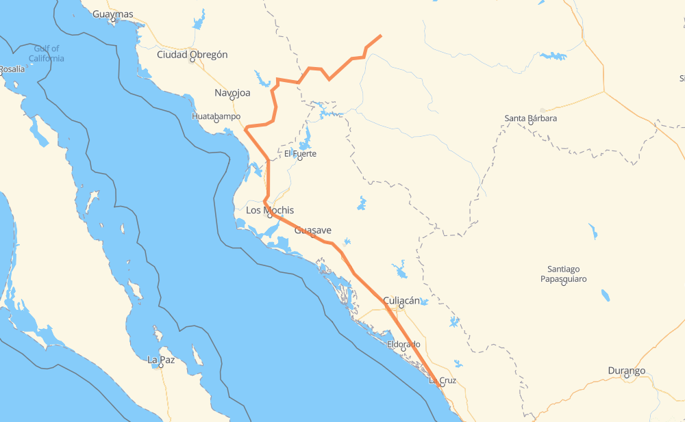
Distance between Ceuta and Creel
The distance from Ceuta to Creel is 487 miles by road including 263 miles on motorways. Road takes approximately 9 hours and 40 minutes and goes through Gabriel Leyva Solano, Los Mochis, Tanques, Campo Balbuena, Colonia Agrícola México (Palmitas), Callejones de Guasavito and Adolfo Ruiz Cortines.
| Shortest distance by air | 270 mi ✈️ |
| Car route length | 486.5 mi 🚗 |
| Driving time | 9 h 40 min |
| Fuel amount | 16.5 gal |
| Fuel cost | 65 USD |
| Toll roads cost | 428 MXN |
| Point | Distance | Time | Fuel | |
| Ceuta | 0 mi | 00 min | 0.0 gal | |
|
MEX 15D 14 mi, 17 min
|
||||
| Tanques | 14 mi | 17 min | 0.3 gal | |
|
MEX 15D 58 mi, 57 min
|
||||
| Campo Balbuena | 72 mi | 1 h 14 min | 2.4 gal | |
|
MEX 15D 38 mi, 39 min
|
||||
| Colonia Agrícola México (Palmitas) | 110 mi | 1 h 53 min | 3.6 gal | |
|
MEX 15D 47 mi, 50 min
|
||||
| Callejones de Guasavito | 157 mi | 2 h 43 min | 5.3 gal | |
|
MEX 15D 10 mi, 12 min
|
||||
| Gabriel Leyva Solano | 167 mi | 2 h 56 min | 5.4 gal | |
|
MEX 15D 9 mi, 11 min
|
||||
| Adolfo Ruiz Cortines | 176 mi | 3 h 07 min | 5.9 gal | |
|
MEX 15D 7 mi, 07 min
|
||||
| Juan José Ríos | 183 mi | 3 h 15 min | 6.1 gal | |
|
MEX 15D 11 mi, 12 min
|
||||
| Los Mochis | 194 mi | 3 h 27 min | 6.5 gal | |
|
MEX 15D 293 mi, 6 h 13 min
|
||||
| Creel | 487 mi | 9 h 40 min | 16.4 gal | |
Hotels of Creel
Frequently Asked Questions
How many toll booths are there from Ceuta to Creel?
There are 6 toll booths between Ceuta and Creel: San Miguel, Sinaloa, Las Brisas, San Pedro km 197+100, Costa Rica and El Pisal.
How much does the toll booths cost from Ceuta to Creel?
Toll roads cost: Costa Rica (152 MXN) + San Pedro km 197+100 (34 MXN) + El Pisal (73 MXN) + Las Brisas (76 MXN) + Sinaloa (24 MXN) + San Miguel (69 MXN) = 428 MXN
How much does it cost to drive from Ceuta to Creel?
Fuel cost: 65 USD
This fuel cost is calculated as: (Route length 486.5 mi) / (Fuel consumption 29.4 mpg) * (Fuel price 3.93 USD / gal)
You can adjust fuel consumption and fuel price here.
Toll roads cost: 428 MXN
How long is a car ride from Ceuta to Creel?
Driving time: 9 h 40 min
This time is calculated for driving at the maximum permitted speed, taking into account traffic rules restrictions.
- 14 mi with a maximum speed 68 mph = 12 min
- 104 mi with a maximum speed 62 mph = 1 h 40 min
- 4 mi with a maximum speed 56 mph = 4 min
- 49 mi with a maximum speed 56 mph = 52 min
- 267 mi with a maximum speed 50 mph = 5 h 21 min
- 18 mi with a maximum speed 37 mph = 29 min
- 30 mi with a maximum speed 31 mph = 58 min
The calculated driving time does not take into account intermediate stops and traffic jams.
How far is Ceuta to Creel by land?
The distance between Ceuta and Creel is 486.5 mi by road including 263.5 mi on motorways.
Precise satellite coordinates of highways were used for this calculation. The start and finish points are the centers of Ceuta and Creel respectively.
How far is Ceuta to Creel by plane?
The shortest distance (air line, as the crow flies) between Ceuta and Creel is 269.7 mi.
This distance is calculated using the Haversine formula as a great-circle distance between two points on the surface of a sphere. The start and finish points are the centers of Ceuta and Creel respectively. Actual distance between airports may be different.
How many hours is Ceuta from Creel by plane?
Boeing 737 airliner needs 32 min to cover the distance of 270 mi at a cruising speed of 497 mph.
Small plane "Cessna 172" needs 1 h 58 min to flight this distance at average speed of 136 mph.
This time is approximate and do not take into account takeoff and landing times, airport location and other real world factors.
How long is a helicopter ride from Ceuta to Creel?
Fast helicopter "Eurocopter AS350" or "Hughes OH-6 Cayuse" need 1 h 48 min to cover the distance of 270 mi at a cruising speed of 149 mph.
Popular "Robinson R44" needs 2 h 4 min to flight this distance at average speed of 130 mph.
This time is approximate and do not take into account takeoff and landing times, aerodrome location and other real world factors.
What city is halfway between Ceuta and Creel?
The halfway point between Ceuta and Creel is Emiliano Zapata Dos. It is located about 1 mi from the exact midpoint by road.
The distance from Emiliano Zapata Dos to Ceuta is 244 mi and driving will take about 4 h 25 min. The road between Emiliano Zapata Dos and Creel has length 243 mi and will take approximately 5 h 14 min.
The other cities located close to halfway point:
Where is Ceuta in relation to Creel?
Ceuta is located 270 mi south of Creel.
Ceuta has geographic coordinates: latitude 23.90193, longitude -106.92873.
Creel has geographic coordinates: latitude 27.75302, longitude -107.63435.
Which highway goes from Ceuta to Creel?
The route from Ceuta to Creel follows MEX 15D.
Other minor sections pass along the road:
- SON 188: 40 mi
- CHIH 77: 34 mi
- CHIH 25: 1 mi
- Sin 419: 1 mi