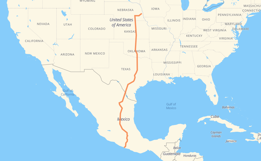
Distance between Chalco NE and Acapulco
The distance from Chalco to Acapulco is 2,039 miles by road including 1,880 miles on motorways. Road takes approximately 32 hours and 54 minutes and goes through Lincoln, Wichita, Edmond, Oklahoma City, Norman, Denton and Fort Worth.
| Shortest distance by air | 1,696 mi ✈️ |
| Car route length | 2,038.7 mi 🚗 |
| Driving time | 32 h 54 min |
| Fuel amount | 69.4 gal |
| Fuel cost | 270.5 USD |
| Toll roads cost | 1,528 + ? MXN |
| Point | Distance | Time | Fuel | |
| Chalco | 0 mi | 00 min | 0.0 gal | |
|
NE 50 I 80 42 mi, 38 min
|
||||
| Lincoln | 42 mi | 38 min | 1.3 gal | |
|
I 80 US 81 275 mi, 4 h 27 min
|
||||
| Wichita | 317 mi | 5 h 06 min | 10.7 gal | |
|
I 135 I 35 143 mi, 2 h 07 min
|
||||
| Edmond | 459 mi | 7 h 13 min | 15.5 gal | |
|
I 35 13 mi, 12 min
|
||||
| Oklahoma City | 472 mi | 7 h 26 min | 15.8 gal | |
|
I 35 18 mi, 17 min
|
||||
| Norman | 490 mi | 7 h 43 min | 16.5 gal | |
|
I 35 147 mi, 2 h 10 min
|
||||
| Denton | 638 mi | 9 h 53 min | 21.4 gal | |
|
I 35 I 35W 35 mi, 31 min
|
||||
| Fort Worth | 672 mi | 10 h 25 min | 22.8 gal | |
|
I 35W Express I 35W 89 mi, 1 h 19 min
|
||||
| Waco | 761 mi | 11 h 44 min | 25.7 gal | |
|
I 35 101 mi, 1 h 31 min
|
||||
| Austin | 863 mi | 13 h 16 min | 29.1 gal | |
|
TX 45 Toll TX 130 Toll 93 mi, 1 h 22 min
|
||||
| San Antonio | 956 mi | 14 h 39 min | 32.4 gal | |
|
I 10 I 35 147 mi, 2 h 10 min
|
||||
| Laredo | 1,103 mi | 16 h 49 min | 37.2 gal | |
|
US 83 10 mi, 09 min
|
||||
| Nuevo Laredo | 1,112 mi | 16 h 58 min | 37.8 gal | |
|
MEX 85 MEX 57 601 mi, 9 h 57 min
|
||||
| San Juan del Rio | 1,713 mi | 26 h 56 min | 58.1 gal | |
|
MEX 57 MEX 57D 152 mi, 2 h 47 min
|
||||
| Cuernavaca | 1,865 mi | 29 h 43 min | 63.3 gal | |
|
MEX 95D 112 mi, 1 h 56 min
|
||||
| Chilpancingo | 1,977 mi | 31 h 40 min | 67.1 gal | |
|
MEX 95D 68 mi, 1 h 13 min
|
||||
| Acapulco | 2,045 mi | 32 h 53 min | 69.4 gal | |
Hotels of Acapulco
Frequently Asked Questions
How many toll booths are there from Chalco to Acapulco?
There are 17 toll booths between Chalco and Acapulco: La Carbonera, Sabinas, Periférico, Lincoln, Los Chorros, Matehuala Omega, Libramiento Oriente De SLP, Chichimequillas, Maxitúnel Acapulco, La Venta, Palo Blanco, Paso Morelos, Francisco Velasco, Tlalpan, Palmillas, Tepotzotlán and Urbana Norte - Viaducto Minería.
How much does the toll booths cost from Chalco to Acapulco?
Toll roads cost: Sabinas (273 MXN) + Lincoln (168 MXN) + Periférico (72 MXN) + La Carbonera (42 MXN) + Los Chorros (66 MXN) + Matehuala Omega (?) + Libramiento Oriente De SLP (70 MXN) + Chichimequillas (51 MXN) + Palmillas (89 MXN) + Tepotzotlán (89 MXN) + Urbana Norte - Viaducto Minería (?) + Tlalpan (114 MXN) + Francisco Velasco (73 MXN) + Paso Morelos (154 MXN) + Palo Blanco (142 MXN) + La Venta (125 MXN) + Maxitúnel Acapulco (?) = 1,528 + ? MXN
How much does it cost to drive from Chalco to Acapulco?
Fuel cost: 270.5 USD
This fuel cost is calculated as: (Route length 2,038.7 mi) / (Fuel consumption 29.4 mpg) * (Fuel price 3.9 USD / gal)
You can adjust fuel consumption and fuel price here.
Toll roads cost: 1,528 + ? MXN
How long is a car ride from Chalco to Acapulco?
Driving time: 32 h 54 min
This time is calculated for driving at the maximum permitted speed, taking into account traffic rules restrictions.
- 1,019 mi with a maximum speed 68 mph = 14 h 59 min
- 67 mi with a maximum speed 65 mph = 1 h 1 min
- 438 mi with a maximum speed 62 mph = 7 h 2 min
- 45 mi with a maximum speed 60 mph = 44 min
- 132 mi with a maximum speed 56 mph = 2 h 21 min
- 114 mi with a maximum speed 56 mph = 2 h 2 min
- 12 mi with a maximum speed 55 mph = 12 min
- 1 mi with a maximum speed 50 mph = 1 min
- 209 mi with a maximum speed 50 mph = 4 h 11 min
- 1 mi with a maximum speed 45 mph = 1 min
- 1 mi with a maximum speed 37 mph = 2 min
- 2 mi with a maximum speed 35 mph = 2 min
- 3 mi with a maximum speed 31 mph = 5 min
- 1 mi with a maximum speed 25 mph = 2 min
The calculated driving time does not take into account intermediate stops and traffic jams.
How far is Chalco to Acapulco by land?
The distance between Chalco and Acapulco is 2,038.7 mi by road including 1,880.3 mi on motorways.
Precise satellite coordinates of highways were used for this calculation. The start and finish points are the centers of Chalco and Acapulco respectively.
How far is Chalco to Acapulco by plane?
The shortest distance (air line, as the crow flies) between Chalco and Acapulco is 1,695.7 mi.
This distance is calculated using the Haversine formula as a great-circle distance between two points on the surface of a sphere. The start and finish points are the centers of Chalco and Acapulco respectively. Actual distance between airports may be different.
How many hours is Chalco from Acapulco by plane?
Boeing 737 airliner needs 3 h 24 min to cover the distance of 1,696 mi at a cruising speed of 497 mph.
Small plane "Cessna 172" needs 12 h 24 min to flight this distance at average speed of 136 mph.
This time is approximate and do not take into account takeoff and landing times, airport location and other real world factors.
How long is a helicopter ride from Chalco to Acapulco?
Fast helicopter "Eurocopter AS350" or "Hughes OH-6 Cayuse" need 11 h 22 min to cover the distance of 1,696 mi at a cruising speed of 149 mph.
Popular "Robinson R44" needs 12 h 59 min to flight this distance at average speed of 130 mph.
This time is approximate and do not take into account takeoff and landing times, aerodrome location and other real world factors.
What city is halfway between Chalco and Acapulco?
Where is Chalco in relation to Acapulco?
Chalco is located 1,696 mi north of Acapulco.
Chalco has geographic coordinates: latitude 41.18389, longitude -96.1503.
Acapulco has geographic coordinates: latitude 16.86029, longitude -99.87683.
Which highway goes from Chalco to Acapulco?
The route from Chalco to Acapulco follows I 35, MEX 57, US 81, MEX 95D, MEX 57D, I 135, TX 130 Toll, I 80, I 35W, MEX 85D, US 77.
Other minor sections pass along the road:
- MEX 85: 56 mi
- MEX 80: 51 mi
- I 10: 41 mi
- TX 130: 33 mi
- US 90: 30 mi
- TX 45 Toll: 29 mi
- KS 15: 27 mi
- MEX 45: 25 mi
- 1610: 24 mi
- US 83: 17 mi
- MEX 40D: 17 mi
- MEX 2: 15 mi
- NL 100D: 14 mi
- I 35W Express: 10 mi
- NL 100: 9 mi
- Periférico: 9 mi
- OK 66: 8 mi
- US 62: 8 mi
- MEX 120: 7 mi
- US 64: 7 mi
- US 190: 4 mi
- Periferico Norte: 4 mi
- I 44: 4 mi
- US 87: 4 mi
- MEX 40: 4 mi
- KS 4: 4 mi
- US 50: 2 mi
- US 70: 2 mi
- OK 53: 2 mi
- NE 50: 1 mi
- NE 4: 1 mi
- OK 9: 1 mi
- US 287 Business: 1 mi
- US 270: 1 mi
- I 40: 1 mi
- I 35-A Business: 1 mi