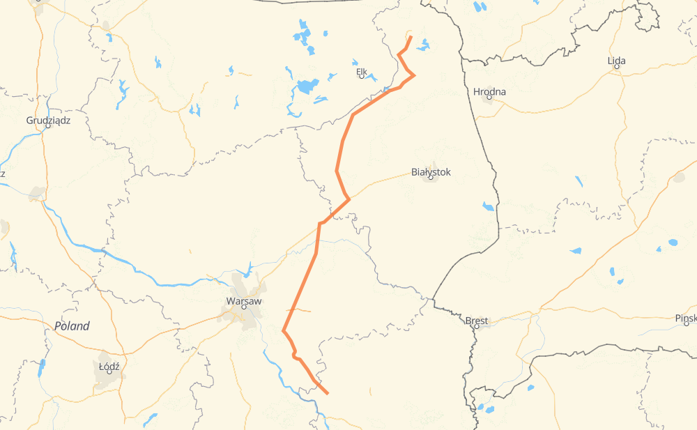
The distance from Chrustne to Suwalken is 226 miles by road. Road takes approximately 4 hours and 22 minutes and goes through Lomscha, Łochów, Brok, Zambrów, Stawiski, Szczuczyn and Raygrod.
You can adjust fuel consumption and fuel price here.
How long is a car ride from Chrustne to Suwalken?
Driving time:
4 h 22 min
This time is calculated for driving at the maximum permitted speed, taking into account traffic rules restrictions.
77 mi with a maximum speed 56 mph = 1 h 22 min
104 mi with a maximum speed 56 mph = 1 h 51 min
17 mi with a maximum speed 50 mph = 20 min
9 mi with a maximum speed 43 mph = 11 min
1 mi with a maximum speed 37 mph = 1 min
18 mi with a maximum speed 31 mph = 34 min
1 mi with a maximum speed 25 mph = 1 min
The calculated driving time does not take into account intermediate stops and traffic jams.
How far is Chrustne to Suwalken by land?
The distance between Chrustne and Suwalken is 225.6 mi by road.
Precise satellite coordinates of highways were used for this calculation. The start and finish points are the centers of Chrustne and Suwalken respectively.
How far is Chrustne to Suwalken by plane?
The shortest distance (air line, as the crow flies) between Chrustne and Suwalken is 176.5 mi.
This distance is calculated using the Haversine formula as a great-circle distance between two points on the surface of a sphere. The start and finish points are the centers of Chrustne and Suwalken respectively. Actual distance between airports may be different.
How many hours is Chrustne from Suwalken by plane?
Boeing 737 airliner needs 21 min to cover the distance of 176 mi at a cruising speed of 497 mph.
Small plane "Cessna 172" needs 1 h 17 min to flight this distance at average speed of 136 mph.
This time is approximate and do not take into account takeoff and landing times, airport location and other real world factors.
How long is a helicopter ride from Chrustne to Suwalken?
Fast helicopter "Eurocopter AS350" or "Hughes OH-6 Cayuse" need 1 h 11 min to cover the distance of 176 mi at a cruising speed of 149 mph.
Popular "Robinson R44" needs 1 h 21 min to flight this distance at average speed of 130 mph.
This time is approximate and do not take into account takeoff and landing times, aerodrome location and other real world factors.
What city is halfway between Chrustne and Suwalken?
The halfway point between Chrustne and Suwalken is Wyszomierz Wielki. It is located about 2 mi from the exact midpoint by road.
The distance from Wyszomierz Wielki to Chrustne is 111 mi and driving will take about 2 h 6 min. The road between Wyszomierz Wielki and Suwalken has length 114 mi and will take approximately 2 h 16 min.
The other cities located close to halfway point:
Żabikowo Rządowe is in 114 mi from Chrustne and 111 mi from Suwalken
Prosienica is in 109 mi from Chrustne and 116 mi from Suwalken
Ostrożne is in 117 mi from Chrustne and 109 mi from Suwalken
Where is Chrustne in relation to Suwalken?
Chrustne is located 176 mi south-west of Suwalken.
Chrustne has geographic coordinates: latitude 51.61228, longitude 21.97754.
Suwalken has geographic coordinates: latitude 54.10033, longitude 22.93323.