Distance between Ciudad López Mateos and Cerro Alto
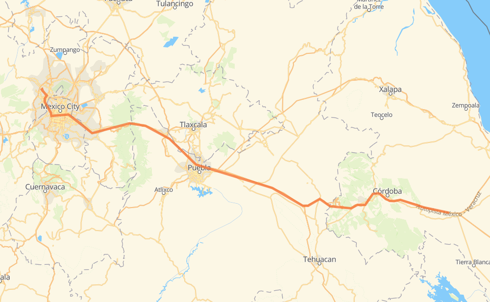
The distance from Ciudad López Mateos to Cerro Alto is 226 miles by road including 216 miles on motorways. Road takes approximately 4 hours and 12 minutes and goes through Orizaba, Tlalnepantla, Naucalpan de Juarez, Miguel Hidalgo, Venustiano Carranza, Nezahualcóyotl and La Paz.
| Shortest distance by air | 187 mi ✈️ |
| Car route length | 225.6 mi 🚗 |
| Driving time | 4 h 12 min |
| Fuel amount | 7.7 gal |
| Fuel cost | 29.9 USD |
| Toll roads cost | 537 + ? MXN |
| Point | Distance | Time | Fuel | |
| Ciudad López Mateos | 0 mi | 00 min | 0.0 gal | |
|
6 mi, 07 min
|
||||
| Tlalnepantla | 6 mi | 07 min | 0.2 gal | |
|
4 mi, 04 min
|
||||
| Naucalpan de Juarez | 9 mi | 11 min | 0.3 gal | |
|
Periferico Norte 4 mi, 04 min
|
||||
| Miguel Hidalgo | 12 mi | 15 min | 0.4 gal | |
|
Periferico Norte Periférico 8 mi, 08 min
|
||||
| Venustiano Carranza | 21 mi | 24 min | 0.6 gal | |
|
1S 5 mi, 06 min
|
||||
| Nezahualcóyotl | 25 mi | 30 min | 0.8 gal | |
|
5 mi, 05 min
|
||||
| La Paz | 30 mi | 36 min | 1.0 gal | |
|
MEX 150D 43 mi, 50 min
|
||||
| San Rafael Tlanalapan | 73 mi | 1 h 27 min | 2.4 gal | |
|
MEX 150D 112 mi, 2 h 04 min
|
||||
| Orizaba | 185 mi | 3 h 31 min | 6.2 gal | |
|
MEX 150D 43 mi, 40 min
|
||||
| Cerro Alto | 228 mi | 4 h 12 min | 7.5 gal | |
Frequently Asked Questions
How many toll booths are there from Ciudad López Mateos to Cerro Alto?
There are 9 toll booths between Ciudad López Mateos and Cerro Alto: Fortín, Cuitláhuac, San Marcos 7, San Martín, Viaducto Elevado de Puebla, Amozoc, Esperanza 27, Viaducto Bicentenario - Santa Mónica and Urbana Norte - Viaducto Minería.
How much does the toll booths cost from Ciudad López Mateos to Cerro Alto?
Toll roads cost: Viaducto Bicentenario - Santa Mónica (?) + Urbana Norte - Viaducto Minería (?) + San Marcos 7 (136 MXN) + San Martín (42 MXN) + Viaducto Elevado de Puebla (?) + Amozoc (72 MXN) + Esperanza 27 (140 MXN) + Fortín (33 MXN) + Cuitláhuac (114 MXN) = 537 + ? MXN
How much does it cost to drive from Ciudad López Mateos to Cerro Alto?
Fuel cost: 29.9 USD
This fuel cost is calculated as: (Route length 225.6 mi) / (Fuel consumption 29.4 mpg) * (Fuel price 3.9 USD / gal)
You can adjust fuel consumption and fuel price here.
Toll roads cost: 537 + ? MXN
How long is a car ride from Ciudad López Mateos to Cerro Alto?
Driving time: 4 h 12 min
This time is calculated for driving at the maximum permitted speed, taking into account traffic rules restrictions.
- 58 mi with a maximum speed 68 mph = 51 min
- 29 mi with a maximum speed 62 mph = 28 min
- 16 mi with a maximum speed 56 mph = 17 min
- 103 mi with a maximum speed 50 mph = 2 h 3 min
- 16 mi with a maximum speed 43 mph = 22 min
- 2 mi with a maximum speed 37 mph = 4 min
- 2 mi with a maximum speed 31 mph = 3 min
The calculated driving time does not take into account intermediate stops and traffic jams.
How far is Ciudad López Mateos to Cerro Alto by land?
The distance between Ciudad López Mateos and Cerro Alto is 225.6 mi by road including 216.2 mi on motorways.
Precise satellite coordinates of highways were used for this calculation. The start and finish points are the centers of Ciudad López Mateos and Cerro Alto respectively.
How far is Ciudad López Mateos to Cerro Alto by plane?
The shortest distance (air line, as the crow flies) between Ciudad López Mateos and Cerro Alto is 187 mi.
This distance is calculated using the Haversine formula as a great-circle distance between two points on the surface of a sphere. The start and finish points are the centers of Ciudad López Mateos and Cerro Alto respectively. Actual distance between airports may be different.
How many hours is Ciudad López Mateos from Cerro Alto by plane?
Boeing 737 airliner needs 22 min to cover the distance of 187 mi at a cruising speed of 497 mph.
Small plane "Cessna 172" needs 1 h 22 min to flight this distance at average speed of 136 mph.
This time is approximate and do not take into account takeoff and landing times, airport location and other real world factors.
How long is a helicopter ride from Ciudad López Mateos to Cerro Alto?
Fast helicopter "Eurocopter AS350" or "Hughes OH-6 Cayuse" need 1 h 15 min to cover the distance of 187 mi at a cruising speed of 149 mph.
Popular "Robinson R44" needs 1 h 26 min to flight this distance at average speed of 130 mph.
This time is approximate and do not take into account takeoff and landing times, aerodrome location and other real world factors.
What city is halfway between Ciudad López Mateos and Cerro Alto?
The halfway point between Ciudad López Mateos and Cerro Alto is San Jerónimo Ocotitlán. It is located about 2 mi from the exact midpoint by road.
The distance from San Jerónimo Ocotitlán to Ciudad López Mateos is 115 mi and driving will take about 2 h 13 min. The road between San Jerónimo Ocotitlán and Cerro Alto has length 111 mi and will take approximately 1 h 58 min.
The other cities located close to halfway point:
Where is Ciudad López Mateos in relation to Cerro Alto?
Ciudad López Mateos is located 187 mi north-west of Cerro Alto.
Ciudad López Mateos has geographic coordinates: latitude 19.5614, longitude -99.26199.
Cerro Alto has geographic coordinates: latitude 18.78333, longitude -96.52.
Which highway goes from Ciudad López Mateos to Cerro Alto?
The route from Ciudad López Mateos to Cerro Alto follows MEX 150D.
Other minor sections pass along the road:
- MEX 190: 4 mi
- Periferico Norte: 4 mi