Distance between Ciudad Mier and El Central
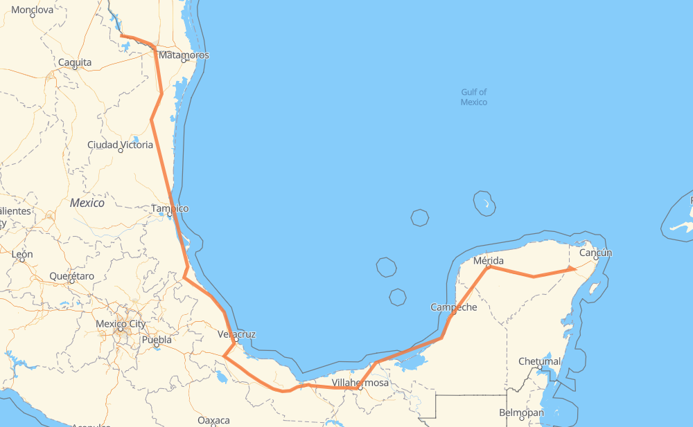
The distance from Ciudad Mier to El Central is 1,454 miles by road including 462 miles on motorways. Road takes approximately 26 hours and 28 minutes and goes through McAllen, Reynosa, Aldama, Ciudad Madero, Mérida and Kanasín.
| Shortest distance by air | 825 mi ✈️ |
| Car route length | 1,454 mi 🚗 |
| Driving time | 26 h 28 min |
| Fuel amount | 49.5 gal |
| Fuel cost | 194.4 USD |
| Toll roads cost | 1,283 + ? MXN |
| Point | Distance | Time | Fuel | |
| Ciudad Mier | 0 mi | 00 min | 0.0 gal | |
|
MEX 2 US 83 22 mi, 27 min
|
||||
| Rio Grande City | 22 mi | 27 min | 0.6 gal | |
|
US 83 31 mi, 36 min
|
||||
| Palmview | 53 mi | 1 h 04 min | 1.7 gal | |
|
I 2 12 mi, 13 min
|
||||
| McAllen | 66 mi | 1 h 17 min | 2.2 gal | |
|
Spur 115 US 281 4 mi, 05 min
|
||||
| Reynosa | 70 mi | 1 h 23 min | 2.4 gal | |
|
MEX 180 247 mi, 4 h 34 min
|
||||
| Aldama | 317 mi | 5 h 58 min | 10.5 gal | |
|
MEX 180 TAM 113 68 mi, 1 h 18 min
|
||||
| Ciudad Madero | 385 mi | 7 h 16 min | 13.0 gal | |
|
MEX 180 915 mi, 16 h 36 min
|
||||
| Mérida | 1,299 mi | 23 h 52 min | 44.1 gal | |
|
15 mi, 17 min
|
||||
| Kanasín | 1,314 mi | 24 h 10 min | 44.3 gal | |
|
MEX 180 MEX 180D 145 mi, 2 h 18 min
|
||||
| El Central | 1,459 mi | 26 h 28 min | 49.5 gal | |
Frequently Asked Questions
How many toll booths are there from Ciudad Mier to El Central?
There are 20 toll booths between Ciudad Mier and El Central: Puente Internacional Miguel Alemán, Tampico, Naranjos, Tuxpan, Cardel - Posa Rica, Nautla, La Antigua, San Julián, Paso del Toro, Cosamaloapan, Acayucan, Antonio Dovali, Sánchez Magallanes, Villahermosa Nacajuca, Zacatal, Unidad, Seybaplaya, Pisté and El Tintal.
How much does the toll booths cost from Ciudad Mier to El Central?
Toll roads cost: Puente Internacional Miguel Alemán (30 MXN) + Tampico (35 MXN) + Naranjos (297 MXN) + Tuxpan (45 MXN) + Cardel - Posa Rica (205 MXN) + Nautla (24 MXN) + La Antigua (?) + San Julián (?) + Paso del Toro (87 MXN) + Cosamaloapan (229 MXN) + Acayucan (?) + Antonio Dovali (20 MXN) + Sánchez Magallanes (82 MXN) + Villahermosa Nacajuca (62 MXN) + Zacatal (90 MXN) + Unidad (?) + Seybaplaya (77 MXN) + Pisté (?) + El Tintal (?) + El Tintal (?) = 1,283 + ? MXN
How much does it cost to drive from Ciudad Mier to El Central?
Fuel cost: 194.4 USD
This fuel cost is calculated as: (Route length 1,454 mi) / (Fuel consumption 29.4 mpg) * (Fuel price 3.93 USD / gal)
You can adjust fuel consumption and fuel price here.
Toll roads cost: 1,283 + ? MXN
How long is a car ride from Ciudad Mier to El Central?
Driving time: 26 h 28 min
This time is calculated for driving at the maximum permitted speed, taking into account traffic rules restrictions.
- 140 mi with a maximum speed 68 mph = 2 h 4 min
- 6 mi with a maximum speed 65 mph = 5 min
- 253 mi with a maximum speed 62 mph = 4 h 3 min
- 270 mi with a maximum speed 56 mph = 4 h 49 min
- 221 mi with a maximum speed 56 mph = 3 h 57 min
- 4 mi with a maximum speed 55 mph = 3 min
- 561 mi with a maximum speed 50 mph = 11 h 17 min
- 2 mi with a maximum speed 37 mph = 2 min
- 1 mi with a maximum speed 25 mph = 3 min
The calculated driving time does not take into account intermediate stops and traffic jams.
How far is Ciudad Mier to El Central by land?
The distance between Ciudad Mier and El Central is 1,454 mi by road including 462.3 mi on motorways.
Precise satellite coordinates of highways were used for this calculation. The start and finish points are the centers of Ciudad Mier and El Central respectively.
How far is Ciudad Mier to El Central by plane?
The shortest distance (air line, as the crow flies) between Ciudad Mier and El Central is 825.2 mi.
This distance is calculated using the Haversine formula as a great-circle distance between two points on the surface of a sphere. The start and finish points are the centers of Ciudad Mier and El Central respectively. Actual distance between airports may be different.
How many hours is Ciudad Mier from El Central by plane?
Boeing 737 airliner needs 1 h 39 min to cover the distance of 825 mi at a cruising speed of 497 mph.
Small plane "Cessna 172" needs 6 h 2 min to flight this distance at average speed of 136 mph.
This time is approximate and do not take into account takeoff and landing times, airport location and other real world factors.
How long is a helicopter ride from Ciudad Mier to El Central?
Fast helicopter "Eurocopter AS350" or "Hughes OH-6 Cayuse" need 5 h 32 min to cover the distance of 825 mi at a cruising speed of 149 mph.
Popular "Robinson R44" needs 6 h 19 min to flight this distance at average speed of 130 mph.
This time is approximate and do not take into account takeoff and landing times, aerodrome location and other real world factors.
What city is halfway between Ciudad Mier and El Central?
The halfway point between Ciudad Mier and El Central is El Barrio. It is located about 4 mi from the exact midpoint by road.
The distance from El Barrio to Ciudad Mier is 732 mi and driving will take about 13 h 36 min. The road between El Barrio and El Central has length 723 mi and will take approximately 12 h 52 min.
The other cities located close to halfway point:
Where is Ciudad Mier in relation to El Central?
Ciudad Mier is located 825 mi north-west of El Central.
Ciudad Mier has geographic coordinates: latitude 26.43064, longitude -99.1482.
El Central has geographic coordinates: latitude 20.95117, longitude -87.55025.
Which highway goes from Ciudad Mier to El Central?
The route from Ciudad Mier to El Central follows MEX 180, MEX 180D, MEX 145D, MEX 97.
Other minor sections pass along the road:
- MEX 101: 49 mi
- US 83: 47 mi
- TAM 113: 36 mi
- MEX 135D: 28 mi
- MEX 150D: 27 mi
- MEX: 19 mi
- MEX 129: 14 mi
- MEX 80: 11 mi
- MEX 2: 9 mi
- MEX 132D: 8 mi
- I 2: 7 mi
- MEX 132: 6 mi
- FM 1016: 4 mi
- Q. ROO 2: 3 mi
- Spur 115: 2 mi
- FM 396: 2 mi
- FM 755: 1 mi
- MEX 305D: 1 mi
- US 281: 1 mi