Distance between Ciudad Mier and Kilómetro 42
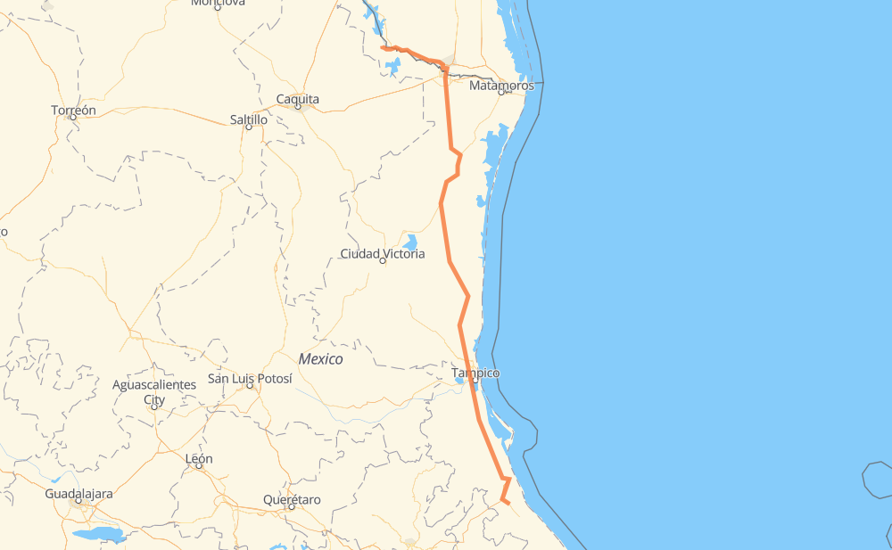
The distance from Ciudad Mier to Kilómetro 42 is 512 miles by road including 81 miles on motorways. Road takes approximately 9 hours and 41 minutes and goes through McAllen, Reynosa, Aldama and Ciudad Madero.
| Shortest distance by air | 416 mi ✈️ |
| Car route length | 512 mi 🚗 |
| Driving time | 9 h 41 min |
| Fuel amount | 17.4 gal |
| Fuel cost | 67.9 USD |
| Toll roads cost | 407 MXN |
| Point | Distance | Time | Fuel | |
| Ciudad Mier | 0 mi | 00 min | 0.0 gal | |
|
MEX 2 US 83 22 mi, 27 min
|
||||
| Rio Grande City | 22 mi | 27 min | 0.6 gal | |
|
US 83 31 mi, 36 min
|
||||
| Palmview | 53 mi | 1 h 04 min | 1.7 gal | |
|
I 2 6 mi, 06 min
|
||||
| Mission | 59 mi | 1 h 10 min | 1.9 gal | |
|
I 2 6 mi, 07 min
|
||||
| McAllen | 66 mi | 1 h 17 min | 2.2 gal | |
|
Spur 115 3 mi, 03 min
|
||||
| Hidalgo | 68 mi | 1 h 21 min | 2.3 gal | |
|
US 281 2 mi, 01 min
|
||||
| Reynosa | 70 mi | 1 h 23 min | 2.4 gal | |
|
MEX 180 247 mi, 4 h 34 min
|
||||
| Aldama | 317 mi | 5 h 58 min | 10.5 gal | |
|
MEX 180 TAM 113 68 mi, 1 h 18 min
|
||||
| Ciudad Madero | 385 mi | 7 h 16 min | 13.0 gal | |
|
MEX 180 132 mi, 2 h 25 min
|
||||
| Kilómetro 42 | 516 mi | 9 h 41 min | 17.5 gal | |
Frequently Asked Questions
How many toll booths are there from Ciudad Mier to Kilómetro 42?
There are 4 toll booths between Ciudad Mier and Kilómetro 42: Puente Internacional Miguel Alemán, Tampico, Naranjos and Tuxpan.
How much does the toll booths cost from Ciudad Mier to Kilómetro 42?
Toll roads cost: Puente Internacional Miguel Alemán (30 MXN) + Tampico (35 MXN) + Naranjos (297 MXN) + Tuxpan (45 MXN) = 407 MXN
How much does it cost to drive from Ciudad Mier to Kilómetro 42?
Fuel cost: 67.9 USD
This fuel cost is calculated as: (Route length 512 mi) / (Fuel consumption 29.4 mpg) * (Fuel price 3.9 USD / gal)
You can adjust fuel consumption and fuel price here.
Toll roads cost: 407 MXN
How long is a car ride from Ciudad Mier to Kilómetro 42?
Driving time: 9 h 41 min
This time is calculated for driving at the maximum permitted speed, taking into account traffic rules restrictions.
- 6 mi with a maximum speed 65 mph = 5 min
- 49 mi with a maximum speed 62 mph = 47 min
- 77 mi with a maximum speed 56 mph = 1 h 22 min
- 154 mi with a maximum speed 56 mph = 2 h 45 min
- 4 mi with a maximum speed 55 mph = 3 min
- 224 mi with a maximum speed 50 mph = 4 h 29 min
- 2 mi with a maximum speed 37 mph = 2 min
- 1 mi with a maximum speed 25 mph = 3 min
The calculated driving time does not take into account intermediate stops and traffic jams.
How far is Ciudad Mier to Kilómetro 42 by land?
The distance between Ciudad Mier and Kilómetro 42 is 512 mi by road including 80.8 mi on motorways.
Precise satellite coordinates of highways were used for this calculation. The start and finish points are the centers of Ciudad Mier and Kilómetro 42 respectively.
How far is Ciudad Mier to Kilómetro 42 by plane?
The shortest distance (air line, as the crow flies) between Ciudad Mier and Kilómetro 42 is 416.3 mi.
This distance is calculated using the Haversine formula as a great-circle distance between two points on the surface of a sphere. The start and finish points are the centers of Ciudad Mier and Kilómetro 42 respectively. Actual distance between airports may be different.
How many hours is Ciudad Mier from Kilómetro 42 by plane?
Boeing 737 airliner needs 50 min to cover the distance of 416 mi at a cruising speed of 497 mph.
Small plane "Cessna 172" needs 3 h 2 min to flight this distance at average speed of 136 mph.
This time is approximate and do not take into account takeoff and landing times, airport location and other real world factors.
How long is a helicopter ride from Ciudad Mier to Kilómetro 42?
Fast helicopter "Eurocopter AS350" or "Hughes OH-6 Cayuse" need 2 h 47 min to cover the distance of 416 mi at a cruising speed of 149 mph.
Popular "Robinson R44" needs 3 h 11 min to flight this distance at average speed of 130 mph.
This time is approximate and do not take into account takeoff and landing times, aerodrome location and other real world factors.
What city is halfway between Ciudad Mier and Kilómetro 42?
The halfway point between Ciudad Mier and Kilómetro 42 is Soto la Marina. It is located about 11 mi from the exact midpoint by road.
The distance from Soto la Marina to Ciudad Mier is 245 mi and driving will take about 4 h 40 min. The road between Soto la Marina and Kilómetro 42 has length 267 mi and will take approximately 5 h 1 min.
The other cities located close to halfway point:
Where is Ciudad Mier in relation to Kilómetro 42?
Ciudad Mier is located 416 mi north-west of Kilómetro 42.
Ciudad Mier has geographic coordinates: latitude 26.43064, longitude -99.1482.
Kilómetro 42 has geographic coordinates: latitude 20.62778, longitude -97.39.
Which highway goes from Ciudad Mier to Kilómetro 42?
The route from Ciudad Mier to Kilómetro 42 follows MEX 180, MEX 97.
Other minor sections pass along the road:
- MEX 101: 49 mi
- US 83: 47 mi
- TAM 113: 36 mi
- MEX 135D: 28 mi
- MEX: 19 mi
- MEX 180D: 17 mi
- MEX 80: 11 mi
- MEX 2: 9 mi
- MEX 132D: 8 mi
- I 2: 7 mi
- MEX 132: 6 mi
- FM 1016: 4 mi
- Spur 115: 2 mi
- FM 396: 2 mi
- FM 755: 1 mi
- US 281: 1 mi