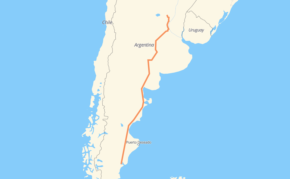
Distance between Comandante Luis Piedrabuena and Elisa
The distance from Comandante Luis Piedrabuena to Elisa is 1,654 miles by road including 100 miles on motorways. Road takes approximately 30 hours and 26 minutes and goes through Caleta Olivia, Comodoro Rivadavia, El Paso, Tres Hermanas, Fitz Roy, El Amigo and Cañadón Minerales.
| Shortest distance by air | 1,394 mi ✈️ |
| Car route length | 1,654.1 mi 🚗 |
| Driving time | 30 h 26 min |
| Fuel amount | 56.3 gal |
| Fuel cost | 221.1 USD |
| Point | Distance | Time | Fuel | |
| Comandante Luis Piedrabuena | 0 mi | 00 min | 0.0 gal | |
|
RN3 183 mi, 3 h 24 min
|
||||
| El Paso | 183 mi | 3 h 24 min | 4.5 gal | |
|
RN3 67 mi, 1 h 20 min
|
||||
| Fitz Roy | 250 mi | 4 h 44 min | 8.0 gal | |
|
RN3 19 mi, 21 min
|
||||
| Cañadón Minerales | 270 mi | 5 h 05 min | 9.0 gal | |
|
RN3 7 mi, 07 min
|
||||
| La Nueva | 276 mi | 5 h 12 min | 9.3 gal | |
|
RN3 10 mi, 11 min
|
||||
| Atlántico | 286 mi | 5 h 23 min | 9.6 gal | |
|
RN3 4 mi, 04 min
|
||||
| Mercado de la Ciudad | 290 mi | 5 h 28 min | 9.8 gal | |
|
RN3 1 mi, 01 min
|
||||
| Mirador | 291 mi | 5 h 30 min | 9.9 gal | |
|
RN3 47 mi, 56 min
|
||||
| Comodoro Rivadavia | 338 mi | 6 h 26 min | 11.5 gal | |
|
RN3 1,316 mi, 23 h 59 min
|
||||
| Elisa | 1,654 mi | 30 h 25 min | 56.2 gal | |
Frequently Asked Questions
How much does it cost to drive from Comandante Luis Piedrabuena to Elisa?
Fuel cost: 221.1 USD
This fuel cost is calculated as: (Route length 1,654.1 mi) / (Fuel consumption 29.4 mpg) * (Fuel price 3.93 USD / gal)
You can adjust fuel consumption and fuel price here.
How long is a car ride from Comandante Luis Piedrabuena to Elisa?
Driving time: 30 h 26 min
This time is calculated for driving at the maximum permitted speed, taking into account traffic rules restrictions.
- 95 mi with a maximum speed 68 mph = 1 h 24 min
- 1 mi with a maximum speed 62 mph = 1 min
- 1,269 mi with a maximum speed 56 mph = 22 h 39 min
- 1 mi with a maximum speed 56 mph = 1 min
- 222 mi with a maximum speed 50 mph = 4 h 28 min
- 58 mi with a maximum speed 37 mph = 1 h 32 min
- 2 mi with a maximum speed 31 mph = 4 min
- 5 mi with a maximum speed 25 mph = 11 min
- 1 mi with a maximum speed 19 mph = 1 min
- 1 mi with a maximum speed 12 mph = 1 min
The calculated driving time does not take into account intermediate stops and traffic jams.
How far is Comandante Luis Piedrabuena to Elisa by land?
The distance between Comandante Luis Piedrabuena and Elisa is 1,654.1 mi by road including 100 mi on motorways.
Precise satellite coordinates of highways were used for this calculation. The start and finish points are the centers of Comandante Luis Piedrabuena and Elisa respectively.
How far is Comandante Luis Piedrabuena to Elisa by plane?
The shortest distance (air line, as the crow flies) between Comandante Luis Piedrabuena and Elisa is 1,394.4 mi.
This distance is calculated using the Haversine formula as a great-circle distance between two points on the surface of a sphere. The start and finish points are the centers of Comandante Luis Piedrabuena and Elisa respectively. Actual distance between airports may be different.
How many hours is Comandante Luis Piedrabuena from Elisa by plane?
Boeing 737 airliner needs 2 h 48 min to cover the distance of 1,394 mi at a cruising speed of 497 mph.
Small plane "Cessna 172" needs 10 h 12 min to flight this distance at average speed of 136 mph.
This time is approximate and do not take into account takeoff and landing times, airport location and other real world factors.
How long is a helicopter ride from Comandante Luis Piedrabuena to Elisa?
Fast helicopter "Eurocopter AS350" or "Hughes OH-6 Cayuse" need 9 h 21 min to cover the distance of 1,394 mi at a cruising speed of 149 mph.
Popular "Robinson R44" needs 10 h 41 min to flight this distance at average speed of 130 mph.
This time is approximate and do not take into account takeoff and landing times, aerodrome location and other real world factors.
What city is halfway between Comandante Luis Piedrabuena and Elisa?
The halfway point between Comandante Luis Piedrabuena and Elisa is El Empalme. It is located about 62 mi from the exact midpoint by road.
The distance from El Empalme to Comandante Luis Piedrabuena is 766 mi and driving will take about 14 h 10 min. The road between El Empalme and Elisa has length 889 mi and will take approximately 16 h 15 min.
The other cities located close to halfway point:
Where is Comandante Luis Piedrabuena in relation to Elisa?
Comandante Luis Piedrabuena is located 1,394 mi south-west of Elisa.
Comandante Luis Piedrabuena has geographic coordinates: latitude -49.98626, longitude -68.91429.
Elisa has geographic coordinates: latitude -30.69507, longitude -61.04913.
Which highway goes from Comandante Luis Piedrabuena to Elisa?
The route from Comandante Luis Piedrabuena to Elisa follows RN3, RN33, RN251, AP01, RN154, RN5.
Other minor sections pass along the road:
- RN35: 49 mi
- RP1: 43 mi
- RN11: 40 mi
- RP18: 34 mi
- RP4: 25 mi
- RNA012: 22 mi
- RN22: 20 mi
- RNA007: 15 mi
- RP62: 12 mi