Distance between Cottonwood CO and Georgetown CO
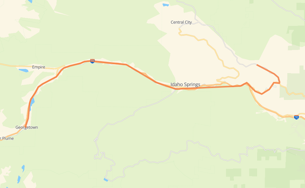
The distance from Cottonwood to Georgetown is 22 miles by road including 16 miles on motorways. Road takes approximately 23 minutes and goes through Idaho Springs, Smith Hill, Dumont, Downieville and Lawson.
| Shortest distance by air | 15 mi ✈️ |
| Car route length | 22.4 mi 🚗 |
| Driving time | 23 min |
| Fuel amount | 0.8 gal |
| Fuel cost | 3 USD |
| Point | Distance | Time | Fuel | |
| Smith Hill | 0 mi | 00 min | 0.0 gal | |
|
CO 119 US 6 8 mi, 09 min
|
||||
| Idaho Springs | 8 mi | 09 min | 0.2 gal | |
|
I 70 5 mi, 05 min
|
||||
| Dumont | 14 mi | 14 min | 0.4 gal | |
|
I 70 2 mi, 01 min
|
||||
| Downieville | 15 mi | 16 min | 0.5 gal | |
|
I 70 1 mi, 00 min
|
||||
| Lawson | 16 mi | 16 min | 0.5 gal | |
|
I 70 6 mi, 06 min
|
||||
| Georgetown | 22 mi | 23 min | 0.7 gal | |
Hotels of Georgetown
Frequently Asked Questions
How much does it cost to drive from Cottonwood to Georgetown?
Fuel cost: 3 USD
This fuel cost is calculated as: (Route length 22.4 mi) / (Fuel consumption 29.4 mpg) * (Fuel price 3.93 USD / gal)
You can adjust fuel consumption and fuel price here.
How long is a car ride from Cottonwood to Georgetown?
Driving time: 23 min
This time is calculated for driving at the maximum permitted speed, taking into account traffic rules restrictions.
- 10 mi with a maximum speed 65 mph = 9 min
- 4 mi with a maximum speed 60 mph = 3 min
- 2 mi with a maximum speed 56 mph = 1 min
- 2 mi with a maximum speed 55 mph = 2 min
- 2 mi with a maximum speed 45 mph = 2 min
The calculated driving time does not take into account intermediate stops and traffic jams.
How far is Cottonwood to Georgetown by land?
The distance between Cottonwood and Georgetown is 22.4 mi by road including 16.2 mi on motorways.
Precise satellite coordinates of highways were used for this calculation. The start and finish points are the centers of Cottonwood and Georgetown respectively.
What city is halfway between Cottonwood and Georgetown?
The halfway point between Cottonwood and Georgetown is Dumont. It is located about 2 mi from the exact midpoint by road.
The distance from Dumont to Cottonwood is 14 mi and driving will take about 14 min. The road between Dumont and Georgetown has length 9 mi and will take approximately 9 min.
The other cities located close to halfway point:
Where is Cottonwood in relation to Georgetown?
Cottonwood is located 15 mi east of Georgetown.
Cottonwood has geographic coordinates: latitude 39.76332, longitude -105.42472.
Georgetown has geographic coordinates: latitude 39.70623, longitude -105.69713.
Which highway goes from Cottonwood to Georgetown?
The route from Cottonwood to Georgetown follows US 6, I 70, US 40.
Other minor sections pass along the road:
- CO 119: 2 mi
- CR 306: 1 mi