Distance between Cumelén and Güer Aike
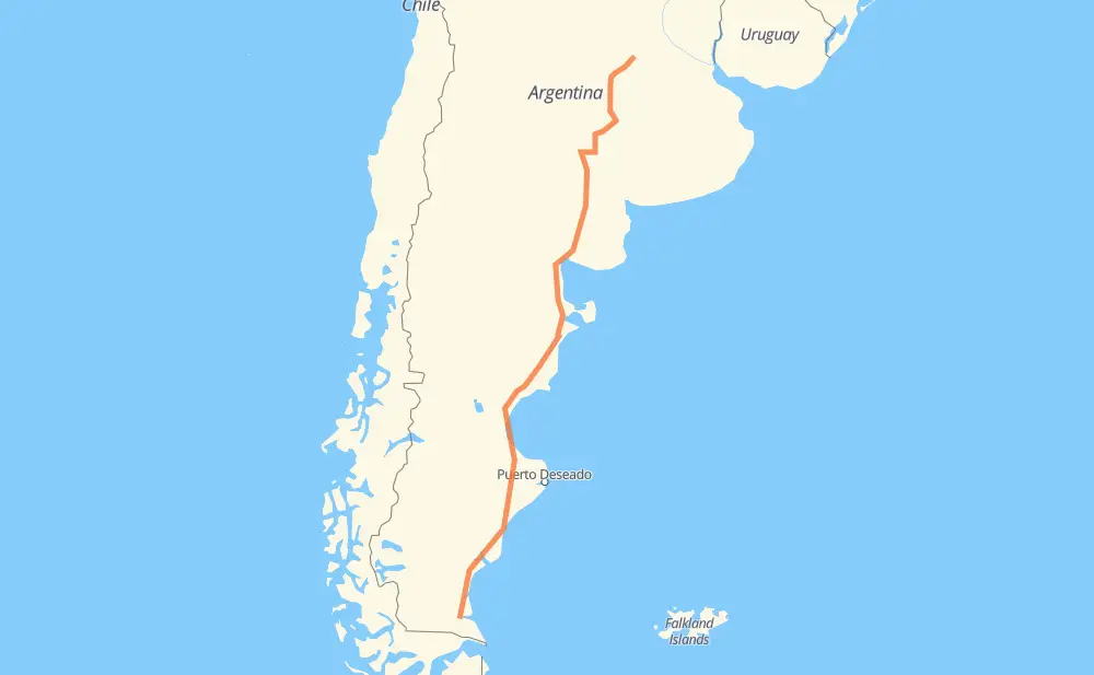
The distance from Cumelén to Güer Aike is 1,513 miles by road. Road takes approximately 27 hours and 49 minutes and goes through Comodoro Rivadavia, Caleta Olivia, Sancti Spíritu, Colonia Dolores, General Villegas, Catriló and Río Colorado.
| Shortest distance by air | 1,297 mi ✈️ |
| Car route length | 1,513 mi 🚗 |
| Driving time | 27 h 49 min |
| Fuel amount | 51.5 gal |
| Fuel cost | 202.2 USD |
| Point | Distance | Time | Fuel | |
| Cumelén | 0 mi | 00 min | 0.0 gal | |
|
RN33 32 mi, 36 min
|
||||
| Sancti Spíritu | 32 mi | 36 min | 0.7 gal | |
|
RN33 35 mi, 39 min
|
||||
| Colonia Dolores | 67 mi | 1 h 16 min | 2.2 gal | |
|
RN33 50 mi, 54 min
|
||||
| General Villegas | 117 mi | 2 h 10 min | 3.6 gal | |
|
RN33 127 mi, 2 h 20 min
|
||||
| Catriló | 244 mi | 4 h 30 min | 8.2 gal | |
|
RN5 RN154 229 mi, 4 h 10 min
|
||||
| Río Colorado | 473 mi | 8 h 40 min | 16.1 gal | |
|
RN22 RN251 146 mi, 2 h 38 min
|
||||
| El Empalme | 620 mi | 11 h 19 min | 21.0 gal | |
|
RN3 75 mi, 1 h 21 min
|
||||
| Sierra Grande | 694 mi | 12 h 40 min | 23.6 gal | |
|
RN3 352 mi, 6 h 23 min
|
||||
| Comodoro Rivadavia | 1,046 mi | 19 h 04 min | 35.6 gal | |
|
RN3 466 mi, 8 h 45 min
|
||||
| Güer Aike | 1,513 mi | 27 h 49 min | 51.0 gal | |
Frequently Asked Questions
How much does it cost to drive from Cumelén to Güer Aike?
Fuel cost: 202.2 USD
This fuel cost is calculated as: (Route length 1,513 mi) / (Fuel consumption 29.4 mpg) * (Fuel price 3.93 USD / gal)
You can adjust fuel consumption and fuel price here.
How long is a car ride from Cumelén to Güer Aike?
Driving time: 27 h 49 min
This time is calculated for driving at the maximum permitted speed, taking into account traffic rules restrictions.
- 1,293 mi with a maximum speed 56 mph = 23 h 5 min
- 183 mi with a maximum speed 50 mph = 3 h 40 min
- 31 mi with a maximum speed 37 mph = 49 min
- 2 mi with a maximum speed 31 mph = 3 min
- 3 mi with a maximum speed 25 mph = 7 min
The calculated driving time does not take into account intermediate stops and traffic jams.
How far is Cumelén to Güer Aike by land?
The distance between Cumelén and Güer Aike is 1,513 mi by road.
Precise satellite coordinates of highways were used for this calculation. The start and finish points are the centers of Cumelén and Güer Aike respectively.
How far is Cumelén to Güer Aike by plane?
The shortest distance (air line, as the crow flies) between Cumelén and Güer Aike is 1,297.4 mi.
This distance is calculated using the Haversine formula as a great-circle distance between two points on the surface of a sphere. The start and finish points are the centers of Cumelén and Güer Aike respectively. Actual distance between airports may be different.
How many hours is Cumelén from Güer Aike by plane?
Boeing 737 airliner needs 2 h 36 min to cover the distance of 1,297 mi at a cruising speed of 497 mph.
Small plane "Cessna 172" needs 9 h 29 min to flight this distance at average speed of 136 mph.
This time is approximate and do not take into account takeoff and landing times, airport location and other real world factors.
How long is a helicopter ride from Cumelén to Güer Aike?
Fast helicopter "Eurocopter AS350" or "Hughes OH-6 Cayuse" need 8 h 42 min to cover the distance of 1,297 mi at a cruising speed of 149 mph.
Popular "Robinson R44" needs 9 h 56 min to flight this distance at average speed of 130 mph.
This time is approximate and do not take into account takeoff and landing times, aerodrome location and other real world factors.
What city is halfway between Cumelén and Güer Aike?
The halfway point between Cumelén and Güer Aike is El Doradillo. It is located about 14 mi from the exact midpoint by road.
The distance from El Doradillo to Cumelén is 770 mi and driving will take about 14 h 1 min. The road between El Doradillo and Güer Aike has length 743 mi and will take approximately 13 h 47 min.
The other cities located close to halfway point:
Where is Cumelén in relation to Güer Aike?
Cumelén is located 1,297 mi north-east of Güer Aike.
Cumelén has geographic coordinates: latitude -33.6981, longitude -61.94507.
Güer Aike has geographic coordinates: latitude -51.63256, longitude -69.61118.
Which highway goes from Cumelén to Güer Aike?
The route from Cumelén to Güer Aike follows RN3, RN33, RN251, RN154, RN5.
Other minor sections pass along the road:
- RN35: 49 mi
- RP1: 43 mi
- RP18: 34 mi
- RN22: 20 mi
- RN288: 6 mi