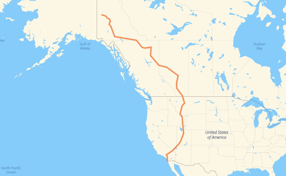
Distance between Dawson City YT and Tijuana
The distance from Dawson City to Tijuana is 3,394 miles by road including 1,652 miles on motorways. Road takes approximately 58 hours and 16 minutes and goes through Whitehorse, Fort St. John, Dawson Creek, Spruce Grove, Edmonton, Leduc and Lacombe.
| Shortest distance by air | 2,385 mi ✈️ |
| Car route length | 3,393.9 mi 🚗 |
| Driving time | 58 h 16 min |
| Fuel amount | 115.4 gal |
| Fuel cost | 453.7 USD |
| Point | Distance | Time | Fuel | |
| Dawson City | 0 mi | 00 min | 0.0 gal | |
|
2 331 mi, 6 h 03 min
|
||||
| Whitehorse | 331 mi | 6 h 03 min | 11.1 gal | |
|
1 97 825 mi, 15 h 13 min
|
||||
| Fort St. John | 1,156 mi | 21 h 16 min | 39.2 gal | |
|
97 45 mi, 49 min
|
||||
| Dawson Creek | 1,202 mi | 22 h 06 min | 40.7 gal | |
|
2 43 344 mi, 6 h 14 min
|
||||
| Spruce Grove | 1,546 mi | 28 h 21 min | 52.4 gal | |
|
16 22 mi, 20 min
|
||||
| Edmonton | 1,568 mi | 28 h 42 min | 52.9 gal | |
|
216 19 mi, 17 min
|
||||
| Leduc | 1,587 mi | 28 h 59 min | 53.8 gal | |
|
2 55 mi, 47 min
|
||||
| Lacombe | 1,642 mi | 29 h 47 min | 55.7 gal | |
|
2 17 mi, 16 min
|
||||
| Red Deer | 1,658 mi | 30 h 04 min | 56.3 gal | |
|
2 71 mi, 1 h 08 min
|
||||
| Airdrie | 1,729 mi | 31 h 12 min | 58.6 gal | |
|
2 146 mi, 2 h 31 min
|
||||
| Lethbridge | 1,875 mi | 33 h 43 min | 63.7 gal | |
|
3 I 15 270 mi, 4 h 45 min
|
||||
| Helena | 2,145 mi | 38 h 29 min | 72.9 gal | |
|
I 15 80 mi, 1 h 26 min
|
||||
| Butte | 2,224 mi | 39 h 55 min | 75.0 gal | |
|
I 15 190 mi, 3 h 27 min
|
||||
| Idaho Falls | 2,415 mi | 43 h 23 min | 82.0 gal | |
|
I 15 52 mi, 53 min
|
||||
| Pocatello | 2,466 mi | 44 h 16 min | 83.7 gal | |
|
I 15 126 mi, 1 h 58 min
|
||||
| Ogden | 2,592 mi | 46 h 15 min | 88.1 gal | |
|
I 15 34 mi, 29 min
|
||||
| Salt Lake City | 2,625 mi | 46 h 44 min | 89.2 gal | |
|
I 15 46 mi, 40 min
|
||||
| Provo | 2,671 mi | 47 h 25 min | 90.7 gal | |
|
I 15 258 mi, 3 h 48 min
|
||||
| St. George | 2,930 mi | 51 h 13 min | 99.5 gal | |
|
I 15 107 mi, 1 h 36 min
|
||||
| North Las Vegas | 3,037 mi | 52 h 50 min | 103.1 gal | |
|
I 15 9 mi, 07 min
|
||||
| Las Vegas | 3,045 mi | 52 h 58 min | 103.5 gal | |
|
I 15 189 mi, 2 h 47 min
|
||||
| Victorville | 3,234 mi | 55 h 46 min | 109.7 gal | |
|
I 15 31 mi, 27 min
|
||||
| San Bernardino | 3,266 mi | 56 h 13 min | 110.9 gal | |
|
I 215 16 mi, 14 min
|
||||
| Riverside | 3,281 mi | 56 h 28 min | 111.4 gal | |
|
I 215 23 mi, 21 min
|
||||
| Menifee | 3,304 mi | 56 h 50 min | 112.3 gal | |
|
I 215 7 mi, 06 min
|
||||
| Murrieta | 3,311 mi | 56 h 56 min | 112.5 gal | |
|
I 215 7 mi, 06 min
|
||||
| Temecula | 3,318 mi | 57 h 02 min | 112.7 gal | |
|
I 15 27 mi, 24 min
|
||||
| Escondido | 3,345 mi | 57 h 27 min | 113.6 gal | |
|
I 15 Business 24 mi, 22 min
|
||||
| San Diego | 3,369 mi | 57 h 50 min | 113.9 gal | |
|
I 15 MEX 1D 25 mi, 25 min
|
||||
| Tijuana | 3,394 mi | 58 h 15 min | 115.3 gal | |
Hotels of Tijuana
Frequently Asked Questions
How much does it cost to drive from Dawson City to Tijuana?
Fuel cost: 453.7 USD
This fuel cost is calculated as: (Route length 3,393.9 mi) / (Fuel consumption 29.4 mpg) * (Fuel price 3.93 USD / gal)
You can adjust fuel consumption and fuel price here.
How long is a car ride from Dawson City to Tijuana?
Driving time: 58 h 16 min
This time is calculated for driving at the maximum permitted speed, taking into account traffic rules restrictions.
- 922 mi with a maximum speed 68 mph = 13 h 33 min
- 127 mi with a maximum speed 65 mph = 1 h 57 min
- 324 mi with a maximum speed 62 mph = 5 h 13 min
- 4 mi with a maximum speed 60 mph = 4 min
- 1,446 mi with a maximum speed 56 mph = 25 h 49 min
- 4 mi with a maximum speed 56 mph = 4 min
- 12 mi with a maximum speed 55 mph = 13 min
- 518 mi with a maximum speed 50 mph = 10 h 25 min
- 22 mi with a maximum speed 43 mph = 30 min
- 3 mi with a maximum speed 37 mph = 4 min
- 9 mi with a maximum speed 31 mph = 16 min
- 1 mi with a maximum speed 30 mph = 1 min
The calculated driving time does not take into account intermediate stops and traffic jams.
How far is Dawson City to Tijuana by land?
The distance between Dawson City and Tijuana is 3,393.9 mi by road including 1,651.6 mi on motorways.
Precise satellite coordinates of highways were used for this calculation. The start and finish points are the centers of Dawson City and Tijuana respectively.
How far is Dawson City to Tijuana by plane?
The shortest distance (air line, as the crow flies) between Dawson City and Tijuana is 2,384.8 mi.
This distance is calculated using the Haversine formula as a great-circle distance between two points on the surface of a sphere. The start and finish points are the centers of Dawson City and Tijuana respectively. Actual distance between airports may be different.
How many hours is Dawson City from Tijuana by plane?
Boeing 737 airliner needs 4 h 47 min to cover the distance of 2,385 mi at a cruising speed of 497 mph.
Small plane "Cessna 172" needs 17 h 26 min to flight this distance at average speed of 136 mph.
This time is approximate and do not take into account takeoff and landing times, airport location and other real world factors.
How long is a helicopter ride from Dawson City to Tijuana?
Fast helicopter "Eurocopter AS350" or "Hughes OH-6 Cayuse" need 15 h 59 min to cover the distance of 2,385 mi at a cruising speed of 149 mph.
Popular "Robinson R44" needs 18 h 16 min to flight this distance at average speed of 130 mph.
This time is approximate and do not take into account takeoff and landing times, aerodrome location and other real world factors.
What city is halfway between Dawson City and Tijuana?
The halfway point between Dawson City and Tijuana is Bowden. It is located about 16 mi from the exact midpoint by road.
The distance from Bowden to Dawson City is 1,681 mi and driving will take about 30 h 25 min. The road between Bowden and Tijuana has length 1,712 mi and will take approximately 27 h 50 min.
The other cities located close to halfway point:
Where is Dawson City in relation to Tijuana?
Dawson City is located 2,385 mi north-west of Tijuana.
Dawson City has geographic coordinates: latitude 64.06066, longitude -139.4317.
Tijuana has geographic coordinates: latitude 32.50086, longitude -116.96417.
Which highway goes from Dawson City to Tijuana?
The route from Dawson City to Tijuana follows I 15, 2, 97, 43, 1.
Other minor sections pass along the road:
- 4: 62 mi
- I 215: 55 mi
- I 84: 38 mi
- US 287: 36 mi
- US 91: 30 mi
- US 89: 25 mi
- US 26: 23 mi
- 16: 22 mi
- US 93: 21 mi
- 519: 20 mi
- US 30: 19 mi
- I 805: 15 mi
- 216: 14 mi
- 3: 12 mi
- US 6: 12 mi
- MT 200: 11 mi
- US 50: 9 mi
- I 90: 7 mi
- I 15 Business: 7 mi
- 23: 5 mi
- 32: 5 mi
- UT 30: 5 mi
- CA 60: 4 mi
- MEX 1D: 3 mi
- 2A: 3 mi
- CA 15: 3 mi
- CA 79: 2 mi
- CA 18: 2 mi
- I 80: 2 mi
- CA 74: 2 mi
- 5: 2 mi
- 501: 2 mi
- 3A: 2 mi
- 757: 1 mi
- I 215 Truck: 1 mi
- 533: 1 mi