Distance between Dawson Creek BC and Sainte-Eulalie QC
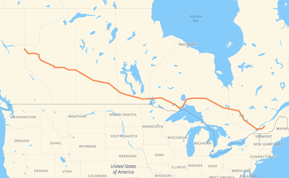
The distance from Dawson Creek to Sainte-Eulalie is 2,665 miles by road including 205 miles on motorways. Road takes approximately 48 hours and 29 minutes and goes through Spruce Grove, Edmonton, Lloydminster, North Battleford, Saskatoon, Yorkton and Portage la Prairie.
You can adjust fuel consumption and fuel price here.
How long is a car ride from Dawson Creek to Sainte-Eulalie?
Driving time:
48 h 29 min
This time is calculated for driving at the maximum permitted speed, taking into account traffic rules restrictions.
17 mi with a maximum speed 68 mph = 14 min
157 mi with a maximum speed 62 mph = 2 h 30 min
1,138 mi with a maximum speed 56 mph = 20 h 19 min
1,107 mi with a maximum speed 56 mph = 19 h 47 min
140 mi with a maximum speed 50 mph = 2 h 48 min
60 mi with a maximum speed 43 mph = 1 h 22 min
16 mi with a maximum speed 37 mph = 25 min
30 mi with a maximum speed 31 mph = 58 min
The calculated driving time does not take into account intermediate stops and traffic jams.
How far is Dawson Creek to Sainte-Eulalie by land?
The distance between Dawson Creek and Sainte-Eulalie is 2,665.1 mi by road including 205.1 mi on motorways.
Precise satellite coordinates of highways were used for this calculation. The start and finish points are the centers of Dawson Creek and Sainte-Eulalie respectively.
How far is Dawson Creek to Sainte-Eulalie by plane?
The shortest distance (air line, as the crow flies) between Dawson Creek and Sainte-Eulalie is 2,144.4 mi.
This distance is calculated using the Haversine formula as a great-circle distance between two points on the surface of a sphere. The start and finish points are the centers of Dawson Creek and Sainte-Eulalie respectively. Actual distance between airports may be different.
How many hours is Dawson Creek from Sainte-Eulalie by plane?
Boeing 737 airliner needs 4 h 18 min to cover the distance of 2,144 mi at a cruising speed of 497 mph.
Small plane "Cessna 172" needs 15 h 41 min to flight this distance at average speed of 136 mph.
This time is approximate and do not take into account takeoff and landing times, airport location and other real world factors.
How long is a helicopter ride from Dawson Creek to Sainte-Eulalie?
Fast helicopter "Eurocopter AS350" or "Hughes OH-6 Cayuse" need 14 h 22 min to cover the distance of 2,144 mi at a cruising speed of 149 mph.
Popular "Robinson R44" needs 16 h 26 min to flight this distance at average speed of 130 mph.
This time is approximate and do not take into account takeoff and landing times, aerodrome location and other real world factors.
What city is halfway between Dawson Creek and Sainte-Eulalie?
The halfway point between Dawson Creek and Sainte-Eulalie is Kenora. It is located about 24 mi from the exact midpoint by road.
The distance from Kenora to Dawson Creek is 1,308 mi and driving will take about 23 h 41 min. The road between Kenora and Sainte-Eulalie has length 1,357 mi and will take approximately 24 h 48 min.
The other cities located close to halfway point:
Vermilion Bay is in 1,368 mi from Dawson Creek and 1,297 mi from Sainte-Eulalie
Oxdrift is in 1,383 mi from Dawson Creek and 1,283 mi from Sainte-Eulalie
West Hawk Lake is in 1,271 mi from Dawson Creek and 1,394 mi from Sainte-Eulalie
Where is Dawson Creek in relation to Sainte-Eulalie?
Dawson Creek is located 2,144 mi west of Sainte-Eulalie.
Dawson Creek has geographic coordinates: latitude 55.75931, longitude -120.22796.
Sainte-Eulalie has geographic coordinates: latitude 46.1118, longitude -72.25056.
Which highway goes from Dawson Creek to Sainte-Eulalie?
The route from Dawson Creek to Sainte-Eulalie follows 16, 11, 17, 117, 43, PTH 16, PTH 1, 20, 101.