Distance between Dolní Lochov and Mladá Boleslav I
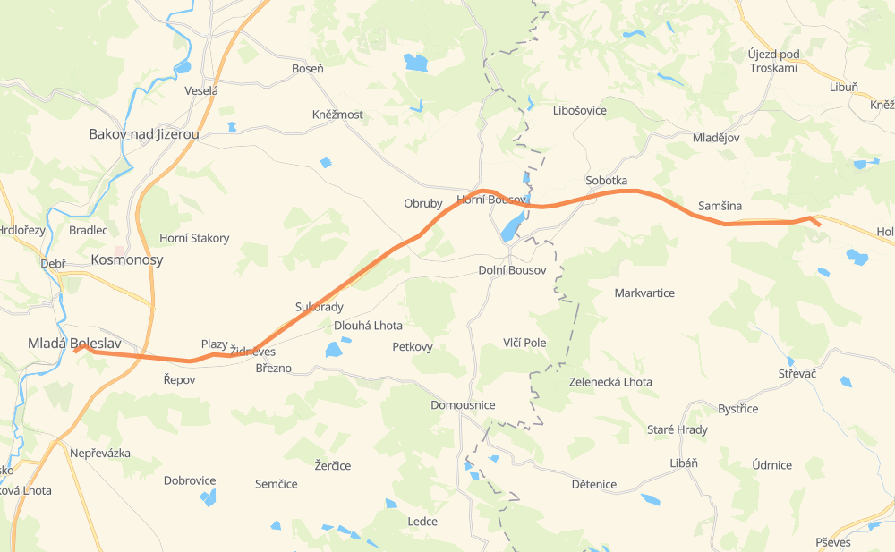
The distance from Dolní Lochov to Mladá Boleslav I is 19 miles by road. Road takes approximately 23 minutes and goes through Jungbunzlau, Ostružno, Ohařice, Samšina, Staňkova Lhota, Osek and Horní Bousov.
| Shortest distance by air | 17 mi ✈️ |
| Car route length | 18.6 mi 🚗 |
| Driving time | 23 min |
| Fuel amount | 0.6 gal |
| Fuel cost | 2.5 USD |
| Point | Distance | Time | Fuel | |
| Dolní Lochov | 0 mi | 00 min | 0.0 gal | |
|
16 1 mi, 02 min
|
||||
| Ohařice | 1 mi | 02 min | 0.0 gal | |
|
16 1 mi, 01 min
|
||||
| Samšina | 2 mi | 03 min | 0.1 gal | |
|
16 2 mi, 01 min
|
||||
| Staňkova Lhota | 4 mi | 05 min | 0.1 gal | |
|
16 2 mi, 01 min
|
||||
| Osek | 6 mi | 07 min | 0.2 gal | |
|
16 2 mi, 02 min
|
||||
| Horní Bousov | 8 mi | 09 min | 0.2 gal | |
|
16 2 mi, 02 min
|
||||
| Obrubce | 11 mi | 11 min | 0.3 gal | |
|
16 2 mi, 03 min
|
||||
| Sukorady | 13 mi | 14 min | 0.4 gal | |
|
16 1 mi, 02 min
|
||||
| Židněves | 14 mi | 17 min | 0.5 gal | |
|
16 4 mi, 06 min
|
||||
| Jungbunzlau | 19 mi | 23 min | 0.6 gal | |
Frequently Asked Questions
How much does it cost to drive from Dolní Lochov to Mladá Boleslav I?
Fuel cost: 2.5 USD
This fuel cost is calculated as: (Route length 18.6 mi) / (Fuel consumption 29.4 mpg) * (Fuel price 3.93 USD / gal)
You can adjust fuel consumption and fuel price here.
How long is a car ride from Dolní Lochov to Mladá Boleslav I?
Driving time: 23 min
This time is calculated for driving at the maximum permitted speed, taking into account traffic rules restrictions.
- 1 mi with a maximum speed 56 mph = 1 min
- 12 mi with a maximum speed 56 mph = 13 min
- 4 mi with a maximum speed 31 mph = 8 min
The calculated driving time does not take into account intermediate stops and traffic jams.
How far is Dolní Lochov to Mladá Boleslav I by land?
The distance between Dolní Lochov and Mladá Boleslav I is 18.6 mi by road.
Precise satellite coordinates of highways were used for this calculation. The start and finish points are the centers of Dolní Lochov and Mladá Boleslav I respectively.
What city is halfway between Dolní Lochov and Mladá Boleslav I?
The halfway point between Dolní Lochov and Mladá Boleslav I is Horní Bousov. It is located about 1 mi from the exact midpoint by road.
The distance from Horní Bousov to Dolní Lochov is 8 mi and driving will take about 9 min. The road between Horní Bousov and Mladá Boleslav I has length 11 mi and will take approximately 14 min.
The other cities located close to halfway point:
Where is Dolní Lochov in relation to Mladá Boleslav I?
Dolní Lochov is located 17 mi east of Mladá Boleslav I.
Dolní Lochov has geographic coordinates: latitude 50.45263, longitude 15.28647.
Mladá Boleslav I has geographic coordinates: latitude 50.41108, longitude 14.90324.
Which highway goes from Dolní Lochov to Mladá Boleslav I?
The route from Dolní Lochov to Mladá Boleslav I follows 16.