Distance between El Batallón and Zaragoza
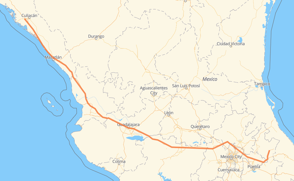
The distance from El Batallón to Zaragoza is 890 miles by road including 792 miles on motorways. Road takes approximately 15 hours and 36 minutes and goes through Dimas (Estación Dimas), Tepic, Tonalá, Navolato, Campo Balbuena, Tanques and El Huajote.
| Shortest distance by air | 728 mi ✈️ |
| Car route length | 890.4 mi 🚗 |
| Driving time | 15 h 36 min |
| Fuel amount | 30.3 gal |
| Fuel cost | 119 USD |
| Toll roads cost | 1,646 + ? MXN |
| Point | Distance | Time | Fuel | |
| El Batallón | 0 mi | 00 min | 0.0 gal | |
|
4 mi, 04 min
|
||||
| Campo Balbuena | 4 mi | 04 min | 0.0 gal | |
|
MEX 15D 60 mi, 59 min
|
||||
| Tanques | 64 mi | 1 h 04 min | 2.1 gal | |
|
MEX 15D 27 mi, 31 min
|
||||
| Dimas (Estación Dimas) | 91 mi | 1 h 35 min | 2.8 gal | |
|
MEX 15D 68 mi, 1 h 09 min
|
||||
| El Huajote | 159 mi | 2 h 45 min | 5.2 gal | |
|
MEX 15D 9 mi, 09 min
|
||||
| Otates | 168 mi | 2 h 54 min | 5.7 gal | |
|
MEX 15D 7 mi, 07 min
|
||||
| El Rosario | 175 mi | 3 h 02 min | 5.8 gal | |
|
MEX 15D 124 mi, 2 h 12 min
|
||||
| Tepic | 298 mi | 5 h 14 min | 10.0 gal | |
|
MEX 15D 138 mi, 2 h 17 min
|
||||
| Tonalá | 436 mi | 7 h 31 min | 14.7 gal | |
|
MEX 15D 454 mi, 8 h 04 min
|
||||
| Zaragoza | 890 mi | 15 h 36 min | 30.3 gal | |
Frequently Asked Questions
How many toll booths are there from El Batallón to Zaragoza?
There are 21 toll booths between El Batallón and Zaragoza: San Pedro km 197+100, Costa Rica, Marmol, El Rosario, Ruiz, Trapichillo, Santa Maria del Oro, Plan de Barrancas, La Joya, Ocotlán, Zinapecuaro, Contepec, Panindicuaro, Ecuandureo, Sanctorum, Atlacomulco — Maravatio, Atlacomulco 2, Cuapiaxtla, Payuca, Zaragoza and Arenal.
How much does the toll booths cost from El Batallón to Zaragoza?
Toll roads cost: San Pedro km 197+100 (34 MXN) + Costa Rica (152 MXN) + Marmol (131 MXN) + El Rosario (140 MXN) + Ruiz (120 MXN) + Trapichillo (80 MXN) + Santa Maria del Oro (115 MXN) + Plan de Barrancas (195 MXN) + Arenal (131 MXN) + La Joya (?) + Ocotlán (226 MXN) + Ecuandureo (111 MXN) + Panindicuaro (?) + Zinapecuaro (161 MXN) + Contepec (?) + Atlacomulco — Maravatio (50 MXN) + Atlacomulco 2 (?) + Sanctorum (?) + Cuapiaxtla (?) + Payuca (?) + Zaragoza (?) = 1,646 + ? MXN
How much does it cost to drive from El Batallón to Zaragoza?
Fuel cost: 119 USD
This fuel cost is calculated as: (Route length 890.4 mi) / (Fuel consumption 29.4 mpg) * (Fuel price 3.93 USD / gal)
You can adjust fuel consumption and fuel price here.
Toll roads cost: 1,646 + ? MXN
How long is a car ride from El Batallón to Zaragoza?
Driving time: 15 h 36 min
This time is calculated for driving at the maximum permitted speed, taking into account traffic rules restrictions.
- 112 mi with a maximum speed 68 mph = 1 h 38 min
- 388 mi with a maximum speed 62 mph = 6 h 14 min
- 74 mi with a maximum speed 56 mph = 1 h 19 min
- 25 mi with a maximum speed 56 mph = 26 min
- 278 mi with a maximum speed 50 mph = 5 h 35 min
- 7 mi with a maximum speed 43 mph = 10 min
- 4 mi with a maximum speed 37 mph = 6 min
- 1 mi with a maximum speed 25 mph = 3 min
The calculated driving time does not take into account intermediate stops and traffic jams.
How far is El Batallón to Zaragoza by land?
The distance between El Batallón and Zaragoza is 890.4 mi by road including 791.6 mi on motorways.
Precise satellite coordinates of highways were used for this calculation. The start and finish points are the centers of El Batallón and Zaragoza respectively.
How far is El Batallón to Zaragoza by plane?
The shortest distance (air line, as the crow flies) between El Batallón and Zaragoza is 728.2 mi.
This distance is calculated using the Haversine formula as a great-circle distance between two points on the surface of a sphere. The start and finish points are the centers of El Batallón and Zaragoza respectively. Actual distance between airports may be different.
How many hours is El Batallón from Zaragoza by plane?
Boeing 737 airliner needs 1 h 27 min to cover the distance of 728 mi at a cruising speed of 497 mph.
Small plane "Cessna 172" needs 5 h 19 min to flight this distance at average speed of 136 mph.
This time is approximate and do not take into account takeoff and landing times, airport location and other real world factors.
How long is a helicopter ride from El Batallón to Zaragoza?
Fast helicopter "Eurocopter AS350" or "Hughes OH-6 Cayuse" need 4 h 53 min to cover the distance of 728 mi at a cruising speed of 149 mph.
Popular "Robinson R44" needs 5 h 34 min to flight this distance at average speed of 130 mph.
This time is approximate and do not take into account takeoff and landing times, aerodrome location and other real world factors.
What city is halfway between El Batallón and Zaragoza?
The halfway point between El Batallón and Zaragoza is Tonalá. It is located about 9 mi from the exact midpoint by road.
The distance from Tonalá to El Batallón is 436 mi and driving will take about 7 h 31 min. The road between Tonalá and Zaragoza has length 454 mi and will take approximately 8 h 4 min.
The other cities located close to halfway point:
Where is El Batallón in relation to Zaragoza?
El Batallón is located 728 mi north-west of Zaragoza.
El Batallón has geographic coordinates: latitude 24.76417, longitude -107.58993.
Zaragoza has geographic coordinates: latitude 19.77278, longitude -97.55667.
Which highway goes from El Batallón to Zaragoza?
The route from El Batallón to Zaragoza follows MEX 15D, MEX M40D.
Other minor sections pass along the road:
- MEX 136: 52 mi
- MEX 129D: 25 mi
- MEX 70: 19 mi
- MEX 90: 19 mi
- MEX 140D: 14 mi
- MEX 80D: 11 mi
- MEX 80: 7 mi
- MEX 23: 5 mi
- MEX 040D: 4 mi