Distance between El Cerrito and Sabinas
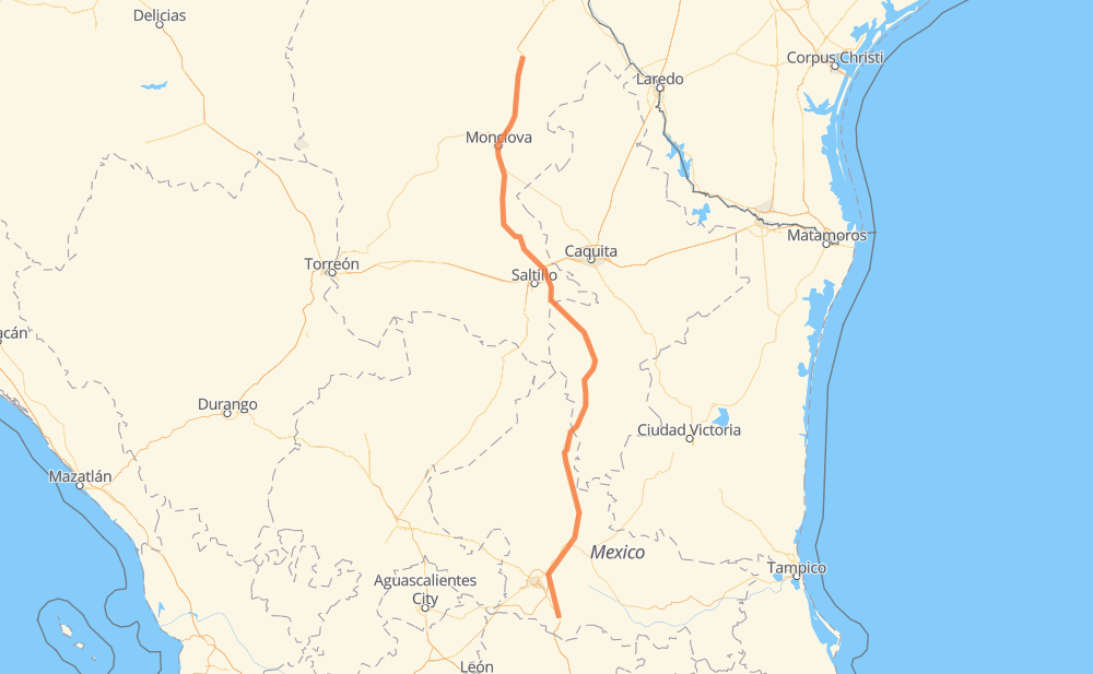
The distance from El Cerrito to Sabinas is 483 miles by road including 303 miles on motorways. Road takes approximately 8 hours and 24 minutes and goes through Monclova, Santa María del Río, Delegación de La Pila, Cerro de San Pedro, Villa Hidalgo, San Cayetano de Vacas and Ejido La Yerba.
| Shortest distance by air | 421 mi ✈️ |
| Car route length | 482.8 mi 🚗 |
| Driving time | 8 h 24 min |
| Fuel amount | 16.4 gal |
| Fuel cost | 64.6 USD |
| Toll roads cost | 178 + ? MXN |
| Point | Distance | Time | Fuel | |
| El Cerrito | 0 mi | 00 min | 0.0 gal | |
|
MEX 57 11 mi, 13 min
|
||||
| Las Enramadas | 11 mi | 13 min | 0.1 gal | |
|
MEX 57 17 mi, 17 min
|
||||
| Delegación de La Pila | 29 mi | 30 min | 0.7 gal | |
|
MEX 57D MEX 80 68 mi, 1 h 10 min
|
||||
| Huizache | 97 mi | 1 h 41 min | 1.8 gal | |
|
MEX 57 85 mi, 1 h 25 min
|
||||
| San Cayetano de Vacas | 181 mi | 3 h 07 min | 5.5 gal | |
|
MEX 57 73 mi, 1 h 09 min
|
||||
| San Rafael | 254 mi | 4 h 17 min | 8.5 gal | |
|
MEX 57 MEX 57D 40 mi, 37 min
|
||||
| Arteaga | 294 mi | 4 h 55 min | 9.9 gal | |
|
MEX 57D MEX 57 110 mi, 1 h 59 min
|
||||
| Castaños | 404 mi | 6 h 54 min | 13.6 gal | |
|
MEX 57 7 mi, 09 min
|
||||
| Monclova | 411 mi | 7 h 04 min | 13.9 gal | |
|
MEX 57 71 mi, 1 h 19 min
|
||||
| Sabinas | 483 mi | 8 h 24 min | 16.3 gal | |
Hotels of Sabinas
Frequently Asked Questions
How many toll booths are there from El Cerrito to Sabinas?
There are 4 toll booths between El Cerrito and Sabinas: La Carbonera, Los Chorros, Matehuala Omega and Libramiento Oriente De SLP.
How much does the toll booths cost from El Cerrito to Sabinas?
Toll roads cost: Libramiento Oriente De SLP (70 MXN) + Matehuala Omega (?) + Los Chorros (66 MXN) + La Carbonera (42 MXN) = 178 + ? MXN
How much does it cost to drive from El Cerrito to Sabinas?
Fuel cost: 64.6 USD
This fuel cost is calculated as: (Route length 482.8 mi) / (Fuel consumption 29.4 mpg) * (Fuel price 3.93 USD / gal)
You can adjust fuel consumption and fuel price here.
Toll roads cost: 178 + ? MXN
How long is a car ride from El Cerrito to Sabinas?
Driving time: 8 h 24 min
This time is calculated for driving at the maximum permitted speed, taking into account traffic rules restrictions.
- 64 mi with a maximum speed 68 mph = 56 min
- 112 mi with a maximum speed 62 mph = 1 h 47 min
- 75 mi with a maximum speed 56 mph = 1 h 20 min
- 179 mi with a maximum speed 56 mph = 3 h 11 min
- 49 mi with a maximum speed 50 mph = 59 min
- 1 mi with a maximum speed 37 mph = 1 min
- 4 mi with a maximum speed 31 mph = 6 min
The calculated driving time does not take into account intermediate stops and traffic jams.
How far is El Cerrito to Sabinas by land?
The distance between El Cerrito and Sabinas is 482.8 mi by road including 303.2 mi on motorways.
Precise satellite coordinates of highways were used for this calculation. The start and finish points are the centers of El Cerrito and Sabinas respectively.
How far is El Cerrito to Sabinas by plane?
The shortest distance (air line, as the crow flies) between El Cerrito and Sabinas is 421.3 mi.
This distance is calculated using the Haversine formula as a great-circle distance between two points on the surface of a sphere. The start and finish points are the centers of El Cerrito and Sabinas respectively. Actual distance between airports may be different.
How many hours is El Cerrito from Sabinas by plane?
Boeing 737 airliner needs 50 min to cover the distance of 421 mi at a cruising speed of 497 mph.
Small plane "Cessna 172" needs 3 h 4 min to flight this distance at average speed of 136 mph.
This time is approximate and do not take into account takeoff and landing times, airport location and other real world factors.
How long is a helicopter ride from El Cerrito to Sabinas?
Fast helicopter "Eurocopter AS350" or "Hughes OH-6 Cayuse" need 2 h 49 min to cover the distance of 421 mi at a cruising speed of 149 mph.
Popular "Robinson R44" needs 3 h 13 min to flight this distance at average speed of 130 mph.
This time is approximate and do not take into account takeoff and landing times, aerodrome location and other real world factors.
What city is halfway between El Cerrito and Sabinas?
The halfway point between El Cerrito and Sabinas is Entronque San Roberto. It is located about 12 mi from the exact midpoint by road.
The distance from Entronque San Roberto to El Cerrito is 229 mi and driving will take about 3 h 53 min. The road between Entronque San Roberto and Sabinas has length 254 mi and will take approximately 4 h 30 min.
The other cities located close to halfway point:
Where is El Cerrito in relation to Sabinas?
El Cerrito is located 421 mi south of Sabinas.
El Cerrito has geographic coordinates: latitude 21.76626, longitude -100.69709.
Sabinas has geographic coordinates: latitude 27.85319, longitude -101.12679.
Which highway goes from El Cerrito to Sabinas?
The route from El Cerrito to Sabinas follows MEX 57, MEX 57D.
Other minor sections pass along the road:
- MEX 80: 50 mi