Distance between Entre Rios and Engenheiro Caldas
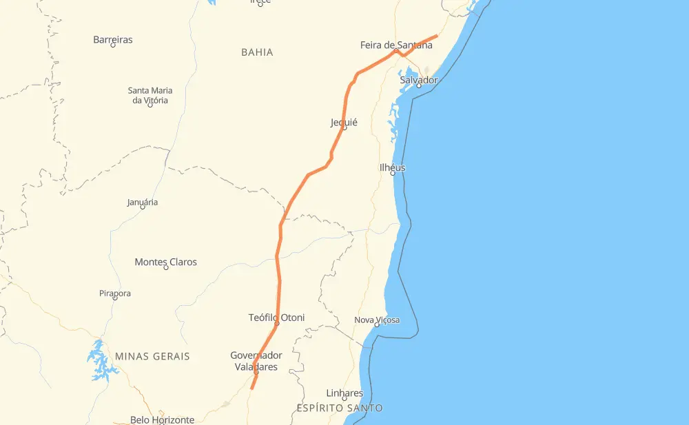
The distance from Entre Rios to Engenheiro Caldas is 682 miles by road including 52 miles on motorways. Road takes approximately 13 hours and 1 minute and goes through Entrocamento do Cem, Distrito Industrial dos Imborés, Nossa Senhora Aparecida, Felícia, Medina, Itaobim and Ponto dos Volantes.
| Shortest distance by air | 567 mi ✈️ |
| Car route length | 682.3 mi 🚗 |
| Driving time | 13 h 1 min |
| Fuel amount | 23.2 gal |
| Fuel cost | 91.2 USD |
| Point | Distance | Time | Fuel | |
| Entre Rios | 0 mi | 00 min | 0.0 gal | |
|
BR-101 BR-116 173 mi, 3 h 03 min
|
||||
| Entrocamento do Cem | 173 mi | 3 h 03 min | 5.7 gal | |
|
BR-116 151 mi, 3 h 01 min
|
||||
| Distrito Industrial dos Imborés | 324 mi | 6 h 04 min | 10.9 gal | |
|
BR-116 2 mi, 02 min
|
||||
| Nossa Senhora Aparecida | 326 mi | 6 h 07 min | 11.1 gal | |
|
BR-116 5 mi, 07 min
|
||||
| Felícia | 331 mi | 6 h 14 min | 11.2 gal | |
|
BR-116 114 mi, 2 h 07 min
|
||||
| Medina | 445 mi | 8 h 21 min | 14.4 gal | |
|
BR-116 30 mi, 32 min
|
||||
| Itaobim | 475 mi | 8 h 54 min | 15.9 gal | |
|
BR-116 15 mi, 17 min
|
||||
| Ponto dos Volantes | 490 mi | 9 h 12 min | 16.4 gal | |
|
BR-116 17 mi, 19 min
|
||||
| Padre Paraíso | 507 mi | 9 h 31 min | 17.0 gal | |
|
BR-116 176 mi, 3 h 29 min
|
||||
| Engenheiro Caldas | 683 mi | 13 h 01 min | 23.1 gal | |
Frequently Asked Questions
How much does it cost to drive from Entre Rios to Engenheiro Caldas?
Fuel cost: 91.2 USD
This fuel cost is calculated as: (Route length 682.3 mi) / (Fuel consumption 29.4 mpg) * (Fuel price 3.93 USD / gal)
You can adjust fuel consumption and fuel price here.
How long is a car ride from Entre Rios to Engenheiro Caldas?
Driving time: 13 h 1 min
This time is calculated for driving at the maximum permitted speed, taking into account traffic rules restrictions.
- 27 mi with a maximum speed 68 mph = 24 min
- 16 mi with a maximum speed 62 mph = 14 min
- 449 mi with a maximum speed 56 mph = 8 h
- 134 mi with a maximum speed 50 mph = 2 h 41 min
- 8 mi with a maximum speed 43 mph = 11 min
- 37 mi with a maximum speed 37 mph = 59 min
- 2 mi with a maximum speed 31 mph = 4 min
- 11 mi with a maximum speed 25 mph = 25 min
The calculated driving time does not take into account intermediate stops and traffic jams.
How far is Entre Rios to Engenheiro Caldas by land?
The distance between Entre Rios and Engenheiro Caldas is 682.3 mi by road including 51.6 mi on motorways.
Precise satellite coordinates of highways were used for this calculation. The start and finish points are the centers of Entre Rios and Engenheiro Caldas respectively.
How far is Entre Rios to Engenheiro Caldas by plane?
The shortest distance (air line, as the crow flies) between Entre Rios and Engenheiro Caldas is 566.7 mi.
This distance is calculated using the Haversine formula as a great-circle distance between two points on the surface of a sphere. The start and finish points are the centers of Entre Rios and Engenheiro Caldas respectively. Actual distance between airports may be different.
How many hours is Entre Rios from Engenheiro Caldas by plane?
Boeing 737 airliner needs 1 h 8 min to cover the distance of 567 mi at a cruising speed of 497 mph.
Small plane "Cessna 172" needs 4 h 8 min to flight this distance at average speed of 136 mph.
This time is approximate and do not take into account takeoff and landing times, airport location and other real world factors.
How long is a helicopter ride from Entre Rios to Engenheiro Caldas?
Fast helicopter "Eurocopter AS350" or "Hughes OH-6 Cayuse" need 3 h 48 min to cover the distance of 567 mi at a cruising speed of 149 mph.
Popular "Robinson R44" needs 4 h 20 min to flight this distance at average speed of 130 mph.
This time is approximate and do not take into account takeoff and landing times, aerodrome location and other real world factors.
What city is halfway between Entre Rios and Engenheiro Caldas?
The halfway point between Entre Rios and Engenheiro Caldas is Lagoa José Luiz. It is located about 1 mi from the exact midpoint by road.
The distance from Lagoa José Luiz to Entre Rios is 342 mi and driving will take about 6 h 26 min. The road between Lagoa José Luiz and Engenheiro Caldas has length 340 mi and will take approximately 6 h 35 min.
The other cities located close to halfway point:
Where is Entre Rios in relation to Engenheiro Caldas?
Entre Rios is located 567 mi north-east of Engenheiro Caldas.
Entre Rios has geographic coordinates: latitude -11.94237, longitude -38.0837.
Engenheiro Caldas has geographic coordinates: latitude -19.20139, longitude -42.04694.
Which highway goes from Entre Rios to Engenheiro Caldas?
The route from Entre Rios to Engenheiro Caldas follows BR-116, BR-101.
Other minor sections pass along the road:
- BR-342: 44 mi
- BA-262: 22 mi
- BR-324: 9 mi
- BR-251: 9 mi
- BR-030: 2 mi
- BA-400: 1 mi