Distance between Fox+Creek AB and Washington KS
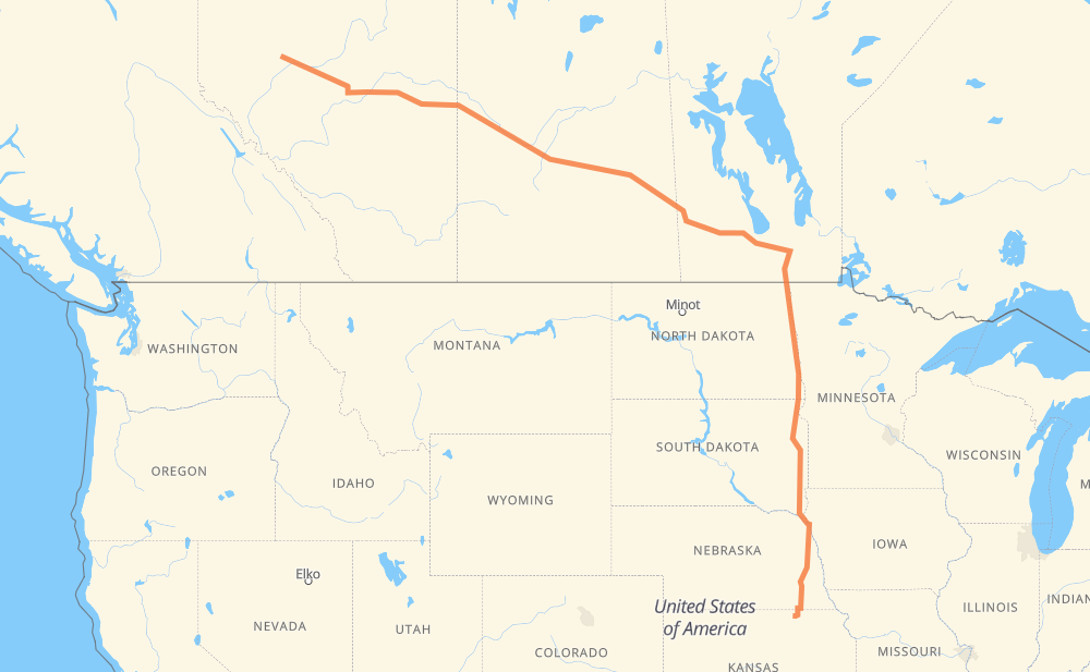
The distance from Fox+Creek to Washington is 1,722 miles by road including 537 miles on motorways. Road takes approximately 30 hours and 13 minutes and goes through Spruce Grove, Edmonton, Lloydminster, North Battleford, Saskatoon, Yorkton and Portage la Prairie.
| Shortest distance by air | 1,362 mi ✈️ |
| Car route length | 1,722.4 mi 🚗 |
| Driving time | 30 h 13 min |
| Fuel amount | 58.6 gal |
| Fuel cost | 230.2 USD |
| Point | Distance | Time | Fuel | |
| Fox+Creek | 0 mi | 00 min | 0.0 gal | |
|
43 142 mi, 2 h 33 min
|
||||
| Spruce Grove | 142 mi | 2 h 33 min | 4.7 gal | |
|
16 17 mi, 17 min
|
||||
| Edmonton | 160 mi | 2 h 51 min | 5.2 gal | |
|
16 153 mi, 2 h 44 min
|
||||
| Lloydminster | 313 mi | 5 h 36 min | 9.9 gal | |
|
16 73 mi, 1 h 19 min
|
||||
| North Battleford | 385 mi | 6 h 56 min | 12.5 gal | |
|
16 101 mi, 1 h 50 min
|
||||
| Saskatoon | 486 mi | 8 h 47 min | 16.4 gal | |
|
16 202 mi, 3 h 37 min
|
||||
| Yorkton | 688 mi | 12 h 24 min | 23.3 gal | |
|
16 PTH 16 229 mi, 4 h 14 min
|
||||
| Portage la Prairie | 917 mi | 16 h 38 min | 31.0 gal | |
|
PTH 1 53 mi, 58 min
|
||||
| Winnipeg | 970 mi | 17 h 36 min | 32.7 gal | |
|
PTH 100 I 29 142 mi, 2 h 34 min
|
||||
| Grand Forks | 1,112 mi | 20 h 11 min | 37.7 gal | |
|
I 29 75 mi, 1 h 17 min
|
||||
| Fargo | 1,186 mi | 21 h 29 min | 40.1 gal | |
|
I 29 140 mi, 2 h 04 min
|
||||
| Watertown | 1,326 mi | 23 h 33 min | 45.0 gal | |
|
I 29 45 mi, 40 min
|
||||
| Brookings | 1,371 mi | 24 h 13 min | 46.6 gal | |
|
I 29 54 mi, 47 min
|
||||
| Sioux Falls | 1,425 mi | 25 h 01 min | 48.3 gal | |
|
I 29 81 mi, 1 h 12 min
|
||||
| Sioux City | 1,506 mi | 26 h 13 min | 51.2 gal | |
|
I 29 US 77 124 mi, 2 h 17 min
|
||||
| Lincoln | 1,630 mi | 28 h 30 min | 55.1 gal | |
|
US 77 92 mi, 1 h 42 min
|
||||
| Washington | 1,722 mi | 30 h 13 min | 58.5 gal | |
Hotels of Washington
Frequently Asked Questions
How much does it cost to drive from Fox+Creek to Washington?
Fuel cost: 230.2 USD
This fuel cost is calculated as: (Route length 1,722.4 mi) / (Fuel consumption 29.4 mpg) * (Fuel price 3.93 USD / gal)
You can adjust fuel consumption and fuel price here.
How long is a car ride from Fox+Creek to Washington?
Driving time: 30 h 13 min
This time is calculated for driving at the maximum permitted speed, taking into account traffic rules restrictions.
- 328 mi with a maximum speed 68 mph = 4 h 49 min
- 29 mi with a maximum speed 65 mph = 26 min
- 84 mi with a maximum speed 62 mph = 1 h 20 min
- 3 mi with a maximum speed 60 mph = 3 min
- 1,038 mi with a maximum speed 56 mph = 18 h 31 min
- 15 mi with a maximum speed 56 mph = 16 min
- 16 mi with a maximum speed 55 mph = 17 min
- 2 mi with a maximum speed 50 mph = 2 min
- 168 mi with a maximum speed 50 mph = 3 h 23 min
- 5 mi with a maximum speed 45 mph = 6 min
- 14 mi with a maximum speed 43 mph = 20 min
- 2 mi with a maximum speed 40 mph = 3 min
- 6 mi with a maximum speed 37 mph = 9 min
- 2 mi with a maximum speed 35 mph = 3 min
- 7 mi with a maximum speed 31 mph = 14 min
- 1 mi with a maximum speed 30 mph = 1 min
- 1 mi with a maximum speed 25 mph = 1 min
The calculated driving time does not take into account intermediate stops and traffic jams.
How far is Fox+Creek to Washington by land?
The distance between Fox+Creek and Washington is 1,722.4 mi by road including 536.9 mi on motorways.
Precise satellite coordinates of highways were used for this calculation. The start and finish points are the centers of Fox+Creek and Washington respectively.
How far is Fox+Creek to Washington by plane?
The shortest distance (air line, as the crow flies) between Fox+Creek and Washington is 1,362 mi.
This distance is calculated using the Haversine formula as a great-circle distance between two points on the surface of a sphere. The start and finish points are the centers of Fox+Creek and Washington respectively. Actual distance between airports may be different.
How many hours is Fox+Creek from Washington by plane?
Boeing 737 airliner needs 2 h 44 min to cover the distance of 1,362 mi at a cruising speed of 497 mph.
Small plane "Cessna 172" needs 9 h 57 min to flight this distance at average speed of 136 mph.
This time is approximate and do not take into account takeoff and landing times, airport location and other real world factors.
How long is a helicopter ride from Fox+Creek to Washington?
Fast helicopter "Eurocopter AS350" or "Hughes OH-6 Cayuse" need 9 h 8 min to cover the distance of 1,362 mi at a cruising speed of 149 mph.
Popular "Robinson R44" needs 10 h 26 min to flight this distance at average speed of 130 mph.
This time is approximate and do not take into account takeoff and landing times, aerodrome location and other real world factors.
What city is halfway between Fox+Creek and Washington?
The halfway point between Fox+Creek and Washington is Neepawa. It is located about 6 mi from the exact midpoint by road.
The distance from Neepawa to Fox+Creek is 854 mi and driving will take about 15 h 29 min. The road between Neepawa and Washington has length 867 mi and will take approximately 14 h 43 min.
The other cities located close to halfway point:
Where is Fox+Creek in relation to Washington?
Fox+Creek is located 1,362 mi north-west of Washington.
Fox+Creek has geographic coordinates: latitude 54.40099, longitude -116.81724.
Washington has geographic coordinates: latitude 39.81806, longitude -97.05086.
Which highway goes from Fox+Creek to Washington?
The route from Fox+Creek to Washington follows 16, I 29, US 81, US 77, PTH 16, 43.
Other minor sections pass along the road:
- PTH 75: 58 mi
- PTH 1: 53 mi
- PTH 83: 23 mi
- US 75: 16 mi
- NE 112: 16 mi
- PTH 100: 14 mi
- SD 20: 11 mi
- KS 148: 11 mi
- US 36: 11 mi
- NE 92: 9 mi
- 11: 8 mi
- US 275: 8 mi
- I 80: 7 mi
- 20: 6 mi
- NE 8: 6 mi
- 32: 5 mi
- 2: 4 mi
- NE 91: 4 mi
- PTH 10: 4 mi
- 6: 3 mi
- 674: 3 mi
- 40: 3 mi
- US 18: 2 mi
- PR 264: 2 mi
- 9: 2 mi
- 21: 2 mi
- US 275 Business: 2 mi
- Route 42: 1 mi
- NE 41: 1 mi
- 757: 1 mi
- 12: 1 mi
- 10: 1 mi
- PR 250: 1 mi
- PTH 5: 1 mi
- 675: 1 mi
- US 20 Business: 1 mi
- 4: 1 mi