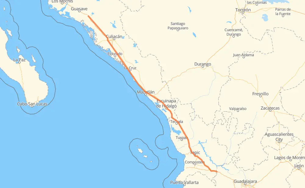
Distance between Gabriel Leyva Velázquez (La Escalera) and Loma
The distance from Gabriel Leyva Velázquez (La Escalera) to Loma is 423 miles by road including 422 miles on motorways. Road takes approximately 7 hours and 15 minutes and goes through Dimas (Estación Dimas), Tepic, Colonia Agrícola México (Palmitas), Campo Balbuena, Tanques, El Huajote and Otates.
| Shortest distance by air | 398 mi ✈️ |
| Car route length | 422.5 mi 🚗 |
| Driving time | 7 h 15 min |
| Fuel amount | 14.4 gal |
| Fuel cost | 56.5 USD |
| Toll roads cost | 921 MXN |
| Point | Distance | Time | Fuel | |
| Gabriel Leyva Velázquez (La Escalera) | 0 mi | 00 min | 0.0 gal | |
|
MEX 15D 19 mi, 19 min
|
||||
| Cerro Bola | 19 mi | 19 min | 0.6 gal | |
|
MEX 15D 10 mi, 10 min
|
||||
| Colonia Agrícola México (Palmitas) | 29 mi | 30 min | 0.9 gal | |
|
MEX 15D 38 mi, 39 min
|
||||
| Campo Balbuena | 67 mi | 1 h 09 min | 2.2 gal | |
|
MEX 15D 58 mi, 57 min
|
||||
| Tanques | 125 mi | 2 h 06 min | 4.1 gal | |
|
MEX 15D 27 mi, 31 min
|
||||
| Dimas (Estación Dimas) | 152 mi | 2 h 38 min | 4.9 gal | |
|
MEX 15D 68 mi, 1 h 09 min
|
||||
| El Huajote | 220 mi | 3 h 47 min | 7.3 gal | |
|
MEX 15D 9 mi, 09 min
|
||||
| Otates | 229 mi | 3 h 56 min | 7.7 gal | |
|
MEX 15D 7 mi, 07 min
|
||||
| El Rosario | 235 mi | 4 h 04 min | 7.8 gal | |
|
MEX 15D 124 mi, 2 h 12 min
|
||||
| Tepic | 359 mi | 6 h 16 min | 12.0 gal | |
|
MEX 15D 63 mi, 58 min
|
||||
| 21.00076, -104.21715 | 423 mi | 7 h 15 min | 14.4 gal | |
Frequently Asked Questions
How many toll booths are there from Gabriel Leyva Velázquez (La Escalera) to Loma?
There are 9 toll booths between Gabriel Leyva Velázquez (La Escalera) and Loma: Las Brisas, San Pedro km 197+100, Costa Rica, Marmol, El Rosario, Ruiz, Trapichillo, Santa Maria del Oro and El Pisal.
How much does the toll booths cost from Gabriel Leyva Velázquez (La Escalera) to Loma?
Toll roads cost: Las Brisas (76 MXN) + El Pisal (73 MXN) + San Pedro km 197+100 (34 MXN) + Costa Rica (152 MXN) + Marmol (131 MXN) + El Rosario (140 MXN) + Ruiz (120 MXN) + Trapichillo (80 MXN) + Santa Maria del Oro (115 MXN) = 921 MXN
How much does it cost to drive from Gabriel Leyva Velázquez (La Escalera) to Loma?
Fuel cost: 56.5 USD
This fuel cost is calculated as: (Route length 422.5 mi) / (Fuel consumption 29.4 mpg) * (Fuel price 3.93 USD / gal)
You can adjust fuel consumption and fuel price here.
Toll roads cost: 921 MXN
How long is a car ride from Gabriel Leyva Velázquez (La Escalera) to Loma?
Driving time: 7 h 15 min
This time is calculated for driving at the maximum permitted speed, taking into account traffic rules restrictions.
- 65 mi with a maximum speed 68 mph = 57 min
- 217 mi with a maximum speed 62 mph = 3 h 29 min
- 19 mi with a maximum speed 56 mph = 20 min
- 113 mi with a maximum speed 50 mph = 2 h 16 min
- 7 mi with a maximum speed 43 mph = 10 min
- 1 mi with a maximum speed 37 mph = 1 min
The calculated driving time does not take into account intermediate stops and traffic jams.
How far is Gabriel Leyva Velázquez (La Escalera) to Loma by land?
The distance between Gabriel Leyva Velázquez (La Escalera) and Loma is 422.5 mi by road including 421.9 mi on motorways.
Precise satellite coordinates of highways were used for this calculation. The start and finish points are the centers of Gabriel Leyva Velázquez (La Escalera) and Loma respectively.
How far is Gabriel Leyva Velázquez (La Escalera) to Loma by plane?
The shortest distance (air line, as the crow flies) between Gabriel Leyva Velázquez (La Escalera) and Loma is 397.7 mi.
This distance is calculated using the Haversine formula as a great-circle distance between two points on the surface of a sphere. The start and finish points are the centers of Gabriel Leyva Velázquez (La Escalera) and Loma respectively. Actual distance between airports may be different.
How many hours is Gabriel Leyva Velázquez (La Escalera) from Loma by plane?
Boeing 737 airliner needs 48 min to cover the distance of 398 mi at a cruising speed of 497 mph.
Small plane "Cessna 172" needs 2 h 54 min to flight this distance at average speed of 136 mph.
This time is approximate and do not take into account takeoff and landing times, airport location and other real world factors.
How long is a helicopter ride from Gabriel Leyva Velázquez (La Escalera) to Loma?
Fast helicopter "Eurocopter AS350" or "Hughes OH-6 Cayuse" need 2 h 40 min to cover the distance of 398 mi at a cruising speed of 149 mph.
Popular "Robinson R44" needs 3 h 2 min to flight this distance at average speed of 130 mph.
This time is approximate and do not take into account takeoff and landing times, aerodrome location and other real world factors.
What city is halfway between Gabriel Leyva Velázquez (La Escalera) and Loma?
The halfway point between Gabriel Leyva Velázquez (La Escalera) and Loma is Ejido Caleritas.
The distance from Ejido Caleritas to Gabriel Leyva Velázquez (La Escalera) is 211 mi and driving will take about 3 h 37 min. The road between Ejido Caleritas and Loma has length 211 mi and will take approximately 3 h 38 min.
The other cities located close to halfway point:
Where is Gabriel Leyva Velázquez (La Escalera) in relation to Loma?
Gabriel Leyva Velázquez (La Escalera) is located 398 mi north-west of Loma.
Gabriel Leyva Velázquez (La Escalera) has geographic coordinates: latitude 25.44859, longitude -108.19658.
Loma has geographic coordinates: latitude 21.00076, longitude -104.21715.
Which highway goes from Gabriel Leyva Velázquez (La Escalera) to Loma?
The route from Gabriel Leyva Velázquez (La Escalera) to Loma follows MEX 15D.