Distance between Galt CA and Traverse City MI
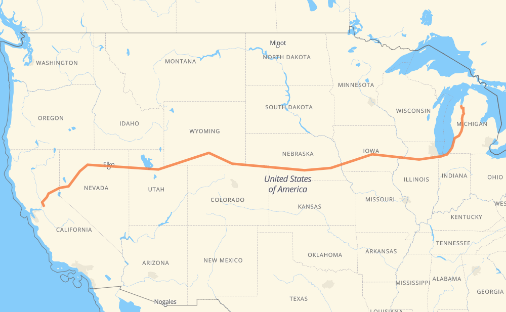
The distance from Galt to Traverse City is 2,371 miles by road including 2,340 miles on motorways. Road takes approximately 35 hours and 45 minutes and goes through Sacramento, Reno, Salt Lake City, Rock Springs, Laramie, Cheyenne and North Platte.
There are tolls on the route.
Page content:
Change the route settings
Click here to load the interactive map
Compare this route in other services:
Point
Distance
Time
Fuel
Galt
0 mi
0:00
00 min
0.0 gal
CA 99 22 mi, 21 min
Sacramento
22 mi
0:21
21 min
0.4 gal
CA 99 I 80 132 mi, 2 h 03 min
Reno
155 mi
2:25
2 h 25 min
5.2 gal
I 80 511 mi, 7 h 32 min
Salt Lake City
667 mi
9:57
9 h 57 min
22.2 gal
I 80 185 mi, 2 h 44 min
Rock Springs
852 mi
12:41
12 h 41 min
28.8 gal
I 80 209 mi, 3 h 04 min
Laramie
1,061 mi
15:46
15 h 46 min
35.9 gal
I 80 48 mi, 42 min
Cheyenne
1,110 mi
16:29
16 h 29 min
37.6 gal
I 80 211 mi, 3 h 05 min
North Platte
1,320 mi
19:34
19 h 34 min
44.5 gal
I 80 231 mi, 3 h 23 min
Lincoln
1,551 mi
22:58
22 h 58 min
52.6 gal
I 80 48 mi, 43 min
Omaha
1,599 mi
23:42
23 h 42 min
54.2 gal
I 80 251 mi, 3 h 45 min
Iowa City
1,849 mi
27:28
27 h 28 min
62.8 gal
I 80 49 mi, 43 min
Davenport
1,898 mi
28:11
28 h 11 min
64.4 gal
I 280 I 80 86 mi, 1 h 16 min
Peru
1,984 mi
29:28
29 h 28 min
67.4 gal
I 80 59 mi, 53 min
Joliet
2,044 mi
30:21
30 h 21 min
69.4 gal
I 80 I 94 186 mi, 2 h 58 min
Grand Rapids
2,229 mi
33:20
33 h 20 min
75.7 gal
I 196 US 131 141 mi, 2 h 24 min
Traverse City
2,371 mi
35:45
35 h 45 min
80.5 gal
Point
Distance
Time
Fuel
Galt
0 mi
0:00
00 min
0.0 gal
CA 99 11 mi, 09 min
Elk Grove
11 mi
0:09
09 min
0.3 gal
CA 99 12 mi, 12 min
Sacramento
22 mi
0:21
21 min
0.4 gal
CA 99 I 80 19 mi, 18 min
Roseville
41 mi
0:40
40 min
1.3 gal
I 80 6 mi, 05 min
Rocklin
47 mi
0:45
45 min
1.5 gal
I 80 5 mi, 04 min
Newcastle
52 mi
0:50
50 min
1.7 gal
I 80 5 mi, 04 min
Auburn
57 mi
0:55
55 min
1.9 gal
I 80 6 mi, 05 min
Applegate
63 mi
1:00
1 h 00 min
2.0 gal
I 80 4 mi, 04 min
Weimar
67 mi
1:04
1 h 04 min
2.2 gal
I 80 4 mi, 03 min
Colfax
71 mi
1:08
1 h 08 min
2.3 gal
I 80 6 mi, 05 min
Magra
78 mi
1:13
1 h 13 min
2.6 gal
I 80 6 mi, 04 min
Alta
83 mi
1:18
1 h 18 min
2.8 gal
I 80 4 mi, 03 min
Baxter
87 mi
1:22
1 h 22 min
2.9 gal
I 80 8 mi, 07 min
Emigrant Gap
95 mi
1:29
1 h 29 min
3.2 gal
I 80 6 mi, 04 min
Yuba Pass
100 mi
1:34
1 h 34 min
3.4 gal
I 80 2 mi, 02 min
Cisco Grove
103 mi
1:37
1 h 37 min
3.5 gal
I 80 2 mi, 01 min
Rainbow
105 mi
1:38
1 h 38 min
3.5 gal
I 80 2 mi, 02 min
Troy
107 mi
1:41
1 h 41 min
3.6 gal
I 80 16 mi, 14 min
Truckee
123 mi
1:55
1 h 55 min
3.9 gal
I 80 13 mi, 12 min
Floriston
136 mi
2:07
2 h 07 min
4.6 gal
I 80 13 mi, 11 min
Mogul
149 mi
2:19
2 h 19 min
5.1 gal
I 80 1 mi, 00 min
Lawton
150 mi
2:20
2 h 20 min
5.1 gal
I 80 5 mi, 04 min
Reno
155 mi
2:25
2 h 25 min
5.2 gal
I 80 6 mi, 05 min
Sparks
162 mi
2:30
2 h 30 min
5.3 gal
I 80 12 mi, 10 min
Mustang
173 mi
2:41
2 h 41 min
5.6 gal
I 80 16 mi, 13 min
Fernley
189 mi
2:55
2 h 55 min
6.3 gal
I 80 41 mi, 36 min
Trinity
230 mi
3:31
3 h 31 min
7.6 gal
I 80 9 mi, 08 min
Toulon
239 mi
3:39
3 h 39 min
8.0 gal
I 80 8 mi, 07 min
Lovelock
247 mi
3:46
3 h 46 min
8.4 gal
I 80 8 mi, 07 min
Colado
255 mi
3:53
3 h 53 min
8.5 gal
I 80 11 mi, 09 min
Rye Patch
266 mi
4:03
4 h 03 min
8.9 gal
I 80 53 mi, 47 min
Winnemucca
319 mi
4:50
4 h 50 min
10.8 gal
I 80 39 mi, 34 min
Valmy
359 mi
5:24
5 h 24 min
12.2 gal
I 80 11 mi, 09 min
Piute
369 mi
5:34
5 h 34 min
12.5 gal
I 80 4 mi, 03 min
Battle Mountain
373 mi
5:37
5 h 37 min
12.6 gal
I 80 22 mi, 19 min
Shoshone
396 mi
5:57
5 h 57 min
13.5 gal
I 80 1 mi, 01 min
Rixies
397 mi
5:58
5 h 58 min
13.5 gal
I 80 10 mi, 08 min
Primeaux
407 mi
6:07
6 h 07 min
13.7 gal
I 80 12 mi, 10 min
Carlin
418 mi
6:17
6 h 17 min
14.0 gal
I 80 7 mi, 06 min
Vivian
426 mi
6:23
6 h 23 min
14.4 gal
I 80 2 mi, 01 min
Tonka
428 mi
6:25
6 h 25 min
14.5 gal
I 80 16 mi, 13 min
Elko
443 mi
6:39
6 h 39 min
14.8 gal
I 80 43 mi, 38 min
Welcome
487 mi
7:18
7 h 18 min
16.5 gal
I 80 6 mi, 04 min
Wells
492 mi
7:22
7 h 22 min
16.6 gal
I 80 58 mi, 50 min
West Wendover
550 mi
8:13
8 h 13 min
18.7 gal
I 80 2 mi, 02 min
Wendover
552 mi
8:16
8 h 16 min
18.8 gal
I 80 72 mi, 1 h 03 min
Delle
625 mi
9:19
9 h 19 min
21.1 gal
I 80 27 mi, 24 min
Lake Point Junction
652 mi
9:43
9 h 43 min
22.1 gal
I 80 14 mi, 13 min
Salt Lake City
667 mi
9:56
9 h 56 min
22.2 gal
I 80 23 mi, 20 min
Altus
690 mi
10:17
10 h 17 min
23.4 gal
I 80 7 mi, 05 min
Kimball Junction
696 mi
10:23
10 h 23 min
23.7 gal
I 80 2 mi, 02 min
Silver Creek Junction
698 mi
10:25
10 h 25 min
23.7 gal
I 80 4 mi, 03 min
Atkinson
703 mi
10:29
10 h 29 min
23.8 gal
I 80 11 mi, 09 min
Coalville
713 mi
10:38
10 h 38 min
24.2 gal
I 80 15 mi, 13 min
Emory
729 mi
10:51
10 h 51 min
24.7 gal
I 80 7 mi, 06 min
Castle Rock
736 mi
10:58
10 h 58 min
24.9 gal
I 80 6 mi, 05 min
Wahsatch
742 mi
11:03
11 h 03 min
25.2 gal
I 80 11 mi, 09 min
Evanston
752 mi
11:12
11 h 12 min
25.5 gal
I 80 66 mi, 58 min
Little America
818 mi
12:10
12 h 10 min
27.7 gal
I 80 17 mi, 15 min
James Town
836 mi
12:26
12 h 26 min
28.4 gal
I 80 6 mi, 04 min
Green River
841 mi
12:30
12 h 30 min
28.4 gal
I 80 6 mi, 05 min
Kanda
847 mi
12:36
12 h 36 min
28.8 gal
I 80 5 mi, 04 min
Rock Springs
852 mi
12:40
12 h 40 min
28.8 gal
I 80 20 mi, 17 min
Thayer Junction
872 mi
12:58
12 h 58 min
29.6 gal
I 80 6 mi, 05 min
Point of Rocks
877 mi
13:03
13 h 03 min
29.8 gal
I 80 39 mi, 34 min
Red Desert
917 mi
13:37
13 h 37 min
31.1 gal
I 80 8 mi, 07 min
Wamsutter
925 mi
13:44
13 h 44 min
31.3 gal
I 80 9 mi, 08 min
Creston Junction
934 mi
13:53
13 h 53 min
31.7 gal
I 80 30 mi, 26 min
Rawlins
964 mi
14:19
14 h 19 min
32.7 gal
I 80 5 mi, 04 min
Sinclair
969 mi
14:23
14 h 23 min
32.9 gal
I 80 92 mi, 1 h 20 min
Laramie
1,061 mi
15:44
15 h 44 min
35.9 gal
I 80 24 mi, 21 min
PhinDeli Town Buford
1,085 mi
16:06
16 h 06 min
36.8 gal
I 80 7 mi, 05 min
Granite
1,092 mi
16:12
16 h 12 min
37.1 gal
I 80 17 mi, 15 min
Cheyenne
1,110 mi
16:27
16 h 27 min
37.6 gal
I 80 34 mi, 30 min
Tracy
1,144 mi
16:57
16 h 57 min
38.7 gal
I 80 6 mi, 05 min
Pine Bluffs
1,150 mi
17:03
17 h 03 min
39.1 gal
I 80 67 mi, 59 min
Sidney
1,217 mi
18:02
18 h 02 min
41.0 gal
I 80 65 mi, 57 min
Ogallala
1,281 mi
18:59
18 h 59 min
43.3 gal
I 80 39 mi, 33 min
North Platte
1,320 mi
19:33
19 h 33 min
44.5 gal
I 80 162 mi, 2 h 22 min
Aurora
1,481 mi
21:55
21 h 55 min
50.4 gal
I 80 11 mi, 09 min
York
1,493 mi
22:05
22 h 05 min
50.4 gal
I 80 58 mi, 51 min
Lincoln
1,551 mi
22:57
22 h 57 min
52.6 gal
I 80 11 mi, 09 min
Waverly
1,562 mi
23:07
23 h 07 min
53.0 gal
I 80 29 mi, 25 min
Chalco
1,591 mi
23:32
23 h 32 min
54.1 gal
I 80 8 mi, 08 min
Omaha
1,599 mi
23:41
23 h 41 min
54.2 gal
I 80 12 mi, 12 min
Council Bluffs
1,611 mi
23:53
23 h 53 min
54.6 gal
I 80 12 mi, 11 min
Underwood
1,624 mi
24:05
24 h 05 min
55.1 gal
I 80 5 mi, 04 min
Neola
1,629 mi
24:10
24 h 10 min
55.4 gal
I 80 60 mi, 53 min
Casey
1,689 mi
25:03
25 h 03 min
57.2 gal
I 80 22 mi, 19 min
Garretville
1,711 mi
25:23
25 h 23 min
58.1 gal
I 80 4 mi, 03 min
De Soto
1,715 mi
25:26
25 h 26 min
58.3 gal
I 80 7 mi, 06 min
West Des Moines
1,722 mi
25:33
25 h 33 min
58.4 gal
I 80 6 mi, 05 min
Clive
1,729 mi
25:39
25 h 39 min
58.8 gal
I 80 4 mi, 03 min
Urbandale
1,732 mi
25:42
25 h 42 min
58.8 gal
I 80 9 mi, 08 min
Swanwood
1,741 mi
25:50
25 h 50 min
59.2 gal
I 80 5 mi, 04 min
Altoona
1,746 mi
25:55
25 h 55 min
59.3 gal
I 80 24 mi, 21 min
Newton
1,770 mi
26:16
26 h 16 min
60.1 gal
I 80 50 mi, 43 min
Gonoa Bluff
1,820 mi
27:00
27 h 00 min
61.8 gal
I 80 18 mi, 15 min
Parkview Mobile Home Park
1,837 mi
27:15
27 h 15 min
62.3 gal
I 80 7 mi, 06 min
Coralville
1,845 mi
27:22
27 h 22 min
62.7 gal
I 80 4 mi, 04 min
Iowa City
1,849 mi
27:26
27 h 26 min
62.8 gal
I 80 9 mi, 07 min
West Branch
1,858 mi
27:34
27 h 34 min
63.2 gal
I 80 40 mi, 35 min
Davenport
1,898 mi
28:10
28 h 10 min
64.4 gal
I 280 7 mi, 06 min
Milan
1,906 mi
28:16
28 h 16 min
64.7 gal
I 280 7 mi, 06 min
Moline
1,913 mi
28:23
28 h 23 min
64.9 gal
I 280 I 74 7 mi, 06 min
Colona
1,920 mi
28:29
28 h 29 min
65.3 gal
I 280 I 80 24 mi, 20 min
Annawan
1,944 mi
28:50
28 h 50 min
66.1 gal
I 80 4 mi, 03 min
Mineral
1,948 mi
28:53
28 h 53 min
66.2 gal
I 80 20 mi, 17 min
Princeton
1,967 mi
29:11
29 h 11 min
66.9 gal
I 80 14 mi, 11 min
Spring Valley
1,981 mi
29:23
29 h 23 min
67.3 gal
I 80 4 mi, 03 min
Peru
1,984 mi
29:26
29 h 26 min
67.4 gal
I 80 13 mi, 11 min
Ottawa
1,997 mi
29:37
29 h 37 min
67.8 gal
I 80 6 mi, 05 min
Dayton
2,003 mi
29:42
29 h 42 min
68.1 gal
I 80 20 mi, 17 min
Ridgecrest
2,023 mi
30:00
30 h 00 min
68.8 gal
I 80 8 mi, 07 min
Minooka
2,031 mi
30:07
30 h 07 min
69.1 gal
I 80 9 mi, 08 min
Rockdale
2,041 mi
30:16
30 h 16 min
69.4 gal
I 80 2 mi, 02 min
Joliet
2,044 mi
30:19
30 h 19 min
69.4 gal
I 80 5 mi, 05 min
New Lenox
2,049 mi
30:24
30 h 24 min
69.6 gal
I 80 3 mi, 03 min
Marley
2,052 mi
30:27
30 h 27 min
69.8 gal
I 80 2 mi, 01 min
Mokena
2,054 mi
30:29
30 h 29 min
69.8 gal
I 80 4 mi, 04 min
Tinley Park
2,058 mi
30:33
30 h 33 min
69.9 gal
I 80 4 mi, 04 min
Country Club Hills
2,063 mi
30:37
30 h 37 min
70.1 gal
I 80 2 mi, 02 min
Markham
2,065 mi
30:40
30 h 40 min
70.2 gal
I 80 1 mi, 00 min
Homewood
2,066 mi
30:41
30 h 41 min
70.3 gal
I 80 2 mi, 02 min
South Holland
2,069 mi
30:44
30 h 44 min
70.3 gal
I 80 3 mi, 03 min
Lansing
2,072 mi
30:47
30 h 47 min
70.4 gal
I 80 2 mi, 01 min
Munster
2,074 mi
30:49
30 h 49 min
70.5 gal
I 80 2 mi, 02 min
Hammond
2,076 mi
30:52
30 h 52 min
70.5 gal
I 80 6 mi, 06 min
Gary
2,082 mi
30:58
30 h 58 min
70.7 gal
I 80 6 mi, 06 min
Lake Station
2,088 mi
31:04
31 h 04 min
70.9 gal
I 94 5 mi, 04 min
Portage
2,093 mi
31:09
31 h 09 min
71.1 gal
I 94 18 mi, 16 min
Waterford
2,111 mi
31:25
31 h 25 min
71.7 gal
I 94 17 mi, 14 min
Hooks Corner
2,128 mi
31:40
31 h 40 min
72.3 gal
I 94 8 mi, 07 min
Bridgman
2,136 mi
31:47
31 h 47 min
72.6 gal
I 94 16 mi, 13 min
Benton Center
2,151 mi
32:01
32 h 01 min
73.1 gal
I 94 US 31 8 mi, 08 min
Lake Michigan Beach
2,159 mi
32:09
32 h 09 min
73.4 gal
I 196 25 mi, 24 min
Ganges
2,185 mi
32:33
32 h 33 min
74.1 gal
I 196 17 mi, 16 min
Holland
2,202 mi
32:49
32 h 49 min
74.8 gal
I 196 21 mi, 20 min
Wyoming
2,222 mi
33:10
33 h 10 min
75.4 gal
I 196 7 mi, 07 min
Grand Rapids
2,229 mi
33:17
33 h 17 min
75.7 gal
I 196 4 mi, 04 min
Walker
2,234 mi
33:21
33 h 21 min
75.9 gal
US 131 6 mi, 06 min
Alpine
2,239 mi
33:28
33 h 28 min
76.0 gal
US 131 112 mi, 1 h 50 min
Kingsley
2,351 mi
35:18
35 h 18 min
79.8 gal
M 113 7 mi, 08 min
Mayfield
2,359 mi
35:27
35 h 27 min
80.2 gal
CR 611 12 mi, 15 min
Traverse City
2,371 mi
35:42
35 h 42 min
80.5 gal
Frequently Asked Questions
How much does it cost to drive from Galt to Traverse City?
Fuel cost:
316.9 USD
This fuel cost is calculated as: (Route length 2,370.5 mi) / (Fuel consumption 29.4 mpg) * (Fuel price 3.93 USD / gal)
You can adjust fuel consumption and fuel price here .
How long is a car ride from Galt to Traverse City?
Driving time:
35 h 45 min
This time is calculated for driving at the maximum permitted speed, taking into account traffic rules restrictions.
1,881 mi with a maximum speed 68 mph = 27 h 39 min
249 mi with a maximum speed 65 mph = 3 h 49 min
120 mi with a maximum speed 62 mph = 1 h 55 min
4 mi with a maximum speed 60 mph = 4 min
4 mi with a maximum speed 56 mph = 4 min
60 mi with a maximum speed 55 mph = 1 h 4 min
47 mi with a maximum speed 50 mph = 56 min
2 mi with a maximum speed 45 mph = 3 min
1 mi with a maximum speed 35 mph = 2 min
1 mi with a maximum speed 31 mph = 2 min
1 mi with a maximum speed 25 mph = 1 min
The calculated driving time does not take into account intermediate stops and traffic jams.
How far is Galt to Traverse City by land?
The distance between Galt and Traverse City is 2,370.5 mi by road including 2,340.1 mi on motorways.
Precise satellite coordinates of highways were used for this calculation. The start and finish points are the centers of Galt and Traverse City respectively.
How far is Galt to Traverse City by plane?
The shortest distance (air line, as the crow flies) between Galt and Traverse City is 1,884.6 mi.
This distance is calculated using the Haversine formula as a great-circle distance between two points on the surface of a sphere. The start and finish points are the centers of Galt and Traverse City respectively. Actual distance between airports may be different.
How many hours is Galt from Traverse City by plane?
Boeing 737 airliner needs 3 h 47 min to cover the distance of 1,885 mi at a cruising speed of 497 mph.
Small plane "Cessna 172" needs 13 h 47 min to flight this distance at average speed of 136 mph.
This time is approximate and do not take into account takeoff and landing times, airport location and other real world factors.
How long is a helicopter ride from Galt to Traverse City?
Fast helicopter "Eurocopter AS350" or "Hughes OH-6 Cayuse" need 12 h 38 min to cover the distance of 1,885 mi at a cruising speed of 149 mph.
Popular "Robinson R44" needs 14 h 26 min to flight this distance at average speed of 130 mph.
This time is approximate and do not take into account takeoff and landing times, aerodrome location and other real world factors.
What city is halfway between Galt and Traverse City?
The halfway point between Galt and Traverse City is Sidney. It is located about 32 mi from the exact midpoint by road.
The distance from Sidney to Galt is 1,217 mi and driving will take about 18 h 2 min. The road between Sidney and Traverse City has length 1,154 mi and will take approximately 17 h 43 min.
The other cities located close to halfway point:
Where is Galt in relation to Traverse City?
Galt is located 1,885 mi west of Traverse City.
Galt has geographic coordinates: latitude 38.25464, longitude -121.29995.
Traverse City has geographic coordinates: latitude 44.76064, longitude -85.61653.
Which highway goes from Galt to Traverse City?
The route from Galt to Traverse City follows I 80, US 30, US 131, US 6, US 95, I 94, I 196, US 189.
Other minor sections pass along the road:
US 93 ALT: 57 mi
US 31: 47 mi
US 95 ALT: 34 mi
I 280: 27 mi
WY 789: 24 mi
CA 99: 22 mi
US 287: 19 mi
M 46: 15 mi
CR 611: 14 mi
I 35: 13 mi
M 113: 11 mi
I 74: 9 mi
I 80 BUS: 9 mi
US 77: 7 mi
M 20: 7 mi
US 61: 6 mi
I 294: 6 mi
US 191: 5 mi
M 55: 3 mi
I-196: 2 mi
I 15: 2 mi
US 87 Business: 2 mi
CA 89: 2 mi
US 41: 1 mi
US 131: 1 mi
US 31 North: 1 mi
I 196 North: 1 mi