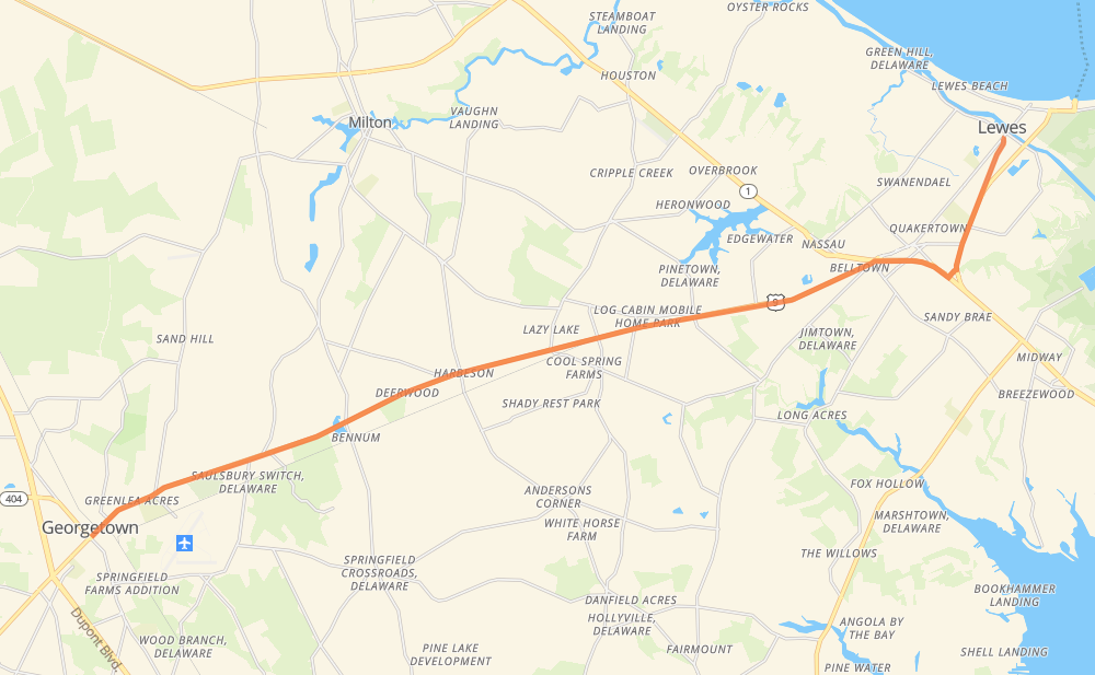
Distance between Georgetown DE and Lewes DE
The distance from Georgetown to Lewes is 16 miles by road. Road takes approximately 20 minutes and goes through Rogers Development, Briarwood Manor, Gravel Hill, Harbeson, Cool Spring, Arabian Acres and Log Cabin Mobile Home Park.
| Shortest distance by air | 14 mi ✈️ |
| Car route length | 15.5 mi 🚗 |
| Driving time | 20 min |
| Fuel amount | 0.5 gal |
| Fuel cost | 2.1 USD |
| Point | Distance | Time | Fuel | |
| Georgetown | 0 mi | 00 min | 0.0 gal | |
|
US 9 5 mi, 06 min
|
||||
| Harbeson | 5 mi | 06 min | 0.1 gal | |
|
US 9 3 mi, 03 min
|
||||
| Cool Spring | 8 mi | 10 min | 0.2 gal | |
|
US 9 3 mi, 04 min
|
||||
| Belltown | 11 mi | 14 min | 0.4 gal | |
|
US 9 1 mi, 01 min
|
||||
| Five Points | 12 mi | 15 min | 0.4 gal | |
|
US 9 3 mi, 04 min
|
||||
| Lewes | 16 mi | 20 min | 0.5 gal | |
Hotels of Lewes
Frequently Asked Questions
How much does it cost to drive from Georgetown to Lewes?
Fuel cost: 2.1 USD
This fuel cost is calculated as: (Route length 15.5 mi) / (Fuel consumption 29.4 mpg) * (Fuel price 3.9 USD / gal)
You can adjust fuel consumption and fuel price here.
How long is a car ride from Georgetown to Lewes?
Driving time: 20 min
This time is calculated for driving at the maximum permitted speed, taking into account traffic rules restrictions.
- 11 mi with a maximum speed 50 mph = 12 min
- 1 mi with a maximum speed 50 mph = 1 min
- 1 mi with a maximum speed 45 mph = 1 min
- 1 mi with a maximum speed 35 mph = 1 min
- 1 mi with a maximum speed 31 mph = 1 min
- 1 mi with a maximum speed 25 mph = 1 min
The calculated driving time does not take into account intermediate stops and traffic jams.
How far is Georgetown to Lewes by land?
The distance between Georgetown and Lewes is 15.5 mi by road.
Precise satellite coordinates of highways were used for this calculation. The start and finish points are the centers of Georgetown and Lewes respectively.
What city is halfway between Georgetown and Lewes?
Where is Georgetown in relation to Lewes?
Georgetown is located 14 mi south-west of Lewes.
Georgetown has geographic coordinates: latitude 38.6901, longitude -75.38573.
Lewes has geographic coordinates: latitude 38.77456, longitude -75.13935.
Which highway goes from Georgetown to Lewes?
The route from Georgetown to Lewes follows US 9, DE 404.
Other minor sections pass along the road:
- DE 1: 1 mi
- (268): 1 mi