Distance between Guardia Civil and Bellavista
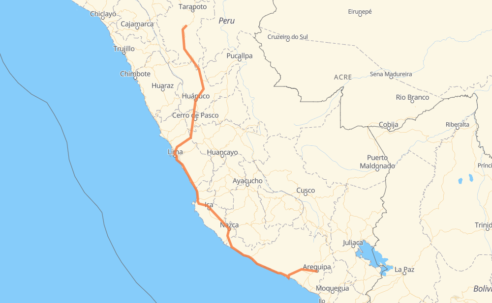
The distance from Guardia Civil to Bellavista is 1,157 miles by road including 142 miles on motorways. Road takes approximately 25 hours and 9 minutes and goes through Cerro de Pasco, Huánuco, Uchumayo, El Cruce, Vitor, Alfonso Ugarte and Ocoña.
| Shortest distance by air | 733 mi ✈️ |
| Car route length | 1,157 mi 🚗 |
| Driving time | 25 h 9 min |
| Fuel amount | 39.4 gal |
| Fuel cost | 154.7 USD |
| Point | Distance | Time | Fuel | |
| Guardia Civil | 0 mi | 00 min | 0.0 gal | |
|
PE-34C PE-34A 12 mi, 19 min
|
||||
| Uchumayo | 12 mi | 19 min | 0.4 gal | |
|
PE-34A 20 mi, 33 min
|
||||
| El Cruce | 32 mi | 52 min | 1.1 gal | |
|
PE-1S 7 mi, 09 min
|
||||
| Vitor | 39 mi | 1 h 02 min | 1.3 gal | |
|
PE-1S 205 mi, 3 h 56 min
|
||||
| Chala | 244 mi | 4 h 59 min | 8.2 gal | |
|
PE-1S 199 mi, 4 h 07 min
|
||||
| Subtanjalla | 444 mi | 9 h 06 min | 15.0 gal | |
|
PE-1S 3 mi, 04 min
|
||||
| Guadalupe | 446 mi | 9 h 11 min | 15.1 gal | |
|
PE-1S 337 mi, 7 h 22 min
|
||||
| Cerro de Pasco | 783 mi | 16 h 34 min | 26.5 gal | |
|
PE-3N 70 mi, 1 h 43 min
|
||||
| Huánuco | 853 mi | 18 h 17 min | 29.0 gal | |
|
PE-18A PE-5N 305 mi, 6 h 52 min
|
||||
| Bellavista | 1,158 mi | 25 h 09 min | 39.3 gal | |
Frequently Asked Questions
How much does it cost to drive from Guardia Civil to Bellavista?
Fuel cost: 154.7 USD
This fuel cost is calculated as: (Route length 1,157 mi) / (Fuel consumption 29.4 mpg) * (Fuel price 3.93 USD / gal)
You can adjust fuel consumption and fuel price here.
How long is a car ride from Guardia Civil to Bellavista?
Driving time: 25 h 9 min
This time is calculated for driving at the maximum permitted speed, taking into account traffic rules restrictions.
- 101 mi with a maximum speed 62 mph = 1 h 37 min
- 304 mi with a maximum speed 56 mph = 5 h 25 min
- 42 mi with a maximum speed 56 mph = 44 min
- 324 mi with a maximum speed 50 mph = 6 h 30 min
- 319 mi with a maximum speed 37 mph = 8 h 33 min
- 9 mi with a maximum speed 34 mph = 15 min
- 50 mi with a maximum speed 31 mph = 1 h 37 min
- 7 mi with a maximum speed 25 mph = 17 min
- 1 mi with a maximum speed 22 mph = 4 min
- 1 mi with a maximum speed 19 mph = 1 min
- 1 mi with a maximum speed 12 mph = 1 min
The calculated driving time does not take into account intermediate stops and traffic jams.
How far is Guardia Civil to Bellavista by land?
The distance between Guardia Civil and Bellavista is 1,157 mi by road including 141.7 mi on motorways.
Precise satellite coordinates of highways were used for this calculation. The start and finish points are the centers of Guardia Civil and Bellavista respectively.
How far is Guardia Civil to Bellavista by plane?
The shortest distance (air line, as the crow flies) between Guardia Civil and Bellavista is 732.6 mi.
This distance is calculated using the Haversine formula as a great-circle distance between two points on the surface of a sphere. The start and finish points are the centers of Guardia Civil and Bellavista respectively. Actual distance between airports may be different.
How many hours is Guardia Civil from Bellavista by plane?
Boeing 737 airliner needs 1 h 28 min to cover the distance of 733 mi at a cruising speed of 497 mph.
Small plane "Cessna 172" needs 5 h 21 min to flight this distance at average speed of 136 mph.
This time is approximate and do not take into account takeoff and landing times, airport location and other real world factors.
How long is a helicopter ride from Guardia Civil to Bellavista?
Fast helicopter "Eurocopter AS350" or "Hughes OH-6 Cayuse" need 4 h 54 min to cover the distance of 733 mi at a cruising speed of 149 mph.
Popular "Robinson R44" needs 5 h 36 min to flight this distance at average speed of 130 mph.
This time is approximate and do not take into account takeoff and landing times, aerodrome location and other real world factors.
What city is halfway between Guardia Civil and Bellavista?
The halfway point between Guardia Civil and Bellavista is Las Salinas. It is located about 1 mi from the exact midpoint by road.
The distance from Las Salinas to Guardia Civil is 580 mi and driving will take about 11 h 37 min. The road between Las Salinas and Bellavista has length 577 mi and will take approximately 13 h 32 min.
The other cities located close to halfway point:
Where is Guardia Civil in relation to Bellavista?
Guardia Civil is located 733 mi south-east of Bellavista.
Guardia Civil has geographic coordinates: latitude -16.42331, longitude -71.5124.
Bellavista has geographic coordinates: latitude -7.05544, longitude -76.58819.
Which highway goes from Guardia Civil to Bellavista?
The route from Guardia Civil to Bellavista follows PE-1S, PE-5N, PE-20A, PE-18A, PE-3N.
Other minor sections pass along the road:
- PE-1SE: 22 mi
- PE-34A: 22 mi
- PE-34C: 6 mi
- SM-839: 4 mi
- PE-1N: 4 mi
- LA: 2 mi
- PE-1SB: 1 mi