Distance between Guelatao de Juárez and Mexico
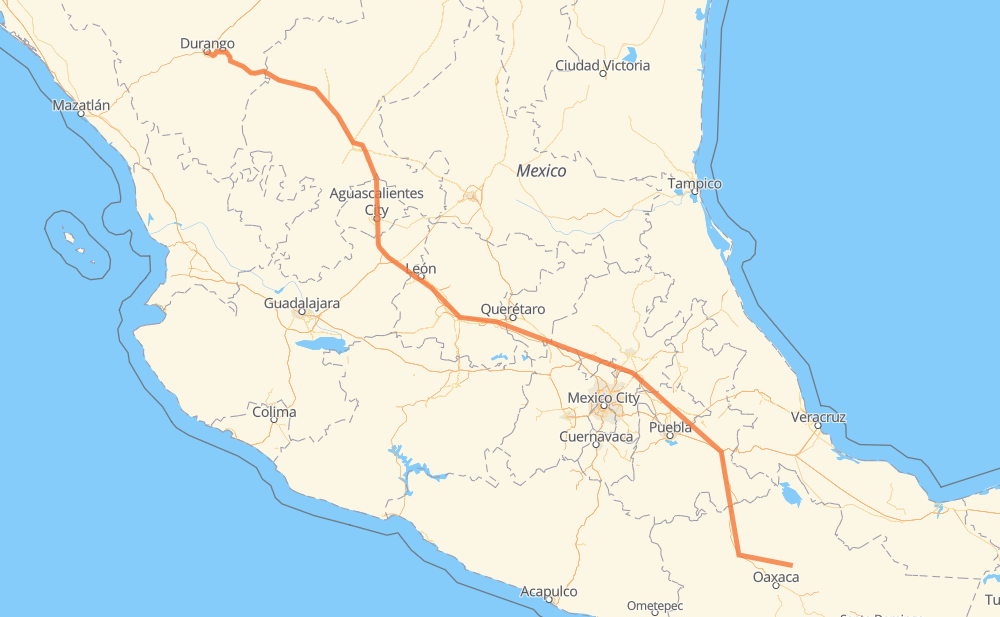
The distance from Guelatao de Juárez to Mexico is 874 miles by road including 585 miles on motorways. Road takes approximately 15 hours and 6 minutes and goes through Oaxaca, Celaya, Salamanca, Aguascalientes and Fresnillo.
| Shortest distance by air | 701 mi ✈️ |
| Car route length | 873.6 mi 🚗 |
| Driving time | 15 h 6 min |
| Fuel amount | 29.7 gal |
| Fuel cost | 116.8 USD |
| Toll roads cost | 1,036 + ? MXN |
| Point | Distance | Time | Fuel | |
| Guelatao de Juárez | 0 mi | 00 min | 0.0 gal | |
|
MEX 175 37 mi, 47 min
|
||||
| Oaxaca | 37 mi | 47 min | 1.2 gal | |
|
MEX 190 MEX 135D 118 mi, 2 h 00 min
|
||||
| San Gabriel Chilac | 156 mi | 2 h 47 min | 5.0 gal | |
|
MEX 135D 24 mi, 26 min
|
||||
| Santiago Miahuatlán | 179 mi | 3 h 14 min | 5.9 gal | |
|
MEX 135D 9 mi, 11 min
|
||||
| San José Ixtapa | 188 mi | 3 h 25 min | 6.3 gal | |
|
MEX 135D MEX M40D 285 mi, 4 h 43 min
|
||||
| Celaya | 473 mi | 8 h 08 min | 16.1 gal | |
|
MEX 45D 21 mi, 20 min
|
||||
| Salamanca | 495 mi | 8 h 29 min | 16.8 gal | |
|
MEX 45D 129 mi, 2 h 03 min
|
||||
| Aguascalientes | 624 mi | 10 h 33 min | 21.1 gal | |
|
MEX 45 MEX 45D 107 mi, 1 h 56 min
|
||||
| Fresnillo | 731 mi | 12 h 29 min | 24.6 gal | |
|
MEX 45D MEX 45 145 mi, 2 h 36 min
|
||||
| Mexico | 876 mi | 15 h 06 min | 29.8 gal | |
Frequently Asked Questions
How many toll booths are there from Guelatao de Juárez to Mexico?
There are 20 toll booths between Guelatao de Juárez and Mexico: Morfín Chávez, Calera, Veta Grande, Zacatecas, Encarnacion De Diaz, León - Aguascalientes, Puerto Interior, Mendoza, Cerro Gordo, Apaseo el Grande, Queretaro, Palmillas, San Martin Texmelucan, San Martín, Amozoc 2, Amozoc, Tehuacán, Miahuatlán, Suchixtlahuaca and Huitzo.
How much does the toll booths cost from Guelatao de Juárez to Mexico?
Toll roads cost: Huitzo (90 MXN) + Suchixtlahuaca (77 MXN) + Miahuatlán (32 MXN) + Tehuacán (45 MXN) + Amozoc (72 MXN) + Amozoc 2 (81 MXN) + San Martín (42 MXN) + San Martin Texmelucan (?) + Queretaro (?) + Palmillas (89 MXN) + Apaseo el Grande (?) + Cerro Gordo (?) + Mendoza (53 MXN) + Puerto Interior (?) + León - Aguascalientes (153 MXN) + Encarnacion De Diaz (150 MXN) + Zacatecas (41 MXN) + Veta Grande (48 MXN) + Calera (23 MXN) + Morfín Chávez (40 MXN) = 1,036 + ? MXN
How much does it cost to drive from Guelatao de Juárez to Mexico?
Fuel cost: 116.8 USD
This fuel cost is calculated as: (Route length 873.6 mi) / (Fuel consumption 29.4 mpg) * (Fuel price 3.93 USD / gal)
You can adjust fuel consumption and fuel price here.
Toll roads cost: 1,036 + ? MXN
How long is a car ride from Guelatao de Juárez to Mexico?
Driving time: 15 h 6 min
This time is calculated for driving at the maximum permitted speed, taking into account traffic rules restrictions.
- 203 mi with a maximum speed 68 mph = 2 h 58 min
- 268 mi with a maximum speed 62 mph = 4 h 19 min
- 129 mi with a maximum speed 56 mph = 2 h 18 min
- 106 mi with a maximum speed 56 mph = 1 h 53 min
- 147 mi with a maximum speed 50 mph = 2 h 58 min
- 6 mi with a maximum speed 43 mph = 8 min
- 12 mi with a maximum speed 37 mph = 20 min
- 1 mi with a maximum speed 31 mph = 1 min
- 3 mi with a maximum speed 25 mph = 7 min
- 1 mi with a maximum speed 19 mph = 1 min
The calculated driving time does not take into account intermediate stops and traffic jams.
How far is Guelatao de Juárez to Mexico by land?
The distance between Guelatao de Juárez and Mexico is 873.6 mi by road including 585.3 mi on motorways.
Precise satellite coordinates of highways were used for this calculation. The start and finish points are the centers of Guelatao de Juárez and Mexico respectively.
How far is Guelatao de Juárez to Mexico by plane?
The shortest distance (air line, as the crow flies) between Guelatao de Juárez and Mexico is 700.9 mi.
This distance is calculated using the Haversine formula as a great-circle distance between two points on the surface of a sphere. The start and finish points are the centers of Guelatao de Juárez and Mexico respectively. Actual distance between airports may be different.
How many hours is Guelatao de Juárez from Mexico by plane?
Boeing 737 airliner needs 1 h 24 min to cover the distance of 701 mi at a cruising speed of 497 mph.
Small plane "Cessna 172" needs 5 h 7 min to flight this distance at average speed of 136 mph.
This time is approximate and do not take into account takeoff and landing times, airport location and other real world factors.
How long is a helicopter ride from Guelatao de Juárez to Mexico?
Fast helicopter "Eurocopter AS350" or "Hughes OH-6 Cayuse" need 4 h 42 min to cover the distance of 701 mi at a cruising speed of 149 mph.
Popular "Robinson R44" needs 5 h 22 min to flight this distance at average speed of 130 mph.
This time is approximate and do not take into account takeoff and landing times, aerodrome location and other real world factors.
What city is halfway between Guelatao de Juárez and Mexico?
The halfway point between Guelatao de Juárez and Mexico is El Jaral. It is located about 9 mi from the exact midpoint by road.
The distance from El Jaral to Guelatao de Juárez is 446 mi and driving will take about 7 h 44 min. The road between El Jaral and Mexico has length 428 mi and will take approximately 7 h 22 min.
The other cities located close to halfway point:
Where is Guelatao de Juárez in relation to Mexico?
Guelatao de Juárez is located 701 mi south-east of Mexico.
Guelatao de Juárez has geographic coordinates: latitude 17.31806, longitude -96.49306.
Mexico has geographic coordinates: latitude 23.99039, longitude -104.6575.
Which highway goes from Guelatao de Juárez to Mexico?
The route from Guelatao de Juárez to Mexico follows MEX 45, MEX 45D, MEX 135D, MEX M40D, MEX 150D.
Other minor sections pass along the road:
- MEX 47D: 52 mi
- MEX 43D: 48 mi
- MEX 57D: 35 mi
- MEX 175: 34 mi
- MEX 70: 31 mi
- MEX 190: 10 mi
- MEX 23: 5 mi
- DGO 45: 5 mi
- MEX 140D: 1 mi