Distance between Hanceville BC and Wiarton ON
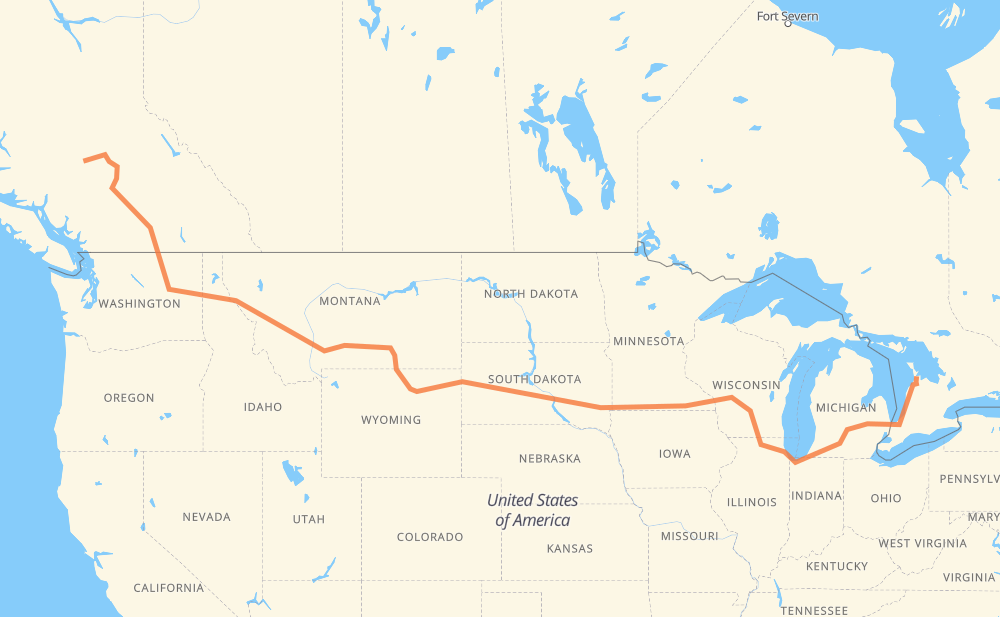
The distance from Hanceville to Wiarton is 2,921 miles by road including 2,282 miles on motorways. Road takes approximately 46 hours and 46 minutes and goes through Williams Lake, Merritt, Penticton, Omak, Spokane, Coeur d'Alene and Missoula.
| Shortest distance by air | 1,959 mi ✈️ |
| Car route length | 2,921.1 mi 🚗 |
| Driving time | 46 h 46 min |
| Fuel amount | 99.4 gal |
| Fuel cost | 390.5 USD |
| Point | Distance | Time | Fuel | |
| Hanceville | 0 mi | 00 min | 0.0 gal | |
|
20 57 mi, 1 h 09 min
|
||||
| Williams Lake | 57 mi | 1 h 09 min | 1.7 gal | |
|
20 97 221 mi, 3 h 56 min
|
||||
| Merritt | 279 mi | 5 h 05 min | 9.2 gal | |
|
97C 92 mi, 1 h 31 min
|
||||
| Penticton | 371 mi | 6 h 37 min | 12.5 gal | |
|
97 US 97 81 mi, 1 h 38 min
|
||||
| Omak | 452 mi | 8 h 15 min | 15.2 gal | |
|
US 97 US 2 140 mi, 2 h 39 min
|
||||
| Spokane | 592 mi | 10 h 55 min | 20.0 gal | |
|
US 2 I 90 34 mi, 31 min
|
||||
| Coeur d'Alene | 626 mi | 11 h 26 min | 21.2 gal | |
|
I 90 165 mi, 2 h 27 min
|
||||
| Missoula | 790 mi | 13 h 54 min | 26.8 gal | |
|
I 90 114 mi, 1 h 40 min
|
||||
| Butte | 905 mi | 15 h 35 min | 30.3 gal | |
|
I 90 226 mi, 3 h 24 min
|
||||
| Billings | 1,131 mi | 19 h 00 min | 38.3 gal | |
|
I 90 134 mi, 2 h 16 min
|
||||
| Sheridan | 1,265 mi | 21 h 16 min | 42.8 gal | |
|
I 90 99 mi, 1 h 27 min
|
||||
| Gillette | 1,365 mi | 22 h 44 min | 46.3 gal | |
|
I 90 97 mi, 1 h 29 min
|
||||
| Spearfish | 1,461 mi | 24 h 14 min | 49.5 gal | |
|
I 90 42 mi, 37 min
|
||||
| Rapid City | 1,504 mi | 24 h 51 min | 51.1 gal | |
|
I 90 11 mi, 10 min
|
||||
| Box Elder | 1,515 mi | 25 h 01 min | 51.3 gal | |
|
I 90 255 mi, 3 h 45 min
|
||||
| Mitchell | 1,770 mi | 28 h 47 min | 59.9 gal | |
|
I 90 72 mi, 1 h 03 min
|
||||
| Sioux Falls | 1,843 mi | 29 h 51 min | 62.6 gal | |
|
I 90 7 mi, 06 min
|
||||
| Brandon | 1,850 mi | 29 h 57 min | 62.8 gal | |
|
I 90 420 mi, 6 h 13 min
|
||||
| Madison | 2,270 mi | 36 h 10 min | 77.0 gal | |
|
I 39 35 mi, 30 min
|
||||
| Janesville | 2,305 mi | 36 h 41 min | 78.3 gal | |
|
I 39 I 90 107 mi, 1 h 39 min
|
||||
| Chicago | 2,412 mi | 38 h 21 min | 81.5 gal | |
|
I 90 I 94 144 mi, 2 h 12 min
|
||||
| Kalamazoo | 2,556 mi | 40 h 34 min | 86.9 gal | |
|
I 94 I 69 65 mi, 56 min
|
||||
| Lansing | 2,620 mi | 41 h 31 min | 89.1 gal | |
|
I 69 62 mi, 54 min
|
||||
| Flint | 2,682 mi | 42 h 25 min | 91.1 gal | |
|
I 69 76 mi, 1 h 14 min
|
||||
| Sarnia | 2,758 mi | 43 h 40 min | 93.6 gal | |
|
402 21 163 mi, 3 h 05 min
|
||||
| Wiarton | 2,921 mi | 46 h 45 min | 99.3 gal | |
Frequently Asked Questions
How much does it cost to drive from Hanceville to Wiarton?
Fuel cost: 390.5 USD
This fuel cost is calculated as: (Route length 2,921.1 mi) / (Fuel consumption 29.4 mpg) * (Fuel price 3.93 USD / gal)
You can adjust fuel consumption and fuel price here.
How long is a car ride from Hanceville to Wiarton?
Driving time: 46 h 46 min
This time is calculated for driving at the maximum permitted speed, taking into account traffic rules restrictions.
- 1,873 mi with a maximum speed 68 mph = 27 h 32 min
- 76 mi with a maximum speed 65 mph = 1 h 9 min
- 198 mi with a maximum speed 62 mph = 3 h 11 min
- 42 mi with a maximum speed 60 mph = 42 min
- 434 mi with a maximum speed 56 mph = 7 h 45 min
- 6 mi with a maximum speed 56 mph = 6 min
- 24 mi with a maximum speed 55 mph = 26 min
- 3 mi with a maximum speed 50 mph = 3 min
- 208 mi with a maximum speed 50 mph = 4 h 11 min
- 11 mi with a maximum speed 45 mph = 13 min
- 8 mi with a maximum speed 43 mph = 11 min
- 4 mi with a maximum speed 37 mph = 6 min
- 7 mi with a maximum speed 35 mph = 12 min
- 16 mi with a maximum speed 31 mph = 29 min
- 6 mi with a maximum speed 30 mph = 10 min
- 2 mi with a maximum speed 25 mph = 6 min
- 2 mi with a maximum speed 25 mph = 4 min
The calculated driving time does not take into account intermediate stops and traffic jams.
How far is Hanceville to Wiarton by land?
The distance between Hanceville and Wiarton is 2,921.1 mi by road including 2,282.3 mi on motorways.
Precise satellite coordinates of highways were used for this calculation. The start and finish points are the centers of Hanceville and Wiarton respectively.
How far is Hanceville to Wiarton by plane?
The shortest distance (air line, as the crow flies) between Hanceville and Wiarton is 1,958.6 mi.
This distance is calculated using the Haversine formula as a great-circle distance between two points on the surface of a sphere. The start and finish points are the centers of Hanceville and Wiarton respectively. Actual distance between airports may be different.
How many hours is Hanceville from Wiarton by plane?
Boeing 737 airliner needs 3 h 56 min to cover the distance of 1,959 mi at a cruising speed of 497 mph.
Small plane "Cessna 172" needs 14 h 19 min to flight this distance at average speed of 136 mph.
This time is approximate and do not take into account takeoff and landing times, airport location and other real world factors.
How long is a helicopter ride from Hanceville to Wiarton?
Fast helicopter "Eurocopter AS350" or "Hughes OH-6 Cayuse" need 13 h 8 min to cover the distance of 1,959 mi at a cruising speed of 149 mph.
Popular "Robinson R44" needs 15 h to flight this distance at average speed of 130 mph.
This time is approximate and do not take into account takeoff and landing times, aerodrome location and other real world factors.
What city is halfway between Hanceville and Wiarton?
The halfway point between Hanceville and Wiarton is Spearfish. It is located about 1 mi from the exact midpoint by road.
The distance from Spearfish to Hanceville is 1,461 mi and driving will take about 24 h 11 min. The road between Spearfish and Wiarton has length 1,460 mi and will take approximately 22 h 34 min.
The other cities located close to halfway point:
Where is Hanceville in relation to Wiarton?
Hanceville is located 1,959 mi west of Wiarton.
Hanceville has geographic coordinates: latitude 51.91667, longitude -123.03333.
Wiarton has geographic coordinates: latitude 44.74074, longitude -81.13324.
Which highway goes from Hanceville to Wiarton?
The route from Hanceville to Wiarton follows I 90, I 94, 97, US 14, I 69, US 87, I 39, US 212, US 12, US 2, 97C, 21.
Other minor sections pass along the road:
- US 191: 57 mi
- 20: 56 mi
- WA 155: 54 mi
- 5: 47 mi
- US 97: 45 mi
- 1: 44 mi
- CR 1: 42 mi
- SD 79: 31 mi
- US 16: 25 mi
- WA 20: 24 mi
- 402: 21 mi
- US 51: 20 mi
- US 83: 19 mi
- WA 174: 19 mi
- 5A: 15 mi
- MT 200: 13 mi
- CR 3: 9 mi
- CR 17: 9 mi
- I 15: 7 mi
- 6: 7 mi
- US 85: 7 mi
- US 89: 7 mi
- SD 63: 7 mi
- CR 10: 6 mi
- SD 73: 6 mi
- SD 50: 6 mi
- SD 34: 6 mi
- US 93: 5 mi
- SD 45: 4 mi
- US 61: 4 mi
- I 96: 4 mi
- US 16 Truck: 4 mi
- 25: 4 mi
- US 31: 3 mi
- WA 231: 3 mi
- US 395: 2 mi
- MN 43: 2 mi
- US 218: 2 mi
- WI 11: 2 mi
- SD 37: 1 mi
- US 53: 1 mi