Distance between Iguala and Huaniqueo de Morales
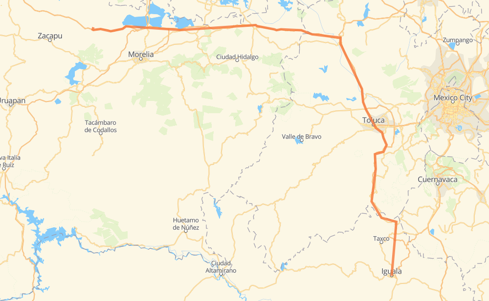
The distance from Iguala to Huaniqueo de Morales is 256 miles by road including 165 miles on motorways. Road takes approximately 4 hours and 37 minutes and goes through Toluca, Taxco, Ixtapan de la Sal, Tenango de Arista, Santa Maria Rayon, San Andres Ocotlan and Metepec.
| Shortest distance by air | 168 mi ✈️ |
| Car route length | 256 mi 🚗 |
| Driving time | 4 h 37 min |
| Fuel amount | 8.7 gal |
| Fuel cost | 34.2 USD |
| Toll roads cost | 309 + ? MXN |
| Point | Distance | Time | Fuel | |
| Iguala | 0 mi | 00 min | 0.0 gal | |
|
MEX 95 23 mi, 28 min
|
||||
| Taxco | 23 mi | 28 min | 0.6 gal | |
|
MEX 95 MEX 55 39 mi, 46 min
|
||||
| Ixtapan de la Sal | 62 mi | 1 h 14 min | 2.1 gal | |
|
25 mi, 25 min
|
||||
| Tenango de Arista | 87 mi | 1 h 40 min | 2.9 gal | |
|
MEX 55 2 mi, 02 min
|
||||
| Santa Maria Rayon | 89 mi | 1 h 43 min | 3.0 gal | |
|
MEX 55 4 mi, 04 min
|
||||
| San Andres Ocotlan | 93 mi | 1 h 47 min | 3.1 gal | |
|
5 mi, 05 min
|
||||
| Metepec | 98 mi | 1 h 53 min | 3.3 gal | |
|
Vialidad Metepec 4 mi, 04 min
|
||||
| Toluca | 102 mi | 1 h 58 min | 3.4 gal | |
|
MEX 55 MEX 55D 21 mi, 22 min
|
||||
| Ixtlahuaca | 123 mi | 2 h 20 min | 4.1 gal | |
|
MEX 55D MEX 15D 133 mi, 2 h 16 min
|
||||
| Huaniqueo de Morales | 256 mi | 4 h 37 min | 8.6 gal | |
Frequently Asked Questions
How many toll booths are there from Iguala to Huaniqueo de Morales?
There are 10 toll booths between Iguala and Huaniqueo de Morales: Zinapecuaro, Contepec, Huaniqueo, Taxco, La Finca, Villa Guerrero, Tenango, El Dorado, Atlacomulco — Maravatio and Atlacomulco.
How much does the toll booths cost from Iguala to Huaniqueo de Morales?
Toll roads cost: Taxco (16 MXN) + La Finca (?) + Villa Guerrero (?) + Tenango (?) + El Dorado (?) + Atlacomulco (?) + Atlacomulco — Maravatio (50 MXN) + Contepec (?) + Zinapecuaro (161 MXN) + Huaniqueo (82 MXN) = 309 + ? MXN
How much does it cost to drive from Iguala to Huaniqueo de Morales?
Fuel cost: 34.2 USD
This fuel cost is calculated as: (Route length 256 mi) / (Fuel consumption 29.4 mpg) * (Fuel price 3.93 USD / gal)
You can adjust fuel consumption and fuel price here.
Toll roads cost: 309 + ? MXN
How long is a car ride from Iguala to Huaniqueo de Morales?
Driving time: 4 h 37 min
This time is calculated for driving at the maximum permitted speed, taking into account traffic rules restrictions.
- 23 mi with a maximum speed 68 mph = 20 min
- 93 mi with a maximum speed 62 mph = 1 h 29 min
- 10 mi with a maximum speed 56 mph = 10 min
- 27 mi with a maximum speed 56 mph = 29 min
- 96 mi with a maximum speed 50 mph = 1 h 55 min
- 6 mi with a maximum speed 37 mph = 9 min
- 1 mi with a maximum speed 31 mph = 2 min
The calculated driving time does not take into account intermediate stops and traffic jams.
How far is Iguala to Huaniqueo de Morales by land?
The distance between Iguala and Huaniqueo de Morales is 256 mi by road including 164.7 mi on motorways.
Precise satellite coordinates of highways were used for this calculation. The start and finish points are the centers of Iguala and Huaniqueo de Morales respectively.
How far is Iguala to Huaniqueo de Morales by plane?
The shortest distance (air line, as the crow flies) between Iguala and Huaniqueo de Morales is 167.8 mi.
This distance is calculated using the Haversine formula as a great-circle distance between two points on the surface of a sphere. The start and finish points are the centers of Iguala and Huaniqueo de Morales respectively. Actual distance between airports may be different.
How many hours is Iguala from Huaniqueo de Morales by plane?
Boeing 737 airliner needs 20 min to cover the distance of 168 mi at a cruising speed of 497 mph.
Small plane "Cessna 172" needs 1 h 13 min to flight this distance at average speed of 136 mph.
This time is approximate and do not take into account takeoff and landing times, airport location and other real world factors.
How long is a helicopter ride from Iguala to Huaniqueo de Morales?
Fast helicopter "Eurocopter AS350" or "Hughes OH-6 Cayuse" need 1 h 7 min to cover the distance of 168 mi at a cruising speed of 149 mph.
Popular "Robinson R44" needs 1 h 17 min to flight this distance at average speed of 130 mph.
This time is approximate and do not take into account takeoff and landing times, aerodrome location and other real world factors.
What city is halfway between Iguala and Huaniqueo de Morales?
The halfway point between Iguala and Huaniqueo de Morales is Ixtlahuaca. It is located about 5 mi from the exact midpoint by road.
The distance from Ixtlahuaca to Iguala is 123 mi and driving will take about 2 h 20 min. The road between Ixtlahuaca and Huaniqueo de Morales has length 133 mi and will take approximately 2 h 16 min.
The other cities located close to halfway point:
Where is Iguala in relation to Huaniqueo de Morales?
Iguala is located 168 mi south-east of Huaniqueo de Morales.
Iguala has geographic coordinates: latitude 18.3438, longitude -99.53722.
Huaniqueo de Morales has geographic coordinates: latitude 19.89792, longitude -101.50611.
Which highway goes from Iguala to Huaniqueo de Morales?
The route from Iguala to Huaniqueo de Morales follows MEX 15D.
Other minor sections pass along the road:
- MEX 55: 33 mi
- MEX 55D: 29 mi
- MEX 95: 29 mi
- MEX 092D: 5 mi
- Vialidad Metepec: 2 mi
- MICH 24: 1 mi