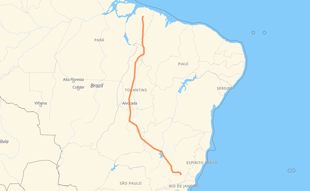
Distance between Irituia and Visconde do Rio Branco
The distance from Irituia to Visconde do Rio Branco is 1,729 miles by road including 89 miles on motorways. Road takes approximately 32 hours and 32 minutes and goes through Açailândia, Ceilândia, Recanto das Emas, Valparaíso de Goiás, Ribeirão das Neves and Conselheiro Lafaiete.
| Shortest distance by air | 1,365 mi ✈️ |
| Car route length | 1,729.3 mi 🚗 |
| Driving time | 32 h 32 min |
| Fuel amount | 58.8 gal |
| Fuel cost | 229.4 USD |
| Point | Distance | Time | Fuel | |
| -1.77095, -47.43997 | 0 mi | 00 min | 0.0 gal | |
|
BR-010 238 mi, 4 h 37 min
|
||||
| Açailândia | 238 mi | 4 h 37 min | 15.7 gal | |
|
BR-010 113 mi, 2 h 08 min
|
||||
| Estreito | 351 mi | 6 h 45 min | 19.7 gal | |
|
BR-226 BR-153 298 mi, 5 h 24 min
|
||||
| Serrano II | 650 mi | 12 h 10 min | 29.9 gal | |
|
BR-153 11 mi, 12 min
|
||||
| Santana | 661 mi | 12 h 22 min | 30.1 gal | |
|
BR-153 454 mi, 8 h 23 min
|
||||
| Ceilândia | 1,114 mi | 20 h 46 min | 45.7 gal | |
|
BR-060 11 mi, 15 min
|
||||
| Recanto das Emas | 1,125 mi | 21 h 01 min | 46.0 gal | |
|
DF-001 BR-040 17 mi, 25 min
|
||||
| Valparaíso de Goiás | 1,142 mi | 21 h 26 min | 46.4 gal | |
|
BR-040 410 mi, 7 h 23 min
|
||||
| Ribeirão das Neves | 1,552 mi | 28 h 50 min | 60.6 gal | |
|
BR-040 80 mi, 1 h 33 min
|
||||
| Conselheiro Lafaiete | 1,632 mi | 30 h 23 min | 63.0 gal | |
|
BR-482 101 mi, 2 h 08 min
|
||||
| Visconde do Rio Branco | 1,732 mi | 32 h 32 min | 66.6 gal | |
Frequently Asked Questions
How much does it cost to drive from Irituia to Visconde do Rio Branco?
Fuel cost: 229.4 USD
This fuel cost is calculated as: (Route length 1,729.3 mi) / (Fuel consumption 29.4 mpg) * (Fuel price 3.9 USD / gal)
You can adjust fuel consumption and fuel price here.
How long is a car ride from Irituia to Visconde do Rio Branco?
Driving time: 32 h 32 min
This time is calculated for driving at the maximum permitted speed, taking into account traffic rules restrictions.
- 58 mi with a maximum speed 68 mph = 51 min
- 1 mi with a maximum speed 62 mph = 1 min
- 1,156 mi with a maximum speed 56 mph = 20 h 38 min
- 4 mi with a maximum speed 56 mph = 3 min
- 431 mi with a maximum speed 50 mph = 8 h 40 min
- 17 mi with a maximum speed 43 mph = 23 min
- 50 mi with a maximum speed 37 mph = 1 h 21 min
- 8 mi with a maximum speed 31 mph = 15 min
- 4 mi with a maximum speed 25 mph = 9 min
- 2 mi with a maximum speed 19 mph = 6 min
The calculated driving time does not take into account intermediate stops and traffic jams.
How far is Irituia to Visconde do Rio Branco by land?
The distance between Irituia and Visconde do Rio Branco is 1,729.3 mi by road including 88.9 mi on motorways.
Precise satellite coordinates of highways were used for this calculation. The start and finish points are the centers of Irituia and Visconde do Rio Branco respectively.
How far is Irituia to Visconde do Rio Branco by plane?
The shortest distance (air line, as the crow flies) between Irituia and Visconde do Rio Branco is 1,365.2 mi.
This distance is calculated using the Haversine formula as a great-circle distance between two points on the surface of a sphere. The start and finish points are the centers of Irituia and Visconde do Rio Branco respectively. Actual distance between airports may be different.
How many hours is Irituia from Visconde do Rio Branco by plane?
Boeing 737 airliner needs 2 h 44 min to cover the distance of 1,365 mi at a cruising speed of 497 mph.
Small plane "Cessna 172" needs 9 h 59 min to flight this distance at average speed of 136 mph.
This time is approximate and do not take into account takeoff and landing times, airport location and other real world factors.
How long is a helicopter ride from Irituia to Visconde do Rio Branco?
Fast helicopter "Eurocopter AS350" or "Hughes OH-6 Cayuse" need 9 h 9 min to cover the distance of 1,365 mi at a cruising speed of 149 mph.
Popular "Robinson R44" needs 10 h 27 min to flight this distance at average speed of 130 mph.
This time is approximate and do not take into account takeoff and landing times, aerodrome location and other real world factors.
What city is halfway between Irituia and Visconde do Rio Branco?
The halfway point between Irituia and Visconde do Rio Branco is Cajueiro. It is located about 5 mi from the exact midpoint by road.
The distance from Cajueiro to Irituia is 859 mi and driving will take about 15 h 57 min. The road between Cajueiro and Visconde do Rio Branco has length 870 mi and will take approximately 16 h 35 min.
The other cities located close to halfway point:
Where is Irituia in relation to Visconde do Rio Branco?
Irituia is located 1,365 mi north of Visconde do Rio Branco.
Irituia has geographic coordinates: latitude -1.77095, longitude -47.43997.
Visconde do Rio Branco has geographic coordinates: latitude -21.01, longitude -42.84083.
Which highway goes from Irituia to Visconde do Rio Branco?
The route from Irituia to Visconde do Rio Branco follows BR-153, BR-040, BR-010, BR-080, BR-222, BR-482, MGC-482, BR-135.
Other minor sections pass along the road:
- BR-226: 62 mi
- BR-050: 53 mi
- BR-356: 42 mi
- BR-120: 24 mi
- BR-251: 22 mi
- BR-414: 22 mi
- MGC-356: 17 mi
- DF-180: 12 mi
- DF-001: 9 mi
- BR-080,GO-424: 4 mi
- DF-451: 4 mi
- DF-240: 3 mi
- PA-253: 2 mi
- GO-080: 2 mi
- BR-060: 2 mi
- DF-459: 2 mi
- BR-230: 1 mi
- DF-003: 1 mi
- BR-381: 1 mi
- BR-262: 1 mi