Distance between Jacupiranga and Sion
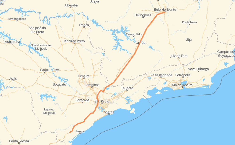
The distance from Jacupiranga to Sion is 502 miles by road including 467 miles on motorways. Road takes approximately 8 hours and 5 minutes and goes through Taboão da Serra, Barueri, Atibaia, Betim and Belo Horizonte.
| Shortest distance by air | 419 mi ✈️ |
| Car route length | 502.1 mi 🚗 |
| Driving time | 8 h 5 min |
| Fuel amount | 17.1 gal |
| Fuel cost | 67.1 USD |
| Point | Distance | Time | Fuel | |
| Jacupiranga | 0 mi | 00 min | 0.0 gal | |
|
BR-116 SP-230 97 mi, 1 h 32 min
|
||||
| Bairro do Soturno | 97 mi | 1 h 32 min | 3.2 gal | |
|
SP-230 22 mi, 21 min
|
||||
| Taboão da Serra | 119 mi | 1 h 53 min | 4.1 gal | |
|
SP-230 SP-021 11 mi, 11 min
|
||||
| Barueri | 130 mi | 2 h 05 min | 4.4 gal | |
|
SP-021 5 mi, 04 min
|
||||
| Jaraguá | 136 mi | 2 h 10 min | 4.6 gal | |
|
SP-330 2 mi, 03 min
|
||||
| Colinas da Anhanguera | 139 mi | 2 h 13 min | 4.7 gal | |
|
SP-330 SP-354 39 mi, 43 min
|
||||
| Atibaia | 177 mi | 2 h 57 min | 5.7 gal | |
|
SP-065 BR-381 305 mi, 4 h 43 min
|
||||
| Betim | 482 mi | 7 h 40 min | 16.3 gal | |
|
BR-381 18 mi, 21 min
|
||||
| Belo Horizonte | 500 mi | 8 h 01 min | 17.0 gal | |
|
2 mi, 03 min
|
||||
| Sion | 502 mi | 8 h 05 min | 17.1 gal | |
Frequently Asked Questions
How much does it cost to drive from Jacupiranga to Sion?
Fuel cost: 67.1 USD
This fuel cost is calculated as: (Route length 502.1 mi) / (Fuel consumption 29.4 mpg) * (Fuel price 3.93 USD / gal)
You can adjust fuel consumption and fuel price here.
How long is a car ride from Jacupiranga to Sion?
Driving time: 8 h 5 min
This time is calculated for driving at the maximum permitted speed, taking into account traffic rules restrictions.
- 348 mi with a maximum speed 68 mph = 5 h 6 min
- 54 mi with a maximum speed 62 mph = 52 min
- 4 mi with a maximum speed 56 mph = 3 min
- 35 mi with a maximum speed 56 mph = 37 min
- 42 mi with a maximum speed 50 mph = 50 min
- 2 mi with a maximum speed 43 mph = 3 min
- 13 mi with a maximum speed 37 mph = 21 min
- 3 mi with a maximum speed 25 mph = 8 min
The calculated driving time does not take into account intermediate stops and traffic jams.
How far is Jacupiranga to Sion by land?
The distance between Jacupiranga and Sion is 502.1 mi by road including 466.6 mi on motorways.
Precise satellite coordinates of highways were used for this calculation. The start and finish points are the centers of Jacupiranga and Sion respectively.
How far is Jacupiranga to Sion by plane?
The shortest distance (air line, as the crow flies) between Jacupiranga and Sion is 419.4 mi.
This distance is calculated using the Haversine formula as a great-circle distance between two points on the surface of a sphere. The start and finish points are the centers of Jacupiranga and Sion respectively. Actual distance between airports may be different.
How many hours is Jacupiranga from Sion by plane?
Boeing 737 airliner needs 50 min to cover the distance of 419 mi at a cruising speed of 497 mph.
Small plane "Cessna 172" needs 3 h 4 min to flight this distance at average speed of 136 mph.
This time is approximate and do not take into account takeoff and landing times, airport location and other real world factors.
How long is a helicopter ride from Jacupiranga to Sion?
Fast helicopter "Eurocopter AS350" or "Hughes OH-6 Cayuse" need 2 h 48 min to cover the distance of 419 mi at a cruising speed of 149 mph.
Popular "Robinson R44" needs 3 h 12 min to flight this distance at average speed of 130 mph.
This time is approximate and do not take into account takeoff and landing times, aerodrome location and other real world factors.
What city is halfway between Jacupiranga and Sion?
The halfway point between Jacupiranga and Sion is Estiva. It is located about 6 mi from the exact midpoint by road.
The distance from Estiva to Jacupiranga is 245 mi and driving will take about 4 h. The road between Estiva and Sion has length 257 mi and will take approximately 4 h 4 min.
The other cities located close to halfway point:
Where is Jacupiranga in relation to Sion?
Jacupiranga is located 419 mi south-west of Sion.
Jacupiranga has geographic coordinates: latitude -24.70377, longitude -48.00606.
Sion has geographic coordinates: latitude -19.94936, longitude -43.93259.
Which highway goes from Jacupiranga to Sion?
The route from Jacupiranga to Sion follows BR-381, SP-230, BR-116.
Other minor sections pass along the road:
- BR-478: 30 mi
- SP-354: 24 mi
- SP-010: 22 mi
- BR-262: 14 mi
- SP-021: 14 mi
- SP-330: 9 mi
- BR-050: 9 mi
- SP-065: 8 mi
- JAR-354: 6 mi
- BR-494: 1 mi