Distance between Kelowna BC and South Brook NL
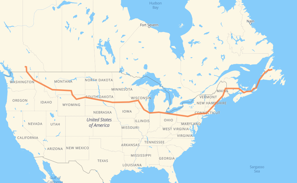
The distance from Kelowna to South Brook is 4,214 miles by road including 3,550 miles on motorways. Road takes approximately 73 hours and 12 minutes and goes through Spokane, Coeur d'Alene, Missoula, Butte, Billings, Sheridan and Gillette.
| Shortest distance by air | 2,750 mi ✈️ |
| Car route length | 4,214.1 mi 🚗 |
| Driving time | 73 h 12 min |
| Fuel amount | 143.3 gal |
| Fuel cost | 563.4 USD |
| Point | Distance | Time | Fuel | |
| Kelowna | 0 mi | 00 min | 0.0 gal | |
|
33 US 395 231 mi, 4 h 27 min
|
||||
| Spokane | 231 mi | 4 h 27 min | 7.9 gal | |
|
I 90 32 mi, 33 min
|
||||
| Coeur d'Alene | 263 mi | 5 h 01 min | 8.8 gal | |
|
I 90 165 mi, 2 h 27 min
|
||||
| Missoula | 428 mi | 7 h 29 min | 14.5 gal | |
|
I 90 114 mi, 1 h 40 min
|
||||
| Butte | 542 mi | 9 h 10 min | 17.9 gal | |
|
I 90 226 mi, 3 h 24 min
|
||||
| Billings | 768 mi | 12 h 35 min | 25.9 gal | |
|
I 90 134 mi, 2 h 16 min
|
||||
| Sheridan | 902 mi | 14 h 51 min | 30.4 gal | |
|
I 90 99 mi, 1 h 27 min
|
||||
| Gillette | 1,002 mi | 16 h 18 min | 33.9 gal | |
|
I 90 97 mi, 1 h 29 min
|
||||
| Spearfish | 1,098 mi | 17 h 48 min | 37.1 gal | |
|
I 90 42 mi, 37 min
|
||||
| Rapid City | 1,141 mi | 18 h 25 min | 38.7 gal | |
|
I 90 11 mi, 10 min
|
||||
| Box Elder | 1,152 mi | 18 h 36 min | 39.0 gal | |
|
I 90 255 mi, 3 h 45 min
|
||||
| Mitchell | 1,407 mi | 22 h 21 min | 47.6 gal | |
|
I 90 72 mi, 1 h 03 min
|
||||
| Sioux Falls | 1,479 mi | 23 h 25 min | 50.2 gal | |
|
I 90 7 mi, 06 min
|
||||
| Brandon | 1,486 mi | 23 h 31 min | 50.5 gal | |
|
I 90 420 mi, 6 h 13 min
|
||||
| Madison | 1,907 mi | 29 h 45 min | 64.7 gal | |
|
I 39 35 mi, 30 min
|
||||
| Janesville | 1,941 mi | 30 h 15 min | 65.9 gal | |
|
I 39 I 90 107 mi, 1 h 39 min
|
||||
| Chicago | 2,049 mi | 31 h 55 min | 69.2 gal | |
|
I 90 86 mi, 1 h 23 min
|
||||
| South Bend | 2,136 mi | 33 h 19 min | 72.5 gal | |
|
I 80 229 mi, 3 h 22 min
|
||||
| Elyria | 2,365 mi | 36 h 41 min | 80.3 gal | |
|
I 80 384 mi, 5 h 44 min
|
||||
| Scranton | 2,749 mi | 42 h 25 min | 93.4 gal | |
|
I 81 I 84 163 mi, 2 h 34 min
|
||||
| Waterbury | 2,912 mi | 45 h 00 min | 98.9 gal | |
|
I 84 27 mi, 27 min
|
||||
| Hartford | 2,938 mi | 45 h 27 min | 99.9 gal | |
|
I 84 64 mi, 1 h 03 min
|
||||
| Worcester | 3,002 mi | 46 h 30 min | 102.0 gal | |
|
I 290 I 495 40 mi, 38 min
|
||||
| Lowell | 3,043 mi | 47 h 09 min | 103.5 gal | |
|
I 495 I 95 96 mi, 1 h 30 min
|
||||
| Portland | 3,139 mi | 48 h 39 min | 106.7 gal | |
|
I 295 55 mi, 52 min
|
||||
| Augusta | 3,193 mi | 49 h 32 min | 108.5 gal | |
|
I 95 13 mi, 11 min
|
||||
| Waterville | 3,206 mi | 49 h 43 min | 108.7 gal | |
|
I 95 63 mi, 55 min
|
||||
| Bangor | 3,269 mi | 50 h 39 min | 110.9 gal | |
|
I 95 189 mi, 2 h 57 min
|
||||
| Fredericton | 3,458 mi | 53 h 36 min | 117.5 gal | |
|
2 106 mi, 1 h 33 min
|
||||
| Moncton | 3,564 mi | 55 h 09 min | 121.0 gal | |
|
2 TCH 534 mi, 15 h 57 min
|
||||
| Corner Brook | 4,097 mi | 71 h 07 min | 139.0 gal | |
|
1 117 mi, 2 h 04 min
|
||||
| South Brook | 4,214 mi | 73 h 11 min | 143.2 gal | |
Frequently Asked Questions
How much does it cost to drive from Kelowna to South Brook?
Fuel cost: 563.4 USD
This fuel cost is calculated as: (Route length 4,214.1 mi) / (Fuel consumption 29.4 mpg) * (Fuel price 3.93 USD / gal)
You can adjust fuel consumption and fuel price here.
How long is a car ride from Kelowna to South Brook?
Driving time: 73 h 12 min
This time is calculated for driving at the maximum permitted speed, taking into account traffic rules restrictions.
- 2,669 mi with a maximum speed 68 mph = 39 h 14 min
- 382 mi with a maximum speed 65 mph = 5 h 52 min
- 231 mi with a maximum speed 62 mph = 3 h 42 min
- 47 mi with a maximum speed 60 mph = 46 min
- 356 mi with a maximum speed 56 mph = 6 h 21 min
- 52 mi with a maximum speed 56 mph = 55 min
- 94 mi with a maximum speed 55 mph = 1 h 43 min
- 47 mi with a maximum speed 50 mph = 55 min
- 193 mi with a maximum speed 50 mph = 3 h 52 min
- 14 mi with a maximum speed 45 mph = 17 min
- 4 mi with a maximum speed 43 mph = 6 min
- 1 mi with a maximum speed 40 mph = 1 min
- 2 mi with a maximum speed 37 mph = 3 min
- 6 mi with a maximum speed 35 mph = 10 min
- 4 mi with a maximum speed 31 mph = 8 min
- 1 mi with a maximum speed 30 mph = 2 min
- 1 mi with a maximum speed 25 mph = 2 min
- 110 mi with a maximum speed 12 mph = 8 h 52 min
The calculated driving time does not take into account intermediate stops and traffic jams.
How far is Kelowna to South Brook by land?
The distance between Kelowna and South Brook is 4,214.1 mi by road including 3,549.9 mi on motorways.
Precise satellite coordinates of highways were used for this calculation. The start and finish points are the centers of Kelowna and South Brook respectively.
How far is Kelowna to South Brook by plane?
The shortest distance (air line, as the crow flies) between Kelowna and South Brook is 2,749.6 mi.
This distance is calculated using the Haversine formula as a great-circle distance between two points on the surface of a sphere. The start and finish points are the centers of Kelowna and South Brook respectively. Actual distance between airports may be different.
How many hours is Kelowna from South Brook by plane?
Boeing 737 airliner needs 5 h 31 min to cover the distance of 2,750 mi at a cruising speed of 497 mph.
Small plane "Cessna 172" needs 20 h 6 min to flight this distance at average speed of 136 mph.
This time is approximate and do not take into account takeoff and landing times, airport location and other real world factors.
How long is a helicopter ride from Kelowna to South Brook?
Fast helicopter "Eurocopter AS350" or "Hughes OH-6 Cayuse" need 18 h 26 min to cover the distance of 2,750 mi at a cruising speed of 149 mph.
Popular "Robinson R44" needs 21 h 4 min to flight this distance at average speed of 130 mph.
This time is approximate and do not take into account takeoff and landing times, aerodrome location and other real world factors.
What city is halfway between Kelowna and South Brook?
The halfway point between Kelowna and South Brook is Hillside. It is located about 11 mi from the exact midpoint by road.
The distance from Hillside to Kelowna is 2,118 mi and driving will take about 33 h. The road between Hillside and South Brook has length 2,097 mi and will take approximately 40 h 12 min.
The other cities located close to halfway point:
Where is Kelowna in relation to South Brook?
Kelowna is located 2,750 mi west of South Brook.
Kelowna has geographic coordinates: latitude 49.88933, longitude -119.49829.
South Brook has geographic coordinates: latitude 49.42884, longitude -56.08658.
Which highway goes from Kelowna to South Brook?
The route from Kelowna to South Brook follows I 90, I 80, I 95, TCH, 1, I 84, 2, US 14, NS 104, US 87, I 94, I 39, US 395, NS 105, 33, US 212, US 12.
Other minor sections pass along the road:
- US 191: 57 mi
- I 495: 55 mi
- I 295: 53 mi
- I 81: 35 mi
- SD 79: 31 mi
- US 16: 25 mi
- US 6: 24 mi
- CR 602: 23 mi
- I 290: 20 mi
- US 51: 20 mi
- US 83: 19 mi
- US 220: 17 mi
- MT 200: 13 mi
- 3: 12 mi
- WA 20: 12 mi
- CR 501: 9 mi
- 95: 9 mi
- I 15: 7 mi
- US 85: 7 mi
- NY 52: 7 mi
- US 89: 7 mi
- 7: 7 mi
- SD 63: 7 mi
- SD 73: 6 mi
- SD 50: 6 mi
- SD 34: 6 mi
- US 395 Fut: 6 mi
- PA 309: 5 mi
- US 93: 5 mi
- CR 530: 4 mi
- SD 45: 4 mi
- US 61: 4 mi
- SR 11: 4 mi
- PA 66: 4 mi
- US 1: 4 mi
- US 16 Truck: 4 mi
- US 7: 4 mi
- I 380: 4 mi
- US 202: 3 mi
- 105: 3 mi
- US 220 Alternate: 2 mi
- NS 4: 2 mi
- 97: 2 mi
- ME 15: 2 mi
- MN 43: 2 mi
- US 218: 2 mi
- PA 28 Truck: 2 mi
- WI 11: 2 mi
- SD 37: 1 mi
- US 53: 1 mi
- 380: 1 mi