Distance between Lagoa do Bauzinho and São Francisco de Itabapoana
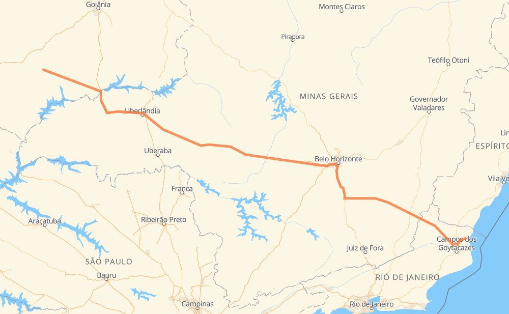
The distance from Lagoa do Bauzinho to São Francisco de Itabapoana is 818 miles by road including 173 miles on motorways. Road takes approximately 15 hours and 26 minutes and goes through Betim, Conselheiro Lafaiete, Muriaé, Centralina, Monte Alegre de Minas, Tocantins and Dona Zulmira.
| Shortest distance by air | 656 mi ✈️ |
| Car route length | 817.7 mi 🚗 |
| Driving time | 15 h 26 min |
| Fuel amount | 27.8 gal |
| Fuel cost | 109.3 USD |
| Point | Distance | Time | Fuel | |
| Lagoa do Bauzinho | 0 mi | 00 min | 0.0 gal | |
|
BR-452 107 mi, 2 h 03 min
|
||||
| Centralina | 107 mi | 2 h 03 min | 3.5 gal | |
|
BR-153 38 mi, 34 min
|
||||
| Monte Alegre de Minas | 146 mi | 2 h 37 min | 4.4 gal | |
|
BR-365 33 mi, 29 min
|
||||
| Tocantins | 178 mi | 3 h 06 min | 6.0 gal | |
|
BR-365 2 mi, 02 min
|
||||
| Dona Zulmira | 180 mi | 3 h 09 min | 6.1 gal | |
|
BR-365 BR-452 62 mi, 1 h 08 min
|
||||
| Santa Juliana | 242 mi | 4 h 17 min | 8.0 gal | |
|
BR-452 45 mi, 51 min
|
||||
| Condomínio Via Verde | 287 mi | 5 h 09 min | 9.7 gal | |
|
BR-452 BR-262 211 mi, 3 h 56 min
|
||||
| Betim | 498 mi | 9 h 05 min | 16.8 gal | |
|
BR-262 BR-040 78 mi, 1 h 29 min
|
||||
| Conselheiro Lafaiete | 577 mi | 10 h 35 min | 19.2 gal | |
|
BR-482 129 mi, 2 h 37 min
|
||||
| Muriaé | 705 mi | 13 h 12 min | 23.6 gal | |
|
BR-356 116 mi, 2 h 13 min
|
||||
| -21.47434, -41.11184 | 821 mi | 15 h 25 min | 27.9 gal | |
Frequently Asked Questions
How much does it cost to drive from Lagoa do Bauzinho to São Francisco de Itabapoana?
Fuel cost: 109.3 USD
This fuel cost is calculated as: (Route length 817.7 mi) / (Fuel consumption 29.4 mpg) * (Fuel price 3.93 USD / gal)
You can adjust fuel consumption and fuel price here.
How long is a car ride from Lagoa do Bauzinho to São Francisco de Itabapoana?
Driving time: 15 h 26 min
This time is calculated for driving at the maximum permitted speed, taking into account traffic rules restrictions.
- 140 mi with a maximum speed 68 mph = 2 h 3 min
- 11 mi with a maximum speed 62 mph = 9 min
- 292 mi with a maximum speed 56 mph = 5 h 12 min
- 332 mi with a maximum speed 50 mph = 6 h 40 min
- 6 mi with a maximum speed 43 mph = 7 min
- 35 mi with a maximum speed 37 mph = 56 min
- 1 mi with a maximum speed 31 mph = 2 min
- 2 mi with a maximum speed 25 mph = 6 min
- 2 mi with a maximum speed 19 mph = 6 min
The calculated driving time does not take into account intermediate stops and traffic jams.
How far is Lagoa do Bauzinho to São Francisco de Itabapoana by land?
The distance between Lagoa do Bauzinho and São Francisco de Itabapoana is 817.7 mi by road including 172.7 mi on motorways.
Precise satellite coordinates of highways were used for this calculation. The start and finish points are the centers of Lagoa do Bauzinho and São Francisco de Itabapoana respectively.
How far is Lagoa do Bauzinho to São Francisco de Itabapoana by plane?
The shortest distance (air line, as the crow flies) between Lagoa do Bauzinho and São Francisco de Itabapoana is 656.2 mi.
This distance is calculated using the Haversine formula as a great-circle distance between two points on the surface of a sphere. The start and finish points are the centers of Lagoa do Bauzinho and São Francisco de Itabapoana respectively. Actual distance between airports may be different.
How many hours is Lagoa do Bauzinho from São Francisco de Itabapoana by plane?
Boeing 737 airliner needs 1 h 19 min to cover the distance of 656 mi at a cruising speed of 497 mph.
Small plane "Cessna 172" needs 4 h 48 min to flight this distance at average speed of 136 mph.
This time is approximate and do not take into account takeoff and landing times, airport location and other real world factors.
How long is a helicopter ride from Lagoa do Bauzinho to São Francisco de Itabapoana?
Fast helicopter "Eurocopter AS350" or "Hughes OH-6 Cayuse" need 4 h 24 min to cover the distance of 656 mi at a cruising speed of 149 mph.
Popular "Robinson R44" needs 5 h 1 min to flight this distance at average speed of 130 mph.
This time is approximate and do not take into account takeoff and landing times, aerodrome location and other real world factors.
What city is halfway between Lagoa do Bauzinho and São Francisco de Itabapoana?
The halfway point between Lagoa do Bauzinho and São Francisco de Itabapoana is Campinho. It is located about 6 mi from the exact midpoint by road.
The distance from Campinho to Lagoa do Bauzinho is 403 mi and driving will take about 7 h 22 min. The road between Campinho and São Francisco de Itabapoana has length 415 mi and will take approximately 8 h 3 min.
The other cities located close to halfway point:
Where is Lagoa do Bauzinho in relation to São Francisco de Itabapoana?
Lagoa do Bauzinho is located 656 mi north-west of São Francisco de Itabapoana.
Lagoa do Bauzinho has geographic coordinates: latitude -17.96516, longitude -50.48677.
São Francisco de Itabapoana has geographic coordinates: latitude -21.47434, longitude -41.11184.
Which highway goes from Lagoa do Bauzinho to São Francisco de Itabapoana?
The route from Lagoa do Bauzinho to São Francisco de Itabapoana follows BR-262, BR-452, BR-356, BR-482, MGC-482.
Other minor sections pass along the road:
- BR-040: 57 mi
- BR-365: 57 mi
- BR-153: 35 mi
- RJ-224: 19 mi
- MGC-356: 17 mi
- BR-381: 14 mi
- MGT-356: 10 mi
- BR-120: 9 mi
- BR-354: 7 mi
- CA-51: 3 mi
- CAM-112: 3 mi
- BR-050: 3 mi