Distance between Laranjal Paulista and Cláudia
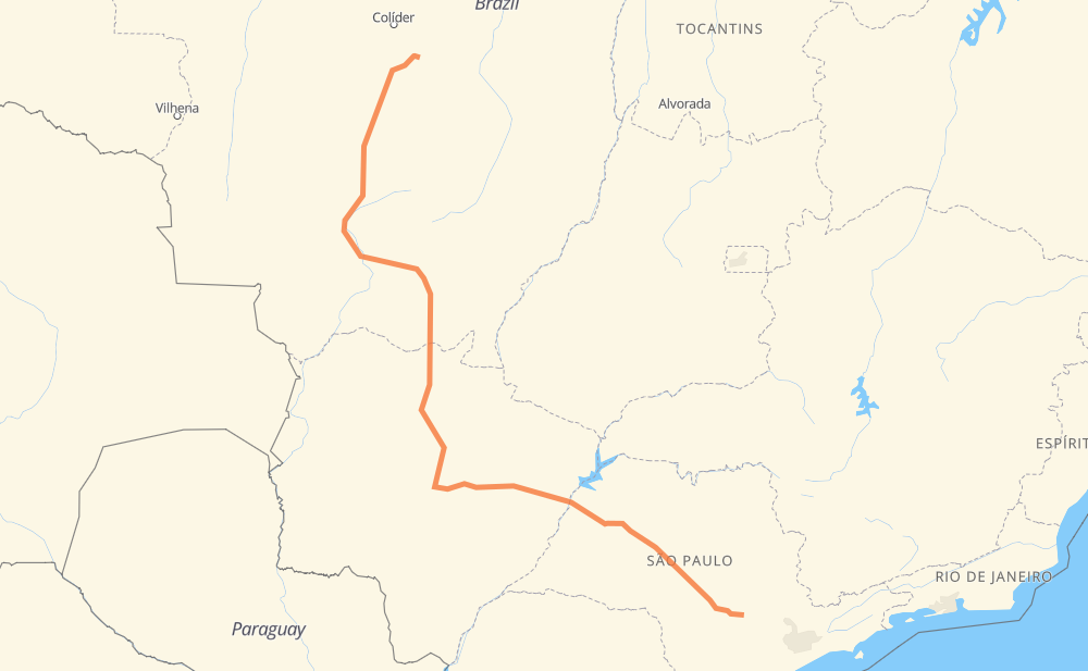
The distance from Laranjal Paulista to Cláudia is 1,313 miles by road including 334 miles on motorways. Road takes approximately 23 hours and 36 minutes and goes through Conjunto Habitacional Pedro Zanella, Distrito Industrial II, Jupiá, Terras do Golfe, Sítios Atlântico, Nova Lima and São Gabriel do Oeste.
| Shortest distance by air | 923 mi ✈️ |
| Car route length | 1,313 mi 🚗 |
| Driving time | 23 h 36 min |
| Fuel amount | 44.7 gal |
| Fuel cost | 175.5 USD |
| Point | Distance | Time | Fuel | |
| Conjunto Habitacional Pedro Zanella | 0 mi | 00 min | 0.0 gal | |
|
SP-300 81 mi, 1 h 33 min
|
||||
| Distrito Industrial II | 81 mi | 1 h 33 min | 2.6 gal | |
|
SP-300 228 mi, 3 h 32 min
|
||||
| Jupiá | 309 mi | 5 h 06 min | 10.4 gal | |
|
BR-262 189 mi, 3 h 25 min
|
||||
| Terras do Golfe | 498 mi | 8 h 32 min | 16.6 gal | |
|
BR-262 BR-163 19 mi, 21 min
|
||||
| Nova Lima | 516 mi | 8 h 53 min | 17.5 gal | |
|
BR-163 78 mi, 1 h 27 min
|
||||
| São Gabriel do Oeste | 594 mi | 10 h 21 min | 20.1 gal | |
|
BR-163 41 mi, 45 min
|
||||
| Rio Verde de Mato Grosso | 635 mi | 11 h 06 min | 21.4 gal | |
|
BR-163 42 mi, 47 min
|
||||
| Coxim | 677 mi | 11 h 54 min | 22.6 gal | |
|
BR-163 128 mi, 2 h 14 min
|
||||
| Vila Goulart | 805 mi | 14 h 09 min | 27.1 gal | |
|
BR-163 66 mi, 1 h 15 min
|
||||
| Jaciara | 871 mi | 15 h 24 min | 29.2 gal | |
|
BR-163 442 mi, 8 h 11 min
|
||||
| -11.50572, -54.87632 | 1,313 mi | 23 h 36 min | 44.7 gal | |
Frequently Asked Questions
How much does it cost to drive from Laranjal Paulista to Cláudia?
Fuel cost: 175.5 USD
This fuel cost is calculated as: (Route length 1,313 mi) / (Fuel consumption 29.4 mpg) * (Fuel price 3.93 USD / gal)
You can adjust fuel consumption and fuel price here.
How long is a car ride from Laranjal Paulista to Cláudia?
Driving time: 23 h 36 min
This time is calculated for driving at the maximum permitted speed, taking into account traffic rules restrictions.
- 209 mi with a maximum speed 68 mph = 3 h 4 min
- 81 mi with a maximum speed 62 mph = 1 h 17 min
- 703 mi with a maximum speed 56 mph = 12 h 33 min
- 21 mi with a maximum speed 56 mph = 22 min
- 278 mi with a maximum speed 50 mph = 5 h 35 min
- 9 mi with a maximum speed 37 mph = 14 min
- 2 mi with a maximum speed 31 mph = 4 min
- 10 mi with a maximum speed 25 mph = 23 min
The calculated driving time does not take into account intermediate stops and traffic jams.
How far is Laranjal Paulista to Cláudia by land?
The distance between Laranjal Paulista and Cláudia is 1,313 mi by road including 334.3 mi on motorways.
Precise satellite coordinates of highways were used for this calculation. The start and finish points are the centers of Laranjal Paulista and Cláudia respectively.
How far is Laranjal Paulista to Cláudia by plane?
The shortest distance (air line, as the crow flies) between Laranjal Paulista and Cláudia is 922.7 mi.
This distance is calculated using the Haversine formula as a great-circle distance between two points on the surface of a sphere. The start and finish points are the centers of Laranjal Paulista and Cláudia respectively. Actual distance between airports may be different.
How many hours is Laranjal Paulista from Cláudia by plane?
Boeing 737 airliner needs 1 h 51 min to cover the distance of 923 mi at a cruising speed of 497 mph.
Small plane "Cessna 172" needs 6 h 45 min to flight this distance at average speed of 136 mph.
This time is approximate and do not take into account takeoff and landing times, airport location and other real world factors.
How long is a helicopter ride from Laranjal Paulista to Cláudia?
Fast helicopter "Eurocopter AS350" or "Hughes OH-6 Cayuse" need 6 h 11 min to cover the distance of 923 mi at a cruising speed of 149 mph.
Popular "Robinson R44" needs 7 h 4 min to flight this distance at average speed of 130 mph.
This time is approximate and do not take into account takeoff and landing times, aerodrome location and other real world factors.
What city is halfway between Laranjal Paulista and Cláudia?
The halfway point between Laranjal Paulista and Cláudia is Coxim. It is located about 21 mi from the exact midpoint by road.
The distance from Coxim to Laranjal Paulista is 677 mi and driving will take about 11 h 54 min. The road between Coxim and Cláudia has length 636 mi and will take approximately 11 h 42 min.
The other cities located close to halfway point:
Where is Laranjal Paulista in relation to Cláudia?
Laranjal Paulista is located 923 mi south-east of Cláudia.
Laranjal Paulista has geographic coordinates: latitude -23.05056, longitude -47.83755.
Cláudia has geographic coordinates: latitude -11.50572, longitude -54.87632.
Which highway goes from Laranjal Paulista to Cláudia?
The route from Laranjal Paulista to Cláudia follows BR-163, SP-300, BR-262, BR-364.
Other minor sections pass along the road:
- BR-060: 56 mi
- BR-070: 54 mi
- BR-267: 30 mi
- MT-423: 21 mi
- MT-407: 10 mi
- BR-158: 3 mi