Distance between Laranjal Paulista and São Simão
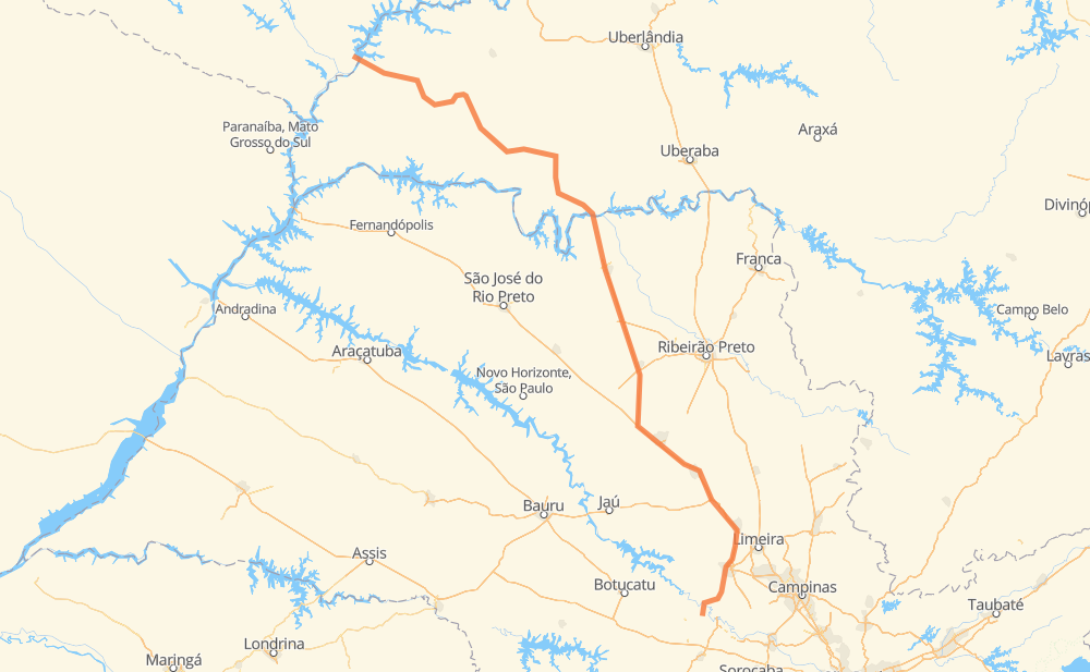
The distance from Laranjal Paulista to São Simão is 422 miles by road including 181 miles on motorways. Road takes approximately 7 hours and 34 minutes and goes through Piracicaba, Rio Claro, Conjunto Habitacional Pedro Zanella, Jardim Itamaraty, Jardim Araucária, Planura and Frutal.
| Shortest distance by air | 331 mi ✈️ |
| Car route length | 421.9 mi 🚗 |
| Driving time | 7 h 34 min |
| Fuel amount | 14.3 gal |
| Fuel cost | 56.4 USD |
| Point | Distance | Time | Fuel | |
| Conjunto Habitacional Pedro Zanella | 0 mi | 00 min | 0.0 gal | |
|
LRP-040 6 mi, 09 min
|
||||
| Morro Vermelho | 6 mi | 09 min | 0.1 gal | |
|
LRP-335 6 mi, 07 min
|
||||
| Conceição | 11 mi | 17 min | 0.3 gal | |
|
BR-373 21 mi, 27 min
|
||||
| Piracicaba | 32 mi | 44 min | 0.9 gal | |
|
SP-127 23 mi, 23 min
|
||||
| Rio Claro | 55 mi | 1 h 07 min | 1.8 gal | |
|
BR-364 SP-310 36 mi, 35 min
|
||||
| Jardim Itamaraty | 91 mi | 1 h 43 min | 3.1 gal | |
|
SP-310 6 mi, 06 min
|
||||
| Jardim Araucária | 98 mi | 1 h 49 min | 3.3 gal | |
|
SP-310 SP-326 144 mi, 2 h 19 min
|
||||
| Planura | 241 mi | 4 h 09 min | 8.1 gal | |
|
BR-364 17 mi, 18 min
|
||||
| Frutal | 258 mi | 4 h 27 min | 8.7 gal | |
|
BR-364 65 mi, 1 h 10 min
|
||||
| Campina Verde | 323 mi | 5 h 38 min | 10.9 gal | |
|
BR-364 98 mi, 1 h 56 min
|
||||
| -18.99350, -50.54704 | 422 mi | 7 h 34 min | 14.3 gal | |
Frequently Asked Questions
How much does it cost to drive from Laranjal Paulista to São Simão?
Fuel cost: 56.4 USD
This fuel cost is calculated as: (Route length 421.9 mi) / (Fuel consumption 29.4 mpg) * (Fuel price 3.93 USD / gal)
You can adjust fuel consumption and fuel price here.
How long is a car ride from Laranjal Paulista to São Simão?
Driving time: 7 h 34 min
This time is calculated for driving at the maximum permitted speed, taking into account traffic rules restrictions.
- 103 mi with a maximum speed 68 mph = 1 h 30 min
- 61 mi with a maximum speed 62 mph = 58 min
- 135 mi with a maximum speed 56 mph = 2 h 24 min
- 6 mi with a maximum speed 56 mph = 5 min
- 103 mi with a maximum speed 50 mph = 2 h 4 min
- 6 mi with a maximum speed 37 mph = 9 min
- 9 mi with a maximum speed 25 mph = 20 min
The calculated driving time does not take into account intermediate stops and traffic jams.
How far is Laranjal Paulista to São Simão by land?
The distance between Laranjal Paulista and São Simão is 421.9 mi by road including 181.4 mi on motorways.
Precise satellite coordinates of highways were used for this calculation. The start and finish points are the centers of Laranjal Paulista and São Simão respectively.
How far is Laranjal Paulista to São Simão by plane?
The shortest distance (air line, as the crow flies) between Laranjal Paulista and São Simão is 330.6 mi.
This distance is calculated using the Haversine formula as a great-circle distance between two points on the surface of a sphere. The start and finish points are the centers of Laranjal Paulista and São Simão respectively. Actual distance between airports may be different.
How many hours is Laranjal Paulista from São Simão by plane?
Boeing 737 airliner needs 39 min to cover the distance of 331 mi at a cruising speed of 497 mph.
Small plane "Cessna 172" needs 2 h 25 min to flight this distance at average speed of 136 mph.
This time is approximate and do not take into account takeoff and landing times, airport location and other real world factors.
How long is a helicopter ride from Laranjal Paulista to São Simão?
Fast helicopter "Eurocopter AS350" or "Hughes OH-6 Cayuse" need 2 h 13 min to cover the distance of 331 mi at a cruising speed of 149 mph.
Popular "Robinson R44" needs 2 h 32 min to flight this distance at average speed of 130 mph.
This time is approximate and do not take into account takeoff and landing times, aerodrome location and other real world factors.
What city is halfway between Laranjal Paulista and São Simão?
The halfway point between Laranjal Paulista and São Simão is Planura. It is located about 30 mi from the exact midpoint by road.
The distance from Planura to Laranjal Paulista is 241 mi and driving will take about 4 h 9 min. The road between Planura and São Simão has length 181 mi and will take approximately 3 h 25 min.
The other cities located close to halfway point:
Where is Laranjal Paulista in relation to São Simão?
Laranjal Paulista is located 331 mi south-east of São Simão.
Laranjal Paulista has geographic coordinates: latitude -23.05056, longitude -47.83755.
São Simão has geographic coordinates: latitude -18.9935, longitude -50.54704.
Which highway goes from Laranjal Paulista to São Simão?
The route from Laranjal Paulista to São Simão follows BR-364, SP-326, SP-310.
Other minor sections pass along the road:
- BR-267: 36 mi
- SP-127: 33 mi
- BR-373: 16 mi
- BR-153: 16 mi
- BR-262: 16 mi
- BR-497: 6 mi
- MG-497: 6 mi
- BR-365: 5 mi
- LRP-335: 4 mi
- LRP-040: 1 mi
- LRP-154: 1 mi