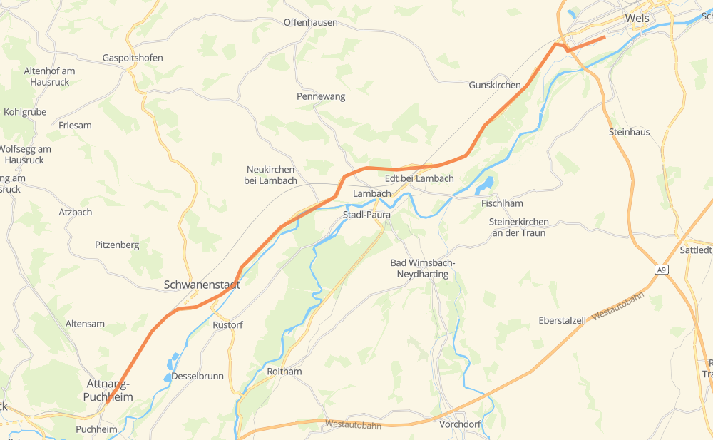
Distance between Lichtenegg and Attnang-Puchheim
The distance from Lichtenegg to Attnang-Puchheim is 18 miles by road. Road takes approximately 22 minutes and goes through Wels, Schwanenstadt, Attnang and Edt bei Lambach.
| Shortest distance by air | 16 mi ✈️ |
| Car route length | 18 mi 🚗 |
| Driving time | 22 min |
| Fuel amount | 0.6 gal |
| Fuel cost | 2.4 USD |
| Point | Distance | Time | Fuel | |
| Wels | 0 mi | 00 min | 0.0 gal | |
|
B1 6 mi, 07 min
|
||||
| Oberroithen | 6 mi | 07 min | 0.2 gal | |
|
B1 2 mi, 02 min
|
||||
| Edt bei Lambach | 7 mi | 10 min | 0.2 gal | |
|
B1 2 mi, 01 min
|
||||
| Niederschwaig | 9 mi | 11 min | 0.3 gal | |
|
B1 1 mi, 00 min
|
||||
| Fischerau | 10 mi | 12 min | 0.3 gal | |
|
B1 1 mi, 01 min
|
||||
| Niederharrern | 11 mi | 13 min | 0.3 gal | |
|
B1 2 mi, 01 min
|
||||
| Oberharrern | 12 mi | 15 min | 0.4 gal | |
|
B1 1 mi, 00 min
|
||||
| Neudorf | 13 mi | 16 min | 0.4 gal | |
|
B1 1 mi, 01 min
|
||||
| Schwanenstadt | 14 mi | 17 min | 0.5 gal | |
|
B1 4 mi, 04 min
|
||||
| Attnang-Puchheim | 18 mi | 22 min | 0.6 gal | |
Hotels of Attnang-Puchheim
Frequently Asked Questions
How much does it cost to drive from Lichtenegg to Attnang-Puchheim?
Fuel cost: 2.4 USD
This fuel cost is calculated as: (Route length 18 mi) / (Fuel consumption 29.4 mpg) * (Fuel price 3.93 USD / gal)
You can adjust fuel consumption and fuel price here.
How long is a car ride from Lichtenegg to Attnang-Puchheim?
Driving time: 22 min
This time is calculated for driving at the maximum permitted speed, taking into account traffic rules restrictions.
- 9 mi with a maximum speed 56 mph = 10 min
- 4 mi with a maximum speed 50 mph = 5 min
- 2 mi with a maximum speed 43 mph = 2 min
- 2 mi with a maximum speed 31 mph = 4 min
The calculated driving time does not take into account intermediate stops and traffic jams.
How far is Lichtenegg to Attnang-Puchheim by land?
The distance between Lichtenegg and Attnang-Puchheim is 18 mi by road.
Precise satellite coordinates of highways were used for this calculation. The start and finish points are the centers of Lichtenegg and Attnang-Puchheim respectively.
What city is halfway between Lichtenegg and Attnang-Puchheim?
The halfway point between Lichtenegg and Attnang-Puchheim is Niederschwaig.
The distance from Niederschwaig to Lichtenegg is 9 mi and driving will take about 11 min. The road between Niederschwaig and Attnang-Puchheim has length 9 mi and will take approximately 10 min.
The other cities located close to halfway point:
Where is Lichtenegg in relation to Attnang-Puchheim?
Lichtenegg is located 16 mi north-east of Attnang-Puchheim.
Lichtenegg has geographic coordinates: latitude 48.15191, longitude 14.00617.
Attnang-Puchheim has geographic coordinates: latitude 48.01146, longitude 13.72108.
Which highway goes from Lichtenegg to Attnang-Puchheim?
The route from Lichtenegg to Attnang-Puchheim follows B1.