Distance between Lloydminster AB and Mont-Laurier QC
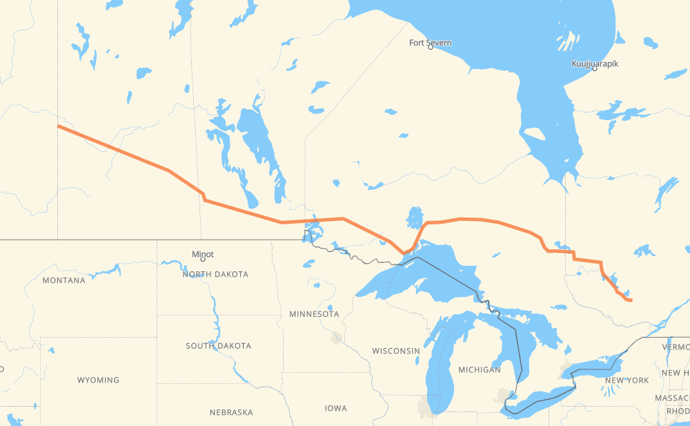
The distance from Lloydminster to Mont-Laurier is 1,924 miles by road including 32 miles on motorways. Road takes approximately 35 hours and 16 minutes and goes through North Battleford, Saskatoon, Yorkton, Portage la Prairie, Winnipeg, Kenora and Dryden.
| Shortest distance by air | 1,587 mi ✈️ |
| Car route length | 1,924.4 mi 🚗 |
| Driving time | 35 h 16 min |
| Fuel amount | 65.4 gal |
| Fuel cost | 255.2 USD |
| Point | Distance | Time | Fuel | |
| Lloydminster | 0 mi | 00 min | 0.0 gal | |
|
16 71 mi, 1 h 18 min
|
||||
| North Battleford | 71 mi | 1 h 18 min | 1.8 gal | |
|
16 101 mi, 1 h 50 min
|
||||
| Saskatoon | 172 mi | 3 h 09 min | 5.7 gal | |
|
16 202 mi, 3 h 37 min
|
||||
| Yorkton | 374 mi | 6 h 46 min | 12.6 gal | |
|
16 PTH 16 229 mi, 4 h 14 min
|
||||
| Portage la Prairie | 603 mi | 11 h 00 min | 20.4 gal | |
|
PTH 1 55 mi, 59 min
|
||||
| Winnipeg | 659 mi | 12 h 00 min | 22.0 gal | |
|
PTH 100 PTH 1 134 mi, 2 h 23 min
|
||||
| Kenora | 793 mi | 14 h 23 min | 26.9 gal | |
|
17A 17 91 mi, 1 h 40 min
|
||||
| Dryden | 884 mi | 16 h 03 min | 29.9 gal | |
|
17 208 mi, 3 h 46 min
|
||||
| Thunder Bay | 1,091 mi | 19 h 50 min | 37.1 gal | |
|
17 11 590 mi, 10 h 54 min
|
||||
| Rouyn-Noranda | 1,681 mi | 30 h 44 min | 56.9 gal | |
|
117 244 mi, 4 h 31 min
|
||||
| Mont-Laurier | 1,924 mi | 35 h 16 min | 65.4 gal | |
Hotels of Mont-Laurier
Frequently Asked Questions
How much does it cost to drive from Lloydminster to Mont-Laurier?
Fuel cost: 255.2 USD
This fuel cost is calculated as: (Route length 1,924.4 mi) / (Fuel consumption 29.4 mpg) * (Fuel price 3.9 USD / gal)
You can adjust fuel consumption and fuel price here.
How long is a car ride from Lloydminster to Mont-Laurier?
Driving time: 35 h 16 min
This time is calculated for driving at the maximum permitted speed, taking into account traffic rules restrictions.
- 17 mi with a maximum speed 62 mph = 16 min
- 678 mi with a maximum speed 56 mph = 12 h 6 min
- 1,027 mi with a maximum speed 56 mph = 18 h 21 min
- 132 mi with a maximum speed 50 mph = 2 h 39 min
- 34 mi with a maximum speed 43 mph = 46 min
- 14 mi with a maximum speed 37 mph = 22 min
- 22 mi with a maximum speed 31 mph = 43 min
The calculated driving time does not take into account intermediate stops and traffic jams.
How far is Lloydminster to Mont-Laurier by land?
The distance between Lloydminster and Mont-Laurier is 1,924.4 mi by road including 32.3 mi on motorways.
Precise satellite coordinates of highways were used for this calculation. The start and finish points are the centers of Lloydminster and Mont-Laurier respectively.
How far is Lloydminster to Mont-Laurier by plane?
The shortest distance (air line, as the crow flies) between Lloydminster and Mont-Laurier is 1,587 mi.
This distance is calculated using the Haversine formula as a great-circle distance between two points on the surface of a sphere. The start and finish points are the centers of Lloydminster and Mont-Laurier respectively. Actual distance between airports may be different.
How many hours is Lloydminster from Mont-Laurier by plane?
Boeing 737 airliner needs 3 h 11 min to cover the distance of 1,587 mi at a cruising speed of 497 mph.
Small plane "Cessna 172" needs 11 h 36 min to flight this distance at average speed of 136 mph.
This time is approximate and do not take into account takeoff and landing times, airport location and other real world factors.
How long is a helicopter ride from Lloydminster to Mont-Laurier?
Fast helicopter "Eurocopter AS350" or "Hughes OH-6 Cayuse" need 10 h 38 min to cover the distance of 1,587 mi at a cruising speed of 149 mph.
Popular "Robinson R44" needs 12 h 9 min to flight this distance at average speed of 130 mph.
This time is approximate and do not take into account takeoff and landing times, aerodrome location and other real world factors.
What city is halfway between Lloydminster and Mont-Laurier?
The halfway point between Lloydminster and Mont-Laurier is Ignace. It is located about 17 mi from the exact midpoint by road.
The distance from Ignace to Lloydminster is 945 mi and driving will take about 17 h 12 min. The road between Ignace and Mont-Laurier has length 979 mi and will take approximately 18 h 4 min.
The other cities located close to halfway point:
Where is Lloydminster in relation to Mont-Laurier?
Lloydminster is located 1,587 mi west of Mont-Laurier.
Lloydminster has geographic coordinates: latitude 53.28, longitude -110.00885.
Mont-Laurier has geographic coordinates: latitude 46.55236, longitude -75.49739.
Which highway goes from Lloydminster to Mont-Laurier?
The route from Lloydminster to Mont-Laurier follows 11, 16, 17, 117, PTH 16, PTH 1, 101.
Other minor sections pass along the road:
- PTH 100: 24 mi
- PTH 83: 23 mi
- 17A: 21 mi
- 102: 21 mi
- 388: 14 mi
- 393: 10 mi
- 20: 6 mi
- PTH 10: 4 mi
- 6: 3 mi
- 674: 3 mi
- 40: 3 mi
- PR 264: 2 mi
- 9: 2 mi
- 21: 2 mi
- PR 206: 1 mi
- 12: 1 mi
- 10: 1 mi
- PR 250: 1 mi
- PTH 5: 1 mi
- 675: 1 mi
- 583: 1 mi
- 4: 1 mi