Distance between Marín and Nuevo Teapa (Santa Cecilia)
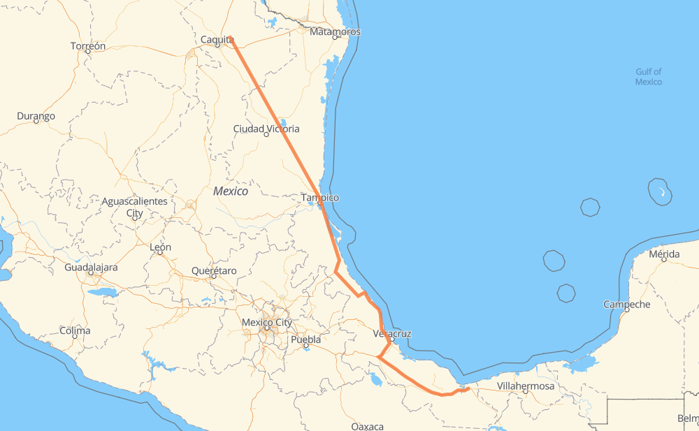
The distance from Marín to Nuevo Teapa (Santa Cecilia) is 823 miles by road including 276 miles on motorways. Road takes approximately 15 hours and 15 minutes and goes through Guadalupe, Monterrey, Ciudad Madero, Apodaca, El Yerbaniz, Santiago and Allende.
| Shortest distance by air | 653 mi ✈️ |
| Car route length | 822.7 mi 🚗 |
| Driving time | 15 h 15 min |
| Fuel amount | 28 gal |
| Fuel cost | 110 USD |
| Toll roads cost | 942 + ? MXN |
| Point | Distance | Time | Fuel | |
| Marín | 0 mi | 00 min | 0.0 gal | |
|
MEX 54 14 mi, 17 min
|
||||
| Apodaca | 14 mi | 17 min | 0.4 gal | |
|
MEX 54 7 mi, 08 min
|
||||
| Guadalupe | 22 mi | 25 min | 0.7 gal | |
|
MEX 40 4 mi, 04 min
|
||||
| Monterrey | 25 mi | 30 min | 0.7 gal | |
|
MEX 40 MEX 85 14 mi, 15 min
|
||||
| El Yerbaniz | 39 mi | 45 min | 1.3 gal | |
|
MEX 85 5 mi, 05 min
|
||||
| Santiago | 44 mi | 51 min | 1.4 gal | |
|
MEX 85 12 mi, 14 min
|
||||
| Allende | 57 mi | 1 h 06 min | 1.8 gal | |
|
MEX 85 42 mi, 48 min
|
||||
| Hualahuises | 98 mi | 1 h 54 min | 3.2 gal | |
|
MEX 85 247 mi, 4 h 41 min
|
||||
| Ciudad Madero | 345 mi | 6 h 35 min | 11.7 gal | |
|
MEX 180 MEX 145D 484 mi, 8 h 39 min
|
||||
| Nuevo Teapa (Santa Cecilia) | 830 mi | 15 h 14 min | 28.1 gal | |
Frequently Asked Questions
How many toll booths are there from Marín to Nuevo Teapa (Santa Cecilia)?
There are 11 toll booths between Marín and Nuevo Teapa (Santa Cecilia): Tampico, Naranjos, Tuxpan, Cardel - Posa Rica, Nautla, La Antigua, San Julián, Paso del Toro, Cosamaloapan, Acayucan and Antonio Dovali.
How much does the toll booths cost from Marín to Nuevo Teapa (Santa Cecilia)?
Toll roads cost: Tampico (35 MXN) + Naranjos (297 MXN) + Tuxpan (45 MXN) + Cardel - Posa Rica (205 MXN) + Nautla (24 MXN) + La Antigua (?) + San Julián (?) + Paso del Toro (87 MXN) + Cosamaloapan (229 MXN) + Acayucan (?) + Antonio Dovali (20 MXN) = 942 + ? MXN
How much does it cost to drive from Marín to Nuevo Teapa (Santa Cecilia)?
Fuel cost: 110 USD
This fuel cost is calculated as: (Route length 822.7 mi) / (Fuel consumption 29.4 mpg) * (Fuel price 3.93 USD / gal)
You can adjust fuel consumption and fuel price here.
Toll roads cost: 942 + ? MXN
How long is a car ride from Marín to Nuevo Teapa (Santa Cecilia)?
Driving time: 15 h 15 min
This time is calculated for driving at the maximum permitted speed, taking into account traffic rules restrictions.
- 11 mi with a maximum speed 68 mph = 10 min
- 205 mi with a maximum speed 62 mph = 3 h 18 min
- 206 mi with a maximum speed 56 mph = 3 h 40 min
- 67 mi with a maximum speed 56 mph = 1 h 11 min
- 331 mi with a maximum speed 50 mph = 6 h 39 min
- 1 mi with a maximum speed 43 mph = 1 min
- 6 mi with a maximum speed 37 mph = 8 min
- 1 mi with a maximum speed 31 mph = 1 min
- 1 mi with a maximum speed 25 mph = 2 min
The calculated driving time does not take into account intermediate stops and traffic jams.
How far is Marín to Nuevo Teapa (Santa Cecilia) by land?
The distance between Marín and Nuevo Teapa (Santa Cecilia) is 822.7 mi by road including 275.9 mi on motorways.
Precise satellite coordinates of highways were used for this calculation. The start and finish points are the centers of Marín and Nuevo Teapa (Santa Cecilia) respectively.
How far is Marín to Nuevo Teapa (Santa Cecilia) by plane?
The shortest distance (air line, as the crow flies) between Marín and Nuevo Teapa (Santa Cecilia) is 653.1 mi.
This distance is calculated using the Haversine formula as a great-circle distance between two points on the surface of a sphere. The start and finish points are the centers of Marín and Nuevo Teapa (Santa Cecilia) respectively. Actual distance between airports may be different.
How many hours is Marín from Nuevo Teapa (Santa Cecilia) by plane?
Boeing 737 airliner needs 1 h 18 min to cover the distance of 653 mi at a cruising speed of 497 mph.
Small plane "Cessna 172" needs 4 h 46 min to flight this distance at average speed of 136 mph.
This time is approximate and do not take into account takeoff and landing times, airport location and other real world factors.
How long is a helicopter ride from Marín to Nuevo Teapa (Santa Cecilia)?
Fast helicopter "Eurocopter AS350" or "Hughes OH-6 Cayuse" need 4 h 22 min to cover the distance of 653 mi at a cruising speed of 149 mph.
Popular "Robinson R44" needs 5 h to flight this distance at average speed of 130 mph.
This time is approximate and do not take into account takeoff and landing times, aerodrome location and other real world factors.
What city is halfway between Marín and Nuevo Teapa (Santa Cecilia)?
The halfway point between Marín and Nuevo Teapa (Santa Cecilia) is Nuevo Xúchitl. It is located about 4 mi from the exact midpoint by road.
The distance from Nuevo Xúchitl to Marín is 408 mi and driving will take about 7 h 45 min. The road between Nuevo Xúchitl and Nuevo Teapa (Santa Cecilia) has length 416 mi and will take approximately 7 h 29 min.
The other cities located close to halfway point:
Where is Marín in relation to Nuevo Teapa (Santa Cecilia)?
Marín is located 653 mi north-west of Nuevo Teapa (Santa Cecilia).
Marín has geographic coordinates: latitude 25.8794, longitude -100.03404.
Nuevo Teapa (Santa Cecilia) has geographic coordinates: latitude 18.07306, longitude -94.27722.
Which highway goes from Marín to Nuevo Teapa (Santa Cecilia)?
The route from Marín to Nuevo Teapa (Santa Cecilia) follows MEX 180, MEX 85, MEX 145D, MEX 180D.
Other minor sections pass along the road:
- MEX 83: 58 mi
- MEX 81: 51 mi
- MEX 80: 45 mi
- MEX 135D: 28 mi
- MEX 150D: 27 mi
- MEX 54: 19 mi
- MEX: 19 mi
- MEX 129: 14 mi
- MEX 132D: 8 mi
- 30: 7 mi
- 25: 7 mi
- MEX 132: 6 mi
- 22: 4 mi
- MEX 40: 4 mi
- NL 113: 1 mi