Distance between Mazagão and São José do Vale do Rio Preto
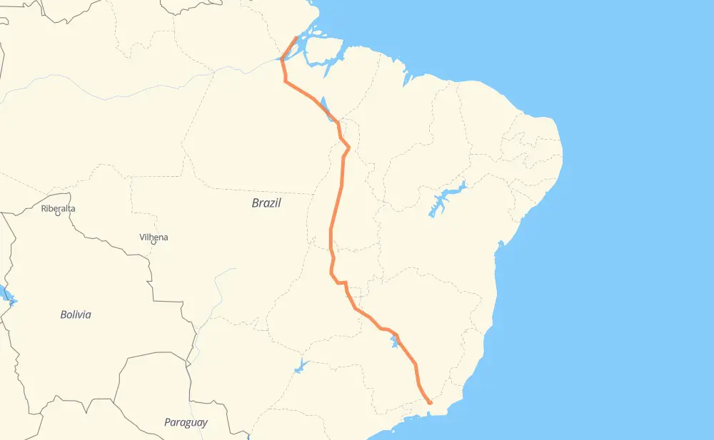
The distance from Mazagão to São José do Vale do Rio Preto is 2,100 miles by road including 169 miles on motorways. Road takes approximately 53 hours and 47 minutes and goes through Maraba, Ceilândia, Recanto das Emas, Valparaíso de Goiás, Ribeirão das Neves, Conselheiro Lafaiete and Barbacena.
| Shortest distance by air | 1,624 mi ✈️ |
| Car route length | 2,100.2 mi 🚗 |
| Driving time | 53 h 47 min |
| Fuel amount | 71.4 gal |
| Fuel cost | 280.8 USD |
| Point | Distance | Time | Fuel | |
| -0.11606, -51.28618 | 0 mi | 00 min | 0.0 gal | |
|
AP-010 14 mi, 15 min
|
||||
| Picarreira | 14 mi | 15 min | 0.8 gal | |
|
AP-010 BR-230 274 mi, 19 h 53 min
|
||||
| Vila Residencial Belo Monte | 288 mi | 20 h 09 min | 10.1 gal | |
|
BR-230 277 mi, 5 h 13 min
|
||||
| Maraba | 565 mi | 25 h 22 min | 19.4 gal | |
|
BR-230 BR-153 391 mi, 7 h 16 min
|
||||
| Serrano II | 956 mi | 32 h 38 min | 32.9 gal | |
|
BR-153 464 mi, 8 h 36 min
|
||||
| Ceilândia | 1,420 mi | 41 h 14 min | 48.7 gal | |
|
BR-060 11 mi, 15 min
|
||||
| Recanto das Emas | 1,431 mi | 41 h 30 min | 49.0 gal | |
|
DF-001 BR-040 17 mi, 25 min
|
||||
| Valparaíso de Goiás | 1,448 mi | 41 h 55 min | 49.4 gal | |
|
BR-040 410 mi, 7 h 23 min
|
||||
| Ribeirão das Neves | 1,859 mi | 49 h 18 min | 63.5 gal | |
|
BR-040 75 mi, 1 h 27 min
|
||||
| Conselheiro Lafaiete | 1,932 mi | 50 h 46 min | 66.0 gal | |
|
BR-040 47 mi, 54 min
|
||||
| Barbacena | 1,979 mi | 51 h 40 min | 67.6 gal | |
|
BR-040 123 mi, 2 h 06 min
|
||||
| -22.15100, -42.92400 | 2,102 mi | 53 h 46 min | 71.9 gal | |
Frequently Asked Questions
How much does it cost to drive from Mazagão to São José do Vale do Rio Preto?
Fuel cost: 280.8 USD
This fuel cost is calculated as: (Route length 2,100.2 mi) / (Fuel consumption 29.4 mpg) * (Fuel price 3.93 USD / gal)
You can adjust fuel consumption and fuel price here.
How long is a car ride from Mazagão to São José do Vale do Rio Preto?
Driving time: 53 h 47 min
This time is calculated for driving at the maximum permitted speed, taking into account traffic rules restrictions.
- 99 mi with a maximum speed 68 mph = 1 h 27 min
- 30 mi with a maximum speed 62 mph = 28 min
- 1,201 mi with a maximum speed 56 mph = 21 h 26 min
- 7 mi with a maximum speed 56 mph = 7 min
- 465 mi with a maximum speed 50 mph = 9 h 21 min
- 18 mi with a maximum speed 43 mph = 25 min
- 36 mi with a maximum speed 37 mph = 58 min
- 1 mi with a maximum speed 31 mph = 2 min
- 4 mi with a maximum speed 25 mph = 11 min
- 1 mi with a maximum speed 19 mph = 1 min
- 240 mi with a maximum speed 12 mph = 19 h 16 min
The calculated driving time does not take into account intermediate stops and traffic jams.
How far is Mazagão to São José do Vale do Rio Preto by land?
The distance between Mazagão and São José do Vale do Rio Preto is 2,100.2 mi by road including 169 mi on motorways.
Precise satellite coordinates of highways were used for this calculation. The start and finish points are the centers of Mazagão and São José do Vale do Rio Preto respectively.
How far is Mazagão to São José do Vale do Rio Preto by plane?
The shortest distance (air line, as the crow flies) between Mazagão and São José do Vale do Rio Preto is 1,623.6 mi.
This distance is calculated using the Haversine formula as a great-circle distance between two points on the surface of a sphere. The start and finish points are the centers of Mazagão and São José do Vale do Rio Preto respectively. Actual distance between airports may be different.
How many hours is Mazagão from São José do Vale do Rio Preto by plane?
Boeing 737 airliner needs 3 h 15 min to cover the distance of 1,624 mi at a cruising speed of 497 mph.
Small plane "Cessna 172" needs 11 h 52 min to flight this distance at average speed of 136 mph.
This time is approximate and do not take into account takeoff and landing times, airport location and other real world factors.
How long is a helicopter ride from Mazagão to São José do Vale do Rio Preto?
Fast helicopter "Eurocopter AS350" or "Hughes OH-6 Cayuse" need 10 h 53 min to cover the distance of 1,624 mi at a cruising speed of 149 mph.
Popular "Robinson R44" needs 12 h 26 min to flight this distance at average speed of 130 mph.
This time is approximate and do not take into account takeoff and landing times, aerodrome location and other real world factors.
What city is halfway between Mazagão and São José do Vale do Rio Preto?
The halfway point between Mazagão and São José do Vale do Rio Preto is Santana. It is located about 84 mi from the exact midpoint by road.
The distance from Santana to Mazagão is 966 mi and driving will take about 32 h 50 min. The road between Santana and São José do Vale do Rio Preto has length 1,134 mi and will take approximately 20 h 56 min.
The other cities located close to halfway point:
Where is Mazagão in relation to São José do Vale do Rio Preto?
Mazagão is located 1,624 mi north-west of São José do Vale do Rio Preto.
Mazagão has geographic coordinates: latitude -0.11606, longitude -51.28618.
São José do Vale do Rio Preto has geographic coordinates: latitude -22.151, longitude -42.924.
Which highway goes from Mazagão to São José do Vale do Rio Preto?
The route from Mazagão to São José do Vale do Rio Preto follows BR-153, BR-040, BR-230, BR-080, BR-135.
Other minor sections pass along the road:
- BR-050: 53 mi
- TO-420: 24 mi
- BR-251: 22 mi
- BR-414: 22 mi
- RJ-134: 21 mi
- BR-492: 21 mi
- AP-010: 14 mi
- BR-356: 12 mi
- DF-180: 12 mi
- DF-001: 9 mi
- BR-080,GO-424: 4 mi
- DF-451: 4 mi
- DF-240: 3 mi
- GO-080: 2 mi
- MG-353: 2 mi
- BR-060: 2 mi
- DF-459: 2 mi
- DF-003: 1 mi
- BR-222: 1 mi
- BR-381: 1 mi
- BR-262: 1 mi