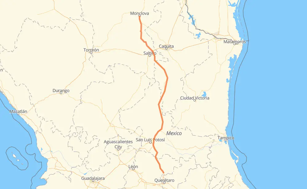
Distance between Monclova and La Cinta
The distance from Monclova to La Cinta is 478 miles by road including 370 miles on motorways. Road takes approximately 8 hours and 10 minutes and goes through Castaños, Arteaga, San Rafael, San Cayetano de Vacas, Ejido La Yerba, Villa Hidalgo and Cerro de San Pedro.
| Shortest distance by air | 415 mi ✈️ |
| Car route length | 478.5 mi 🚗 |
| Driving time | 8 h 10 min |
| Fuel amount | 16.3 gal |
| Fuel cost | 63.9 USD |
| Toll roads cost | 178 + ? MXN |
| Point | Distance | Time | Fuel | |
| Monclova | 0 mi | 00 min | 0.0 gal | |
|
MEX 57 7 mi, 09 min
|
||||
| Castaños | 7 mi | 09 min | 0.2 gal | |
|
MEX 57 110 mi, 1 h 59 min
|
||||
| Arteaga | 117 mi | 2 h 09 min | 3.9 gal | |
|
MEX 57D 14 mi, 11 min
|
||||
| Los Llanos | 130 mi | 2 h 21 min | 4.4 gal | |
|
MEX 57D 16 mi, 14 min
|
||||
| El Cuije | 146 mi | 2 h 35 min | 4.8 gal | |
|
MEX 57 12 mi, 12 min
|
||||
| San Rafael | 158 mi | 2 h 47 min | 5.3 gal | |
|
MEX 57 48 mi, 46 min
|
||||
| Refugio de los Ibarra | 206 mi | 3 h 34 min | 6.8 gal | |
|
MEX 57 24 mi, 23 min
|
||||
| San Cayetano de Vacas | 231 mi | 3 h 57 min | 7.2 gal | |
|
MEX 57 158 mi, 2 h 41 min
|
||||
| Delegación de La Pila | 388 mi | 6 h 39 min | 12.8 gal | |
|
MEX 57D MEX 57 91 mi, 1 h 31 min
|
||||
| La Cinta | 478 mi | 8 h 10 min | 14.5 gal | |
Frequently Asked Questions
How many toll booths are there from Monclova to La Cinta?
There are 4 toll booths between Monclova and La Cinta: La Carbonera, Los Chorros, Matehuala Omega and Libramiento Oriente De SLP.
How much does the toll booths cost from Monclova to La Cinta?
Toll roads cost: La Carbonera (42 MXN) + Los Chorros (66 MXN) + Matehuala Omega (?) + Libramiento Oriente De SLP (70 MXN) = 178 + ? MXN
How much does it cost to drive from Monclova to La Cinta?
Fuel cost: 63.9 USD
This fuel cost is calculated as: (Route length 478.5 mi) / (Fuel consumption 29.4 mpg) * (Fuel price 3.93 USD / gal)
You can adjust fuel consumption and fuel price here.
Toll roads cost: 178 + ? MXN
How long is a car ride from Monclova to La Cinta?
Driving time: 8 h 10 min
This time is calculated for driving at the maximum permitted speed, taking into account traffic rules restrictions.
- 63 mi with a maximum speed 68 mph = 56 min
- 174 mi with a maximum speed 62 mph = 2 h 48 min
- 12 mi with a maximum speed 56 mph = 13 min
- 180 mi with a maximum speed 56 mph = 3 h 12 min
- 46 mi with a maximum speed 50 mph = 55 min
- 1 mi with a maximum speed 37 mph = 1 min
- 2 mi with a maximum speed 31 mph = 3 min
The calculated driving time does not take into account intermediate stops and traffic jams.
How far is Monclova to La Cinta by land?
The distance between Monclova and La Cinta is 478.5 mi by road including 370.3 mi on motorways.
Precise satellite coordinates of highways were used for this calculation. The start and finish points are the centers of Monclova and La Cinta respectively.
How far is Monclova to La Cinta by plane?
The shortest distance (air line, as the crow flies) between Monclova and La Cinta is 415.1 mi.
This distance is calculated using the Haversine formula as a great-circle distance between two points on the surface of a sphere. The start and finish points are the centers of Monclova and La Cinta respectively. Actual distance between airports may be different.
How many hours is Monclova from La Cinta by plane?
Boeing 737 airliner needs 50 min to cover the distance of 415 mi at a cruising speed of 497 mph.
Small plane "Cessna 172" needs 3 h 2 min to flight this distance at average speed of 136 mph.
This time is approximate and do not take into account takeoff and landing times, airport location and other real world factors.
How long is a helicopter ride from Monclova to La Cinta?
Fast helicopter "Eurocopter AS350" or "Hughes OH-6 Cayuse" need 2 h 47 min to cover the distance of 415 mi at a cruising speed of 149 mph.
Popular "Robinson R44" needs 3 h 10 min to flight this distance at average speed of 130 mph.
This time is approximate and do not take into account takeoff and landing times, aerodrome location and other real world factors.
What city is halfway between Monclova and La Cinta?
The halfway point between Monclova and La Cinta is San Cayetano de Vacas. It is located about 9 mi from the exact midpoint by road.
The distance from San Cayetano de Vacas to Monclova is 231 mi and driving will take about 3 h 57 min. The road between San Cayetano de Vacas and La Cinta has length 248 mi and will take approximately 4 h 13 min.
The other cities located close to halfway point:
Where is Monclova in relation to La Cinta?
Monclova is located 415 mi north of La Cinta.
Monclova has geographic coordinates: latitude 26.90079, longitude -101.41659.
La Cinta has geographic coordinates: latitude 20.96003, longitude -100.42398.
Which highway goes from Monclova to La Cinta?
The route from Monclova to La Cinta follows MEX 57, MEX 57D.
Other minor sections pass along the road:
- MEX 80: 51 mi